Welcome to Sandy

sandy_harrison_w

We are pleased to welcome Professor Sandy Harrison, a world expert on past climate change who has moved to Reading from Macquarie University in Australia.

Sandy is setting up a Centre for Past Climate Change at Reading which will focus on generating new observations, including the development of new reconstruction techniques. A web page to introduce the group has now been created:

Read about Sandy

Read about the Centre for Past Climate Change

Palm oil plantations in Liberia – are buffer zones the answer?

Elaeis guineensis

Elaeis guineensis

Ahead of the launch of a report by Geoff Griffiths and Ruth Evans on the environmental and social impacts of a proposed Palm Oil plantation in Liberia, Geoff featured in two interviews for the BBC World Service.

The Newsday interview was broadcast at 6am on Monday 24 June (55 minutes into the programme). Listen to the Newsday programme (available until 29 June.)

The World Business Report with Mike Johnson, a ‘head-to-head’ between Geoff and a representative from Sime Darby (Malaysia Palm Oil Company) was broadcast at 22:32 on Monday 24 June (15.35 minutes into the programme).   Listen to the World Business Report programme.

“Our work suggests that buffer zones of 1 to 4 km around local settlements would help local people retain farmland and some access to forest resources. Our innovative environmental assessment also identifies key areas for biodiversity, carbon storage, water supply and livelihoods. Protecting such areas would help to reduce negative impacts.” says Geoff. Read more on Phys.org

Read the full report: Palm oil, land rights and ecosystem services in Gbarpolu County, Liberia

Read about Geoff

Read about Ruth

Photo credit: Marco Schmidt / Foter.com / CC BY-SA

Soil research photographic competition

Ploughed soil in the Harris Garden

Ploughed soil in the Harris Garden

Do you work with soils? If so, we’re interested in finding out more about what you do through our photo competition. Photos can include images from the field in the UK or overseas, or work in the laboratory. We’re particularly interested in images showing people at work with soils or those that illustrate a particular ‘global issue’ like food security or climate change. Photos can been taken of any activity carried out in the University, including:

  • BSc/MSc field and lab classes showing students working with soils
  • Dissertation projects
  • PhD Research
  • Research projects

Photos will be displayed on the Soil Research Centre web pages later this year.

Prizes

Amazon Gift Vouchers will be awarded. The winner will receive £100 voucher; £50 will be awarded for second place and £25 for two highly commended images.

Eligibility

This competition is open to all students and staff at the University of Reading.

How to enter

E-mail a high resolution jpeg/tiff/pdf file containing your image to Sue Hawthorne (s.m.hawthorne@reading.ac.uk ). Please enter ‘SRC Photo competition 2013’ as the e-mail subject. Remember to include your full name, degree programme (if appropriate), e-mail, contact phone number and a short description of the photo in the e-mail message. Please also confirm in your e-mail that you (and all those shown in the photo) are happy for this photo to be displayed on the Soil Research Centre web pages. It would be a good idea to check with everyone in the picture before entering the competition.

Closing date

Entries must be submitted by 22 August 2013.

SINATRA to study flooding from intense rainfall

Erosion and deposition derived from before and after LiDAR images from the Cockermouth floods

Erosion and deposition derived from before and after LiDAR images from the Cockermouth floods

Hannah Cloke has won a large NERC consortium grant as part of NERC’s Flooding From Intense Rainfall (FFIR) call entitled: ‘Susceptibility of catchments to INTense RAinfall and flooding – SINATRA’.

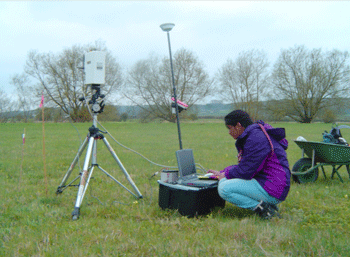
Extreme rainfall events may only last for a few hours at most, but can generate terrifying and destructive floods. Their impact can be affected by a wide range factors such as the location and intensity of the rainfall, the shape and steepness of the catchment it falls on, how much sediment is moved by the water and the vulnerability of the communities in the flood’s path. These events are by their nature rapid, making it very difficult for researchers to ‘capture’ measurements at the time. The complexity, speed and lack of field measurements make it difficult to create computer models to predict flooding.

NERC launched the FFIR research programme to reduce the risks from surface water and flash floods by improving our identification and prediction of the weather, flooding and sediment and debris moved by floods. A major requirement of the programme is identifying how particular catchments may be vulnerable to sudden flooding, due to factors such as catchment area, shape, geology and soil type as well as land-use.

Project SINATRA will address these issues in three stages:

  1. Increase our understanding of what factors cause FFIR
  2. Use this new understanding and data to improve models of FFIR so we can predict where they may happen nationwide
  3. Use these new findings and predictions to provide the Environment Agency and other professionals with information and software they can use to manage FFIR, reducing their damage and impact to communities.

Co-Investigators at Reading are Anne Verhoef (GES), David Mason and Richard Allan (Meteorology) and Sarah Dance (Maths and Statistics).

The  other institutions in the consortium are Newcastle University, University of Bristol, King’s College London, University of Exeter, University of Hull and the British Geological Survey (BGS).

There has been severs flooding in Germany. Read about it in Spiegal online.

The European flood awareness system (EFAS) is designed to predict such floods on the medium range (15 days in advance) and its operational centre is situated in Reading. Hannah Cloke works closely with the EFAS team researching ways to improve flood forecasting.

Visit www.efas.eu.

Read about Hannah

Gold star for Sally

Sally lecturingDr Sally Lloyd-Evans, Senior Lecturer in Human Geography has been awarded the ‘Gold Star Award for Best Lecturer in the Faculty of Science’ by Reading University Student’s Union.

Students nominate staff who they feel have had positive impact on their studies by supporting and inspiring them: “The winner of the Science Gold Star Award always gives enjoyable and interesting lectures, is incredibly enthusiastic and is always on hand to help students, whether that is via email or one to one meetings. Sally is praised by students for being supportive, patient and understanding, always being on hand to offer guidance and words of encouragement. When students were faced with a new style of working she takes time out to allow students to hand in drafts of their reports and offer hand written comments giving not only fantastic feedback, but motivational words of encouragement.”

Dr Steve Gurney, Senior Lecturer in Geomorphology, was short-listed for the award for the second year running which demonstrates how well-deserved Geography’s excellent reputation for teaching quality is.

Read about Sally

Read about Steve

More about the award

Competition for soil studies

bsss_logo_largeFor the first time this year the British Society of Soil Science will sponsor two awards for students at the University of Reading:

  • Best BSc dissertation in Soil Research
  • Best MSc dissertation in Soil Research

The annual competitions are open to all BSc and MSc students at Reading carrying out soil research for their dissertation or final year independent project. Students must be nominated to be considered for the awards.

Full details and entry forms

Review on modelling climate impact on floods highlights large uncertainties in results

Road closed due to flooding

The UK has over £82 billion worth of assets at risk from river flooding and flooded homes cause misery to thousands of people.

The NERC programme Flood Risk from Extreme Events (FREE) is research to predict floods minutes to weeks and seasons to decades ahead.

Research by Dr Hannah Cloke, Reader in Hydrology, features in the Quarterly Journal of the Royal Meteorological Society‘s Special Issue on Flooding from Extreme Events published  this month. The article underlines the challenges in using the current generation of Regional Climate Models for local climate impact studies on flooding.

Looking at the current best practice in modelling climate impact on floods with ensemble climate projections, the study highlights the stark differences in results when using different methods and also the strong assumptions made in using Model Output Statistics to produce the estimates of future river discharge.

Read the article on-line: Modelling climate impact on floods with ensemble climate projections

View the Special Issue: Flood Risk from Extreme Events FREE 

Read about the NERC FREE programme

Read about Dr Hannah Cloke


NERC Airborne Research and Survey Facility (ARSF) to assist with floodplain meadow research

Determination of radiance spectra (using a GER 3700 hyperspectral radiometer) on Yarnton Mead, an ancient floodplain meadow near Oxford.   PhD-student Suvarna Punalekar (Felix scholar, University of Reading). These data serve as calibration for the airborne remote sensing data.

Determination of radiance spectra (using a GER 3700 hyperspectral radiometer) on Yarnton Mead, an ancient floodplain meadow near Oxford. PhD-student Suvarna Punalekar (Felix scholar, University of Reading). These data serve as calibration for the airborne remote sensing data.

Anne Verhoef, Kevin White and Suvarna Punalekar a PhD student funded by the Felix Scholarship scheme, have been successful in an application to the NERC Airborne Research and Survey Facility (ARSF). The ARSF will fly the NERC -funded network of sensors project (FUSE) project site at least 3 times (weather permitting), possibly more often. Airborne remote sensing provides an efficient method for the rapid collection of data over a specified area.

The FUSE project is based at Yarnton mead an ancient hay meadow that is part of the Oxford Meadows Special Area of Conservation. The team are investigating the interactions between the hydrological, thermal and nutrient regime and the functioning of plant communities in this example of a floodplain meadow.
Some floodplain meadow ecosystems have evolved into highly bio-diverse plant communities due to the continuance of traditional management practices. These areas are important for flood storage and sediment retention. The UK now has less than 1500 ha of this unique habitat remaining and the habitat has been given protection under the European Habitats Directive. In order to conserve and better exploit the services provided by floodplain meadows, an improved understanding of its functioning is essential.

Anne Verhoef with the NERC Dornier 228 aircraft

Anne Verhoef with the NERC Dornier 228 aircraft

The NERC ARSF remote campaign with FUSE field observations gathered during 2013 will provide an important contribution to monitoring the biophysical properties as well as vegetation processes. The remote sensing and in-situ data will be used in conjunction with the SCOPE model, to ensure the derived information on the functioning of the floodplain ecosystem is mechanistically sound.

Read about the Fuse project

Hear the Naked Scientist’s interview with Anne Verhoef

See a video report on NERC’s scientific research plane, the Dornier 228 

Read about the SCOPE model

Read about ARSF

UK human geography number 1 in the world

International benchmarking review of UK human geography

International benchmarking review of UK human geography

The Economic and Social Research Council (ESRC), the Royal Geographical Society (with the Institute of British Geographers) and Arts and Humanities Research Council (AHRC) launched the results of a benchmarking review of human geography this month.

The key conclusions from the report were:

  • UK human geography ranks first in the world. Findings also showed it as an empirically and conceptually innovative, diverse, vibrant discipline that in many areas sets the intellectual agenda
  • The UK publishes more than its share of major disciplinary journals; bibliometric indicators reveal international primacy both in volume and citation impact; and a large number of the seminal publications (books as well as articles) continue to have a UK origin
  • UK human geography is radically interdisciplinary and with the spatial turn in the humanities and social sciences has become an exporter of ideas and faculty to other disciplines
  • There was confidence that research in human geography had substantial impact on policy and practice and would successfully meet the challenges of the current impact agenda

Read the press release

Study Human Geography at Reading

Cold war satellites help glacier research


View from mount Elbrus

View from Mount Elbrus, at 5150 m above sea level, the highest mountain in Europe. Taken by Stas Kutuzov

Maria Shahgedanova presented a summary of her research at yesterday’s research seminar.

Maria grew up in Moscow, Russia and studied meteorology at Moscow State University before completing a DPhil in climate science at the University of Oxford.  Among her research interests are the response of glaciers to climate change. The melting of glaciers will contribute to sea level rise and can impact on water resources for human populations especially in arid regions.

Maria’s research has focused on several locations in south-eastern Europe and northern and central Asia including extremely remote areas such as Polar Urals and Kodar Mountains where research is extremely limited. Using various techniques – analysis of aerial photographs and satellite imagery, ground surveys using Digital Global Positioning Systems (DGPS) and GIS, climate and glaciological modelling  – Maria and her colleagues increase the accuracy of our knowledge of glacier retreat showing that in northern Asia, glaciers lost between 20 and 40% of their area since the middle of the 20th Century.  Although glaciers are shrinking fast even in the coldest regions of Siberia, using satellite imagery the team discovered four glaciers in the remote Kodar Mountains in eastern Siberia which were not on the geographical maps before.

“One of the positive outcomes of the cold war is the extensive satellite cover of the former Soviet Union by US satellites providing us with a wealth of data” says Maria. “an now we work as an international, multi-disciplinary team including scientists from the UK, Germany, Austria, Switzerland, Russia and Georgia.”

Maria’s current research project, DIOGENES – Dust Impacts on Glaciated Environments, looks at the effect of dust on glacier melt and geochemistry of glaciated environments. Dust reduces the albedo (reflectance) of glaciers and can increase melt rates. It also provides additional nutrients for the aquatic systems nourished by high-altitude glaciers and snow pack.

Read more about the DOIGENES project

Read more about Maria