It was a mild October’s day in Reading and the time had finally come for the eagerly anticipated MSc trip to Dorset, the aim being to ‘experience the weather’. With the promise of weather, countryside walks, beer, and the odd balloon, spirits were high.
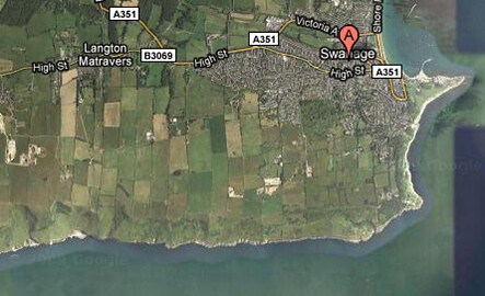
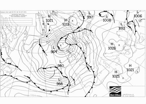
We set off at lunchtime with the WCD forecast fresh in our minds, it was to be a wet weekend with a cold front to pass by late that afternoon and an occluded front with lots of rain to hit on Sunday. It became very apparent on the drive down that Autumn was well and truly with us, the leaves were seasonally coloured and Corfe castle looked particularly spooky, it being so close to Halloween and all. The rain did hit us just as we neared Leeson house as predicted, it was refreshing to be in the company of others who got excited about a heavy rain shower, a reminder of why it is we have all gravitated towards Reading Met department!
A brief for the weekend followed a substantial dinner (I’m glad I wasn’t the only one to go for seconds). The forecast showed the cold front that had hit us earlier that day travelling up and across Europe leaving clearer skies and cooler air in its wake. It looked good for our walks on Saturday, a mild South Westerly flow, good visibility and no frontal rain predicted. The famous occlusion was looming in the Atlantic at this time, those timetabled to do more walking on Sunday braced themselves.
The frontal rain cleared just in time for us to make the walk into Langton Matravers for a beverage or two, but sadly the clouds hung around so there were no stars to be seen away from the light pollution of the city.
Saturday came and armed with measuring instruments the mighty group D set off on their weather walk. The general picture was convection over the warmer sea with the clouds dissipating not long after they travelled over the cooler land surface. There were plenty of fluffy white clouds, posing for photos which was convenient. As we neared dancing ledge on the coast some higher cirrus clouds could be seen to the west, could this be the first sign of the dreaded occlusion?! As we left our idyllic lunch spot at the base of the cliffs a dark looking cloud was looming to the west, later analysis suggested this could be related to a small warm front. As far as I know everyone managed to avoid the rain this brought and stayed relatively dry (but maybe a bit muddy from rolling down hills…).
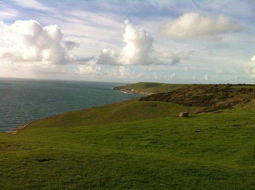
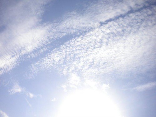
We followed the coast line taking our measurements every half an hour until we reached Durlston Head where the weather mast was located and radiosonde launches were taking place. On the walk along the coast we witnessed the convective clouds over the ocean lining up, a result of rolling winds in the boundary layer. By this point some higher alto and cirrus clouds were also evident, one with an impressive evaporation trail within it, most likely from a high flying plane causing ice to fall out of it.
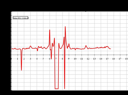
One of the more interesting features of the weather mast was the instrument for measuring potential gradient, which went crazy with precipitation. Later analysis showed an erratic signal early Saturday morning, too early for any of us to be awake, but speaking to a local in the pub that night I learnt that there had been an intense precipitation event around that time. The potential gradient also showed erratic behaviour around the time of the heavy rain shower we experienced Friday afternoon.
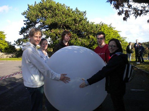
We had now arrived at the main event, launching a weather balloon! Slightly upset that the film crew that had been around for the first group that morning had left, we carried on undeterred. Turned out it was a good thing they had left as we managed to burst the first balloon… there was no impressive bang just a boring slow leak. The on looking crowd did enjoy watching us let this first balloon go. It only occurred to me after we had done this the fun we could have had with the helium, we could have put our atmospheric physics theory about your voice going up an octave and a half to the test.
Our weather balloon was the first of the day to go through a cloud which gave us something to look at on the tephigram. It just about made it to the tropopause before the radio signal became too intermittent to track. Saturday evening saw a trip to the other pub in the village to take measures of another kind. I was sure to take my umbrella to ward of the big bad occlusion, it seemed to work!
Sunday was a cloudy day with predominantly stratocumulus and some light, fragmented precipitation. It seems the looming occlusion had changed its course and passed us by. The winds became more south easterly; the south westerly wind witnessed on Friday and earlier on Saturday had had a marked change in direction. This could have been related to the occluded front which we may have been in the flank of rather than being in the band of frontal rainfall as expected.
After some interesting presentations we headed back to Reading, having experienced the weather and learnt a valuable lesson: ‘the forecast was right, the weather was wrong’.