Postgraduate researcher, Andrew McIlwraith, is examining how the design of floorplans can aid people visiting museums.
While conducting his research, Andrew has gained access to the archives of the Victoria & Albert museum and has been able to examine the floorplans produced over 140 years to aid navigation in the V&A.
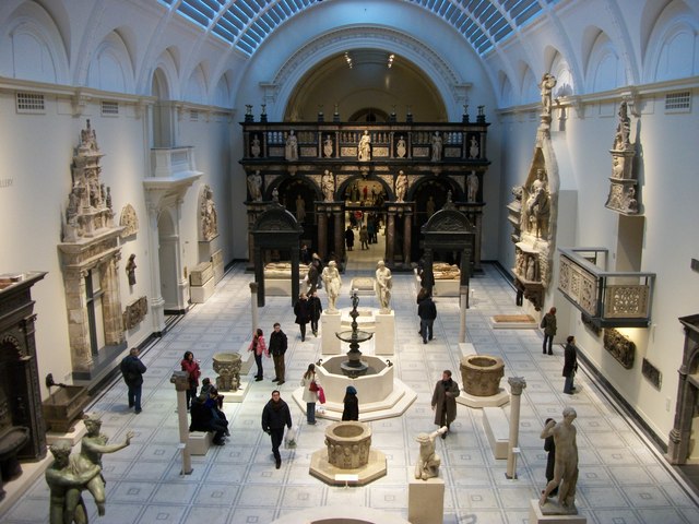
A close look at the maps brings to the fore relevant challenges of wayfinding, and also shows interesting approaches taken by the designers when trying to guide what is essentially a physical and sensory experience through the use of an encoded flat illustration. Some of these include graphic ways to suggest routes to the visitor and ways to highlight the location of particular exhibits. Specially relevant to the V&A building (which can be complicated even for frequent visitors) are the ways to show the different floors, how they sit on top of each other, and how the visitor can move between them.
Read Andrew’s article here http://www.vam.ac.uk/blog/research-department/best-laid-plans-mapping-the-va-by-andrew-mcilwraith
Andrew is a PhD student in the Department of Typography and Graphic Communication, funded by the Design Star Centre for Doctoral Training.
140 years of visitor maps for the V&A
image via Wikimedia Commons
Postgraduate researcher, Andrew McIlwraith, is examining how the design of floorplans can aid people visiting museums.
While conducting his research, Andrew has gained access to the archives of the Victoria & Albert museum and has been able to examine the floorplans produced over 140 years to aid navigation in the V&A.
A close look at the maps brings to the fore relevant challenges of wayfinding, and also shows interesting approaches taken by the designers when trying to guide what is essentially a physical and sensory experience through the use of an encoded flat illustration. Some of these include graphic ways to suggest routes to the visitor and ways to highlight the location of particular exhibits. Specially relevant to the V&A building (which can be complicated even for frequent visitors) are the ways to show the different floors, how they sit on top of each other, and how the visitor can move between them.
Read Andrew’s article here http://www.vam.ac.uk/blog/research-department/best-laid-plans-mapping-the-va-by-andrew-mcilwraith
Andrew is a PhD student in the Department of Typography and Graphic Communication, funded by the Design Star Centre for Doctoral Training.
Share this: