Author Archives: Rob Thompson

Groundwater Flooding and its Role in Flooding from Intense Rainfall

0987

By David McDonald (British Geological Survey)
18nd July 2014

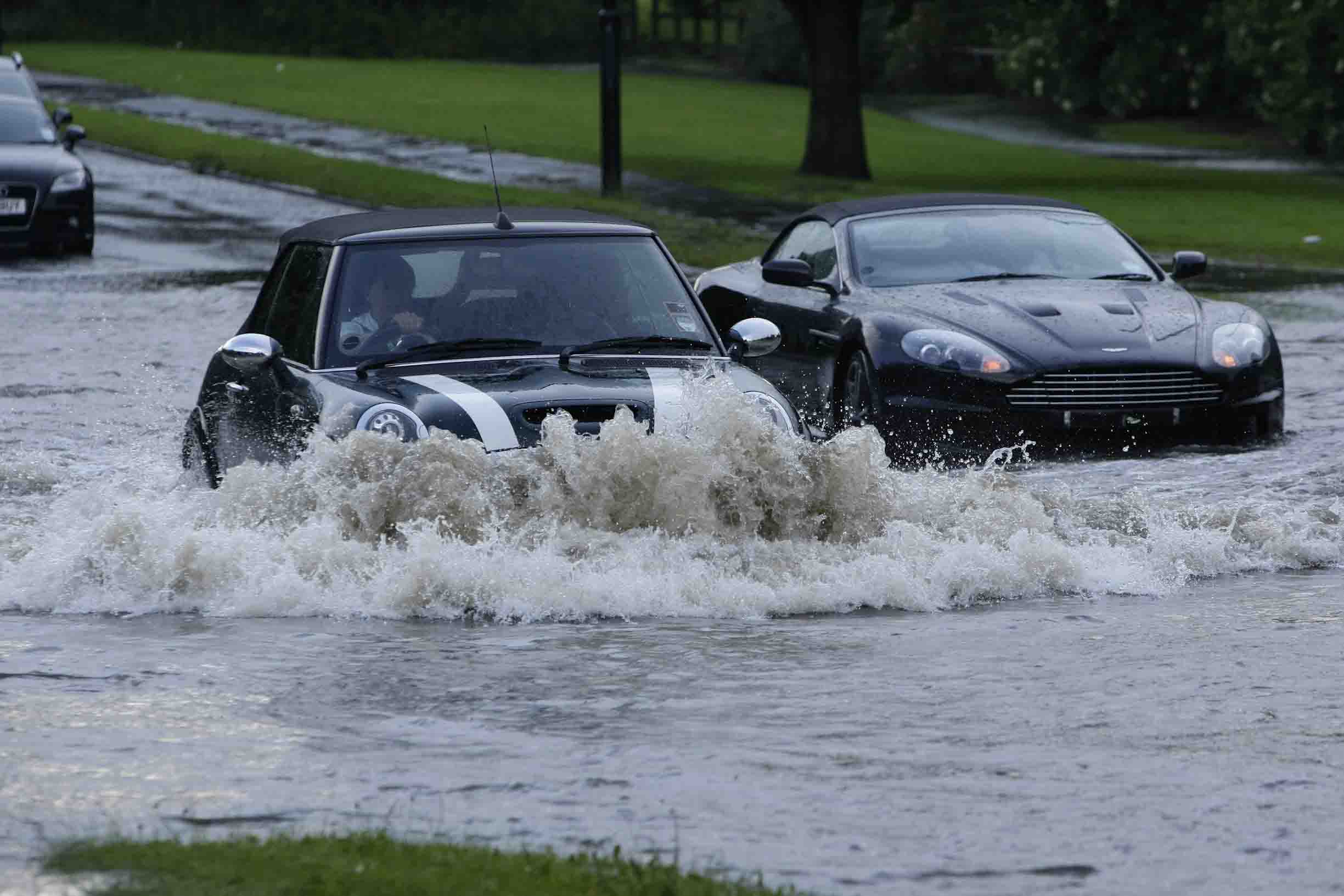
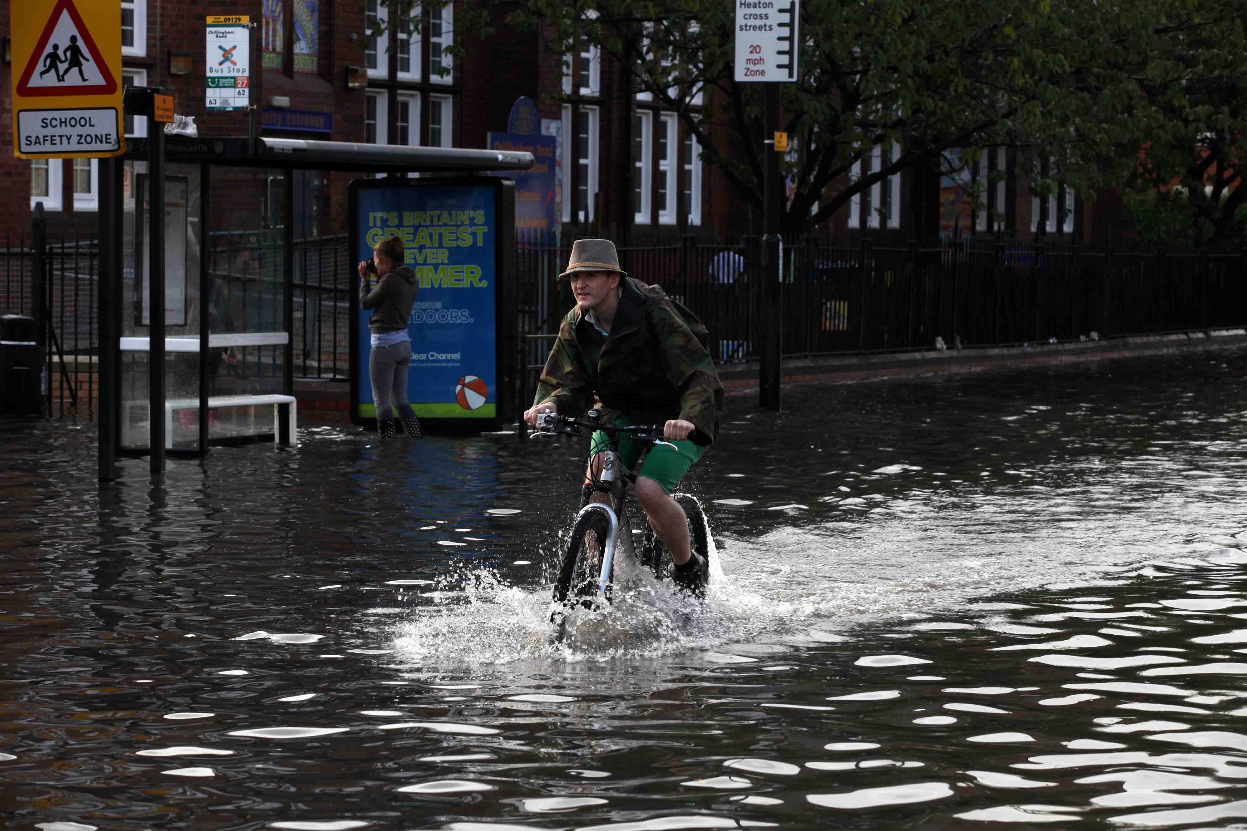
What the floods of early 2014 managed to do was to get lots of people thinking about groundwater’s role in flooding – even the Prime Minister was talking about it! When the water table rises outside of its normal range it can cause groundwater flooding. This is where the water table makes it above ground but also where it rises into basements or into sewers causing them to stop working properly. Groundwater flooding played a big part of the 2014 floods because much of high rains fell where you have permeable  rocks (aquifers) at the ground surface that the rain could infiltrate into. The water table was already high in the Chalk aquifer in south England as a result of a very wet autumn and winter. This gradually filled it up near to the brim with the intense rainfall in January and February causing it to overspill in places. It took some time for the aquifer to fill but then a long time for it to get rid of the excess water through springs and streams. The flooding was often of property, roads and railway lines down-gradient of the springs and streams because proper drainage wasn’t in place – these being unusual flood events. So although our main rivers returned to their banks relatively quickly it took much longer for groundwater flooding to stop.

fig1

So is groundwater flooding relevant when we’re considering flooding from intense rainfall that occurs over hours rather than weeks? This is something that the British Geological Survey (BGS), along with the University of Reading (UoR), is investigating within the SINATRA project. The water table in the Chalk aquifer is generally quite deep but there are other types of aquifer where the water table sits normally quite close to the ground surface. These are mainly where you have very permeable sediments in the floodplains of rivers. During floods, river water will help to fill the aquifer, especially where it has overbanked. But in those areas that the river flood water doesn’t reach, rainfall infiltrating directly into the aquifer could cause groundwater flooding. In these locations how quickly do we see the water table respond to rainfall and how much is required for the ground to get fully saturated? Where you get flash floods does the saturation of the ground play a role? If the water table responds very quickly, groundwater seeping into drains underground might mean they’re less efficient in getting rid of flash food waters.

fig2

BGS and UoR are going to use data from an ongoing study of groundwater flooding in Oxford to investigate the role of groundwater in flooding from intense rainfall. The graph shows how groundwater levels responded to the rainfall event that preceded the summer floods of 2007. The groundwater level rose by 50 cm in a matter of hours – that’s a lot when the water table is normally around a metre below the ground. The rainfall in Oxford itself wasn’t that intense – had it have been would we have seen the water table reach the ground surface quickly enough to cause immediate problems, rather than just the groundwater flooding that came later as the Thames started to gradually rise. We’ll learn from this case study and then use BGS’ national datasets of groundwater level and permeability to see whether this might be a flood mechanism that is important over many areas of the country.

Convective dynamical regimes and their role in Flash Flooding

DF_AZ By David Flack (University of Reading)
2nd July 2014

We are now a month into summer (June, July and August as defined by meteorologists) so convective events (showers, Thunderstorms, etc.) are likely to give us most of our rainfall at this time of year. Convective events provide the most intense, short lived rainfall and often result in flash flooding throughout the world.

My PhD project is part of FRANC and it focuses on looking at the errors in forecasts of these events to see if the forecasts could be improved by assimilating convective-scale data into the forecast. It is of particular interest to see if this data assimilation is of more use in one convective regime compared to the other.

Convection can broadly be classed into two distinct convective regimes: convective quasi-equilibrium or triggered (non-equilibrium) convection. In order to explain these regimes and how they can sometimes lead to flash floods, I need to explain a quantity which gives an indication as to whether convection will occur.

This quantity is the Convective Available Potential Energy (CAPE). It indicates the amount of energy that a parcel of air could have for convective motion, if it is able to get at it.

CAPE_CIN

Consider this sketch of a vertical profile of the atmosphere, with the brown line representing the Temperature, grey line as the dewpoint temperature and red line as a theoretical parcel of air that is ascending through the atmosphere.

If we were to give this parcel of air a kick from the surface it would not rise as it is in stable air, there is an inversion acting as a cap to the motion of a parcel, this is known as the convective inhibition (CIN), the blue area.

If we were to force this parcel of air above this cap and gave it a kick it would rise freely and use the energy (CAPE) as the atmosphere at this point is unstable, and if the parcel is saturated the liquid water vapour would condense and form a convective cloud, that has access to the CAPE and could develop into a thunderstorm. In this diagram the CAPE is represented by the orange area.

There are various different types of convective storms including, showers, squall lines and supercells, to name but a few. Not all of these systems occur in the same dynamical regime and some can occur in both regimes.

The first regime I shall explain is that of convective quasi-equilibrium. In this type of event the large scale production of CAPE balances its release at the convective scale. This release of CAPE is associated with the rainfall. In this situation the value of CAPE is very small and there is usually no CIN. The weather situation associated with this event is scattered showers. The classic April Showers situation falls under this regime. This type of convection is often associated with a large scale trough in the atmosphere or ascent to the right of a Jet exit (as in the case shown in the satellite image).

convlinecornwall

Convective quasi-equilibrium can lead to flash flooding from multiple showers passing over the same area in a short space of time, or slow moving cells, with intense convection.

The second regime is that of non-equilibrium (Triggered) convection. In this situation the CAPE is built up over a period of time due to something (CIN) blocking the access to the energy. This can lead to high values (especially in the Great Plains of the USA in spring) of CAPE forming. At some point, if the CIN can be overcome, by large scale lifting or convergence of the winds at the surface (see satellite image below of convection associated with a convergence line on the north coast of Cornwall), the CAPE will be release all at once and this can often lead to explosive convection. This is how severe thunderstorms and supercells occur, or indeed like the flash flooding on 7/8th June (see previous entry). Because there is a distinct trigger it is often known where these events form so with high resolution forecasts there is better forecasting of them.

scattershowers

These events can also lead to flash flooding, by remaining stationary over an area for a period of time, so that one area is subjected to the heavy rainfall, or again by having slow moving cells or rapidly moving cells passing over the same area in quick succession. Indeed the Boscastle event of 2004 was of a similar setup to the satellite image above where the convection did not move from that area. The only reason why this event shown did not lead to a flash flood was that the rainfall was not as intense as Boscastle.

My work has recently involved looking at the separation of these events using a convective adjustment timescale (first proposed as part of James Done’s PhD at Reading in 2002 by one of his supervisors, George Craig, who is one of my supervisors).  This quantity gives the time it takes the atmosphere to adjust from an unstable profile to a neutral one (on the diagram showing the CAPE and CIN, the red line would be on top of the brown line for a neutral atmosphere). I have been looking at its sensitivity to various averaging methods and seeing whether or not it could apply to convection over the UK, in order to see if I can use this as a diagnostic for the rest of my work looking into convective-scale error growth. The results so far indicate that the timescale can be used to distinguish between convective regime over the UK and its looks like it will be a useful diagnostic for determining regimes for the rest of my work.

June 7/8th Floods

picture By Dr. Matt Perks (Newcastle University)
19th June 2014

The weekend of the 7th and 8th June 2014 saw a severe weather warning of heavy rain issued by the Met Office for almost the entirety of England, coupled with the Flood Forecasting Centre issuing a warning of isolated significant impacts across England and Wales. Early warnings of this weather system were available as early as the 3rd June providing the public, agencies and researchers advanced warning that flash floods may occur. With this news, the FLood Action Team (FLoAT), led out of Newcastle University, began preparing to head out to gather high quality data describing the magnitude and timing of flooding events as a result of intense rainfall. Armed with a range of instrumentation including a rain-gauge, water level sensors, Acoustic Doppler flow meter, turbidity probe and high resolution fixed cameras, the team was prepared to generate data describing the floods and flood-generating processes.

As the weather system moved into the south of England on the 7th June, the team headed south from Newcastle University guided by forecasts produced by The Met Office Global and Regional Ensemble Prediction System (MOGREPS), the Met Office Hazard Manager and real-time crowdsourcing of flooding related tweets. The team planned on intercepting the quickly moving front around the Greater Manchester area, however, based on updated forecasts the team headed to the River Calder (West Yorkshire), a Rapidly Responding Catchment (RRC), with recent history of flash flooding affecting Hebden Bridge and surrounding villages.

graphic

On the 7th June, a total of 11.60mm of rain fell in Hebden Bridge (Station C) in under two hours between 10:30 and 12:20 GMT. The rainfall was localised and intense with a maximum rate of 9mm in 15 minutes. Following the onset of this event, a dampened response was observed from rivers draining the south and western parts of the catchment (Stations A and B). Whilst to the east and north of the catchment, rivers responded rapidly with a time to peak of 2 hours at Hebden Bridge, although 99% of the peak was achieved in just 15 minutes. The impacts of this event on the local communities of Todmorden, Hebden Bridge and Mytholmroyd were minimal as a result of the favourable antecedent conditions and localised nature of the rainfall combined with the speed of the weather system.

Data assimilation – Blending models and observations to predict intense rainfall

o_m-a By Dr. Oscar Martinez-Alvarado (University of Reading
13th June 2014

In sunny days like those we are experiencing right now it is easy to forget the risk of flooding. However, we all know that sooner or later there will be intense rainfall somewhere and the risk of flooding will increase. As scientists it is nice to have a break like this to keep thinking and developing our science so that it becomes useful in the near of far future, once the rain is back. Remember that an increase in summer storms is expected in a warmer, moister environment (for more details see this blog entry).

The prediction of intense rainfall relies heavily on numerical models. These are complex computer codes that solve the equations that describe the motion of air, water vapour and liquid and ice cloud particles. Numerical models are already very good at forecasting large-scale motion. For example, they can forecast with reasonable accuracy the path and development of a low-pressure system many days in advance. However, numerical models are not so good at forecasting small-scale motion because to do so they require equations to accurately describe small-scale processes, which for the large scale were just minor details. This is similar to looking at a distant tree with its top full of leaves. At first sight the edge of the tree (large scale) appears static, but when you look closer you realise that the edge exhibits tiny motions as individual leaves (small scale) oscillate in response to the wind pushing them.

One of the most important aspects of the forecasting process is starting the model. One would think that this is just a matter of pressing a computer button, but it is actually much more complicated than that. The first thing we need is to provide the model with an accurate estimate of the state of the atmosphere at the start of the forecast. The model needs to know where to start. To do this we need to take the observations available and blend them with a first guess of the state of the atmosphere. The first guess is usually provided by a previous forecast. The process of blending observations and previous forecasts is called data assimilation.

Part of project FRANC is to develop new data assimilation techniques to be useful for the prediction of intense rainfall at small scales, more specifically at convective scales (around 1 km). The blending of observations and model information requires some knowledge of how trustable the observations and the model are. In other words, we need to know how big the errors in observations and previous forecasts are. Once again, there has been great improvement in recent years in the estimation of the level of trust we can place in observations and models when applied to the large-scale description of the atmosphere.

The improvements in large-scale data assimilation are partly due to the fact that it is relatively easier to find relationships between variables at large scales. For example, vertical motions are very small compared to horizontal motions so that the large-scale motion can be thought of as almost two-dimensional and in balance with pressure. This is not so true for small-scale motion where the updrafts inside clouds become important. They are not just details to add. Instead they are essential part of the phenomena we are interested in. Coming back to the example of the tree, if we were asked to draw the tree we can sketch the main branches and then cover them with leaves at random. The situation changes completely if we are interested in the motion of the leaves itself because then we would need to consider more details. For instance, we would need to know how the air flows around the leaves even in a calm day.

The representation of moist processes by the data assimilation methods is another big challenge to overcome if we want to improve our ability to forecast intense rainfall. Apart from the lack of simple relationships between moisture variables (water vapour and liquid and ice cloud particles) and other atmospheric variables, another important problem is that the theory assumes a very specific shape for the probability distribution function of the errors in the first guess. This shape is the very well-known, bell-shaped Gaussian (or normal) distribution. Errors in moisture variables simply refuse to be described by such a simple shape and have come up with all sorts of probability distribution functions.

The problems just outlined define the challenges that we will be tackling in project FRANC. These can be summarised in two questions:

  • How should we take into account the relationships between errors the first guess of moisture variables and errors in other atmospheric variables?
  • How should we account for the non-Gaussian properties of errors in the first guess of moisture variables?

The answers to these questions should highlight improvement steps to incorporate into operational data assimilation systems such as the Met Office system. In this way project FRANC’s efforts will translate into benefits for the public in terms of better forecasting capabilities and consequently improved means to prevent and mitigate the catastrophic effects of flooding.

The way in which these questions will be addressed is by designing new so-called moisture control variables. Moisture control variables are variables containing the same information as the original variables (in our case water vapour, cloud particles, temperature, pressure and vertical velocity) but with enhanced properties. They can be more Gaussian, for example. The approach taken consists of using analytic and statistical regressions to relate moisture variables to other variables. The new moisture control variables will then be separated into balanced parts, explained by regressions, and unbalanced parts, whose statistical properties will then be analysed. Once we have a few options for moisture control variables, we will investigate the advantages and disadvantages of using and implementing each option into operational data assimilation systems.

So please keep visiting this blog where we will keep posting summaries of our results from data assimilation and other intense-rainfall-related matters as they come along.


We hope too add some figures to this blog early next week.

Flood Risk and Management

Savic By Prof. Dragan Savic FREng (University of Exeter
10th June 2014

The winter storms of last winter have been exceptional in their duration and intensity, and have led to the wettest December to January period in the UK since records began, causing serious coastal damage and widespread, persistent flooding. Later on in the year, the worst floods in more than a century have submerged large parts of both Serbia and Bosnia and Herzegovina following unprecedented levels of rainfall. Northern Afghanistan has been hit by a series of flash floods in recent weeks, which have affected tens of thousands of people. Those dramatic events that have consumed the south-west UK last winter, the Balkan countries this May and Afghanistan in recent weeks show how flooding can hit unexpectedly and cause devastation to people and communities. They should also raise a number of serious questions in us all, both as individuals and members of a wider society.

The first is why we cannot seem to provide total flood prevention. After all, we do not face the frequent and devastating monsoons and widespread flooding that affect many developing countries in south-east Asia, for example, while our continental neighbours in the Netherlands seem to offer tangible evidence as to how hard engineering can provide total flood control, by forcing back and so keeping out the river and sea waters. However, the Dutch are well aware of the difficulties associated with building ever-larger flood defences to combat changing conditions. Instead, they have instigated a policy of managed retreat from some coastal areas. This does not mean they have stopped upgrading, rebuilding and improving existing flood defences, but are instead developing a portfolio of measures to manage and live with floods.

So perhaps we need to start recognising flooding as another type of risk we live with and manage in our daily life. With flooding, we have to accept there will always be a real risk and it cannot be completely eliminated.

Even the huge investment in improving the UK flood defences after the tidal surge of 1953 could not prevent the flooding experienced in the storm surge last Christmas. Yet there is no doubt that risk has been reduced in recent years. If you compared the flooding of 1953 and now, which are comparable in tidal height and the strength of the wind, then the previous flooding caused much more devastation – causing 300 deaths and numerous sea wall breaches. This and other recent major flooding incidents, such as those experienced in Gloucestershire in 2007, Cumbria in 2009 and Wales in 2012, would have caused much more damage if it were not for the work and expertise of the Environment Agency.

The way forward is to forget about one simple “silver bullet” solution to the flood risk problem, such as dredging or only building concrete flood walls, but to think of flood risk management as a way of increasing societal resilience. This would involve a combination of measures and decisions: to prevent or mitigate flood risk, to prepare for the inevitable occurrence of flooding, to develop warning and alarm raising systems, to plan for an effective response to flooding events and limit loss and exposure, and to plan and organise recovery.

Even if we focus only on prevention and mitigation of flood risk, the difficult decisions will have to be made by government, its agencies, local authorities, families and ourselves, on an individual level. We have to ask ourselves some tough questions. What are our strategic priorities? Can we develop more synergistic policies that help reduce flood risk, like encouraging better farm management practices? Where best to invest limited funds, to gain maximum protection from flooding? Can we allow some farmland to be designated for being safely flooded in extreme situations to protect towns elsewhere? Can we continue to build on flood plains? When do we consider managed retreat from flood vulnerable areas?

The bottom line is flood management is not only about how much dredging we can do, how many more new drains to dig, or how much concrete we can pour. We have to use our best science and engineering, but also work with nature to maximise natural flood protection, which means: protecting and restoring wetlands (that can store or slow down water flowing into our rivers), reconnecting flood plains (to make space for water and protect important areas), investing in upland forestry (to reduce flooding downstream). Research at the University of Exeter has demonstrated that the restoration of peat bogs on Exmoor could result in a third less water leaving the moor during heavy rainfall.

Growing populations, increasing urbanisation, economic growth and climate change mean the likelihood and the consequences of flooding may increase. The question we face as a society is not whether we can beat the nature, but whether we can live with it. To achieve the above, public bodies, businesses, communities, families and individuals will all need to do their bit to respond to the threat of floods. This year marks the centenary of the beginning of the First World War, but this time the urgent recruiting slogan could be “Your country needs you to prepare for, and live with, floods!”

Professor Dragan Savic FREng is the co-director of the Centre for Water Systems, and Professor of Hydroinformatics at the University of Exeter.

First evidence of heavier summer downpours with climate change

OLYMPUS DIGITAL CAMERA By Prof. Hayley Fowler (Newcastle University) & Dr. Elizabeth Kendon (Met Office Hadley Centre)
4th June 2014

Our study, recently published in the journal Nature Climate Change, shows the first evidence that summer downpours in the UK could become heavier with climate change. We used a very high-resolution model more typically used for weather forecasting to study changes in hourly rainfall. Unlike current climate models, this has a fine resolution and is able to realistically represent hourly rainfall, so this allows us to make these future projections with some confidence.

JM280612FLOODS-50


Cars in flood on the Great North Road, Newcastle upon Tyne. Photo from the 28th June 2012 “Toon Monsoon” event in Newcastle upon Tyne, UK, where there was almost 50mm rainfall in 90 mins. ncjMedia Ltd – John Millard.

What we found was that summers are likely to become drier overall by 2100, in a warming climate. But our results suggest that when it does rain, it will be heavier in short outbreaks. In particular, intense rainfall with the potential to cause serious flash flooding (more than 30mm in an hour) could become a more common occurrence, increasing in frequency by several times. This is, of course, of great significance for the SINATRA project.

Climate models generally work at coarse resolutions, using grids of around 12km square or larger, and have been able to accurately simulate winter rainfall from sustained, long-lasting periods of rain from large-scale weather systems. These models point toward wetter winters, with the potential for greater daily rainfall in the future.

But summer weather is harder to predict using such coarse models. In summer rainfall tends to come in short but intense bursts, such as during the “Toon Monsoon” in Newcastle on 28th June 2012, so it is  changes on an hourly basis that are important. So far climate models have lacked the resolution to accurately simulate the smaller-scale convective storms (intense showers formed by rising air) which cause this type of rain. However, we use a 1.5km square grid model (the same as the UK Met Office Weather Forecast model); this is the most detailed model ever used in long climate simulations to examine rainfall change, leading to much higher accuracy.

We ran this model to simulate two 13-year periods, one based on the current climate and one based on the climate at the end of the century under a high-emissions scenario (the IPCC’s RCP8.5 scenario). The simulations were so computationally intensive that it took the Met Office’s supercomputer – one of the world’s most powerful – about nine months to run the simulations, and even then we could only run the model for the southern half of the UK, about as far north as Manchester.

For winter, our model showed increases in hourly rainfall intensity consistent with previous studies. However the finely grained model also revealed that short-duration rain will become more intense during summer, something that coarser models are unable to simulate. This finding is of major importance due to the potential for flooding: a threshold of 30mm per hour is used by the Met Office and Environment Agency Flood Forecasting Centre as guidance to indicate likely flash flooding, and our results suggest this may be exceeded more often (up to five times) and over a wider area in the future.

Summer Storm


Cyclist on Chillingham Road in Heaton,  Newcastle upon Tyne. Photo from the 28th June 2012 “Toon Monsoon” event in Newcastle upon Tyne, UK, where there was almost 50mm rainfall in 90 mins. ncjMedia Ltd – Lewis Arnold.

Our findings are only the results of one climate model and we need to wait for other centres to run similarly detailed simulations to see whether their results support these findings. However, an increase in summer storms in a warmer, moister environment is consistent with theoretical expectations, and with the limited observational studies we have of hourly rainfall to date.

This work was widely reported in the media, see, e.g.:

Guardian: http://tinyurl.com/qysax7a

BBC: http://tinyurl.com/q44eeg4

Journal: http://tinyurl.com/knpq6nn

Sky News: http://tinyurl.com/lxdbzqp

Independent: http://tinyurl.com/op9pgkr

Northern Echo: http://tinyurl.com/k8mqfda

This work is part of the joint Met Office and NERC-funded CONVEX project. The next steps are to see if the results are consistent with observations and predictions of hourly rainfall from climate models in other parts of the world, to be undertaken by the European Research Council-funded INTENSE project jointly run by Newcastle University academics in collaboration with the UK Met Office and other leading international scientists. And to use these results within the SINATRA hydrodynamic and hydrological models to examine the potential effects on flash floods.


We acknowledge funding from the Joint DECC/Defra Met Office Hadley Centre programme (GA01101) and the NERC funded project CONVEX (NE/1006680/1).

Measuring the spatial predictability of rainfall

robert_plant By Dr. Robert Plant (University of Reading)
23rd May 2014

Here are three snapshots of the rain rate over the southern part of the UK, obtained from the radar network. The first two are for the 2nd August 2013, at 9Z and 16Z while the plot on the right is for 14Z on the following day. At a glance we can see that these days were convectively active, but for the most part this is not simply scattered convection. In particular, there are quite a few linear features and some localized areas of heavy, almost continuous, rain.

pic1

Suppose now that we were forecasters looking at plots akin to these and produced from a model. These plots might give us cause for some concern. The last one in particular, with a linear feature along the centre of the southwest peninsula is somewhat reminiscent of the devastating Boscastle flash flood in 2004. In that case, prolonged, intense convective rainfall was maintained along a near-stationary convergence line that was itself caused by a stalled sea-breeze front. The Boscastle flood was a rather extreme example, of course, but the basic situation are not particularly unusual. Indeed, a recent climatology of heavy, prolonged convective rainfall in the UK (ie, quasi-stationary convective storms) has been conducted by Rob Warren and highlights this mechanism and the south-west peninsula in particular. (It would be remiss of me not to congratulate Rob for submitting his PhD thesis on the day that this blog entry goes live. For details of his climatology work see http://www.met.reading.ac.uk/~hy010960/phd/climatology.html)

Model output is not perfect of course. What are the model uncertainties that we ought to be mindful of? Well, we can reasonably suppose that the model has not gone completely askew and has at least have generated some heavy rain in the south of the country. But that rain may nonetheless be somewhat too intense or too light. Also, the model simulation may have produced the rain in the wrong place. This has potentially profound implications for the forecast of flood risk if it alters the relation between the heavy rainfall and the river catchments. Of course, it is just for these reasons that a convective-scale ensemble is so useful: a set of simulations that provides information about the uncertainties in the forecast.

But how should we exploit the ensemble of simulations? In principle, it contains an enormous amount of information, and certainly an enormous amount of data is produced. But we need to be able to extract key aspects quickly and easily. Staring hard at many, many plots from the various simulations can give a good subjective sense of the forecast uncertainty, but is not always the best approach, and is certainly not the most efficient. Another PhD student at Reading, Seonaid Dey, is working on just such issues, not directly as part of FFIR, but obviously closely related. Here is an example of the methods being developed.

pic2

Variations in the intensity of the rainfall between different ensemble simulations are relatively easy to assess, and you can no doubt devise some simple but useful analysis methods without thinking too hard. But the spatial predictability is a tougher proposition. In the figure above, the top line shows the same rainfall data as before, whilst the bottom line shows a measure of spatial predictability produced from the ensemble data for the same time. Let’s talk through the interpretation to show why such analysis is so useful, and then I’ll explain a bit about the calculation methodology for the benefit of interested experts.

The dark reds show the locations with high spatial predictability for rainfall, and light colours have little spatial predictability. One thing to notice immediately is that for areas where there is no rain forecast by any of the model simulations then it is natural that the spatial predictability of the rainfall should be diagnosed as very low, as indeed is the case. In the first example the rainfall is not very predictable. There is a linear feature across Wales that all the simulations agreed about, as well as the scattered showers along the south coast. But the line feature passing close to the Bristol channel is uncertain in the forecast, as is the rainfall area over East Anglia.

The second example is an interesting case with mixed predictability, which stresses the point that a single spatial predictability measure for the whole domain is not sufficient to give the full picture: we really need to able to produce such maps. Imagine a NE to SW line passing through the Wash. The rainfall to the north of this line is well captured, with good agreement across the ensemble. However, predictability to the south of the line is very low, and the feature in the radar data just crossing the south coast could not have been forecast with any confidence.

Finally the last example shows that the rainfall oriented along the south west peninsula is very spatially predictable across ensemble members, and so shows us very quickly and easily that this is a very probable event that’s well worth watching. Fortunately, these storms were not particularly intense and there were no reports of damaging impacts.

And so, as promised, I should close by giving some idea of the calculations. We adapt a verification metric known as the Fractions Skill Score, or FSS. It is used to compare all the possible combinations of two simulations. For each pair, we determine a skill score imagining that one of the simulations is being used to predict the other. The score varies with spatial scale: at the grid scale the simulations are unlikely to agree but considered at larger scales the simulations start to appear more alike. Successively increasing the scale over which the calculation is performed, we can identify that for which one simulation has meaningful skill at usefully predicting the other. Average this scale over all possible pairs, and that’s what was plotted.

Haltwhistle Burn Catchment – April and May 2014 flash flood events

photo (5) By Eleanor Starkey, Dr. Geoff Parkin and Dr. Matt Perks (Newcastle University)
19th May 2014

The Haltwhistle Burn catchment (Northumberland) is predominantly rural, 42km2 in size and is situated in the centre on Britain. The catchment is elongated, which becomes particularly steep and narrow towards its confluence and outlet with the South Tyne River. The town of Haltwhistle (population of just under 5000 – Office for Statistics, 2011 census) is also located close to the outlet. The Haltwhistle Burn catchment has a history of flooding, with records dating back to at least 1892, affecting the town in numerous locations during 2007, 2012, 2013 and more recently, April and May 2014 events. As a result, the Haltwhistle Burn catchment is listed on the Environment Agency’s Rapid Response Catchment (RRC) register.

The recent flood events which occurred on Wednesday 30th April and Sunday 11th May 2014 highlight how flashy and localised rainfall and subsequent flood events are within this catchment. On both occasions there were no weather warnings issued by the Met Office and rainfall totals took locals by surprise. On each occasion, the rain storm lasted approximately 40 minutes. Many properties flooded, culverts became blocked by sediment and drains surcharged. On both occasions, the Fire Bridge was called out. A local resident commented that “the floods had been and gone within a few hours”.

fig1 Haltwhistle Burn 30/04/14 1600hrs at peakflow                    Rainfall radar at 1445hrs 30/04/14

A PhD project at Newcastle University (which is focussing on the Haltwhistle Burn catchment, see http://research.ncl.ac.uk/haltwhistleburn/) has collected data from members of the locals community (through a ‘community monitoring’ approach) and nearby traditional monitoring sites. The map below illustrates where rainfall has been monitored within and near the Haltwhistle Burn catchment on 30th April 2014. A total of 41mm of rainfall was observed by a local resident in Haltwhistle, yet nearby monitoring stations were far lower. The nearest national rainfall monitoring station is 3.4km away from the Haltwhistle but only measured 17.2mm of rainfall.


fig2

A comparison between 24 hour rainfall totals for 30/04/2014 event

To further emphasise how localised these heavy rainfall events were, a Flood & Coastal Erosion Risk Management Engineer from Northumberland County Council confirmed that they did not have any reports of flooding elsewhere in the county during these two days. This case study provides an excellent example of why monitoring is required on a local level to capture the nature and understand the impacts from flash flood events.


Atmospheric Precursors to Flash Floods

adrian_champion By Dr. Adrian Champion (University of Reading)
19th May 2014

One of the most important requirements to improving our prediction of flash floods is to know and understand what the atmospheric precursors are for a flash flood, i.e. what was the atmosphere doing that caused the flash flood to occur? As mentioned in an earlier post (Summer Intense Rainfall Events vs Winter Flooding, 28th January 2014, Adrian Champion) there are many problems associated with predicting flash floods, however the main issue when understanding the atmospheric precursors is the scale at which flash floods occur.

Flash floods, floods that last for less than a day, affect a very small area and are caused by weather systems that are only a few 10s of km in size. This makes them very difficult to predict and observe, with weather forecast models only recently able to predict systems of this size, and ground observations also being at this scale. Therefore to detect what atmospheric features cause flash floods is extremely challenging.

Atmospheric Rivers

Atmospheric Rivers are areas of high moisture convergence that, when present, stretch back from the UK coastline across the Atlantic for at least 2000 km and are present for at least 18 hours. This represents a significant amount of moisture that has the potential to fall as intense rain over the UK. Atmospheric Rivers have already been shown to be the cause of 60% of all the most extreme winter flooding events in the UK over the past 30 years.

Preliminary findings suggest that Atmospheric Rivers cannot be associated with summer flash flooding events. This is not particularly surprising as atmospheric rivers provide a continual supply of moisture over a large area for an extended period, this does not match with the scale or duration of flash floods. Therefore one of the questions being investigated by SINATRA is whether there is a common atmospheric feature that can be attributed to summer flash floods. This also requires an observational record of intense rain events.

June2012MF

Observing Intense Rain

To be able to associate certain atmospheric features to summer flash floods we need to know when there was intense rain. Part of the work being undertaken at the Department of Meteorology, University of Reading is to create a record of when flash floods occurred using an observational dataset. One dataset being used is the raingauge network, a series of buckets that collect water and record every time 0.2 mm of rain is collected – known as tipping bucket raingauges. The advantage of this dataset is that it observes the amount of rain reaching the ground with a high degree of accuracy. The disadvantage of this dataset is that they are spread sporadically across the UK and are very susceptible to errors, either mechanical or due to local factors. These errors need to be addressed before the intensities can be used in observing the rain.

A further problem is calculating what intensity rainfall may lead to a flash flood. This is highly dependent on the ground conditions prior to the intense rain. One of the causes of the prolonged flooding over the winter was due to the ground becoming saturated, followed by a series of heavy rainfall events. The ground is still saturated from the winter flooding, and therefore even a relatively low-intensity rain event may cause flash flooding. The opposite is also a problem; last summer during the drought period, the ground was so dry that it was unable to absorb any rain, resulting in higher chance of flash flooding.

rain_gauge_diagram

Summary

It is clear that associating flash floods with a common atmospheric feature is a complex task that has many problems. Whether or not an intense rain event causes a flash flood is dependent on the preceding ground conditions, where the rain falls (i.e. which catchment) and the period over which the rain falls. It is hoped, however, that by finding an atmospheric feature that is commonly associated with summer flash floods, the prediction of these events can be improved.

Tyne project wins national river partnership prize

Geoff Parkin By Dr. Geoff Parkin and Eleanor Starkey (Newcastle University)
15th May 2014

A project involving a partnership between Tyne Rivers Trust, Newcastle University, and community groups has won the Partnership category in the inaugural England River Prize run by Environment Agency, River Restoration Centre and WWF.

The Haltwhistle Burn Catchment Restoration Fund (CRF) project involves a ‘total catchment’ approach which brings together organisations and individuals to tackle issues of water quality and flood risk management as well as collectively improving our understanding of the sub-catchment and river processes. To support the CRF project outcomes, Tyne Rivers Trust has part funded Eleanor Starkey’s PhD within CEG, with supervisors Geoff Parkin, Paul Quinn and Andy Large. Eleanor’s research project ‘Community Monitoring and Modelling for Catchment Management and Restoration within the UK’ is focussing on engagement with the local community in the Haltwhistle Burn catchment, a tributary of the Tyne, to monitor a range of catchment parameters and issues using low-cost and simple techniques, develop and test green-engineering catchment management techniques, and use modelling strategies that can provide meaningful results back to the community. This work builds on existing research in CEG in natural flood management, hydraulic and hydrological model development, and crowd-sourcing methods for data gathering.

pic

This research study is closely aligned with the Sinatra project objectives, in using community sourced data to provide essential information on rapidly responding catchments, which complement the spatially-sparse national observation networks for rainfall and river flows. The study is providing evidence of the value of this information, as well as testing methods for engaging with local communities that will help to support the work of the Sinatra Flood Action Team (FloAT).

Visit http://research.ncl.ac.uk/haltwhistleburn/ for further details.