
By: Thorwald Stein
It’s been a tough summer for rain enthusiasts in Southern England, with the region having just recorded its driest July on record. But, there was no shortage of cloud: there will have been the slight probability of a shower in the forecast, a hint of rain on the weather radar app, or you spotted a particularly juicy cumulus cloud in the sky getting tantalisingly close to you before it disappeared into thin air. You wonder why there was a promise of rain a few hours or even moments ago, and you brought in your washing or put on your poncho for no reason. What happened to that cloud?
The first thing to consider is that clouds have edges, which, while not always easily defined, for a cumulus cloud can be imagined where the white of the cloud ends and the blue of the sky begins. In this sense, the cloud is defined by the presence of lots of liquid droplets due to the air being saturated, i.e. very humid conditions, and the blue sky – which we refer to as the “environment” – by the absence of droplets, due to the air being subsaturated. The second realisation is that clouds are always changing and not just static objects plodding along across the sky. Consider this timelapse of cumulus clouds off the coast near Miami and try to focus on a single cloud – see how it grows and then dissipates!
Notice how each cloud is made up of several consecutive pulses, each with its own (smaller scale) billows. If one such a pulse is vigorous enough, it may lead to deeper growth and, ultimately, rainfall. But, the cloud edge is not solid: through turbulent mixing from those pulses and billows, environmental air is trapped inside the clouds, encouraging evaporation of droplets and inhibiting cloud growth. Cumulus convection over the UK usually does not behave in such a photogenic fashion, as it often results from synoptic-scale rather than local weather systems, but we observe similar processes.
Why, then, are there often showers predicted that do not materialise? (1) Consider that the individual cumulus cloud is about a kilometre across and a kilometre deep. The individual pulses are smaller than that and the billows are smaller still, “… and little whirls have lesser whirls and so on to viscosity” (L.F.Richardson, 1922): we are studying complex turbulent processes over a wide range of scales, from more than a kilometre to less than a centimetre. Operational forecast models are run at grid lengths of around 1 km, which would turn the individual cumulus cloud into a single Minecraft-style cuboid. The turbulent processes that are so important for cloud development and dissipation are parameterised: a combination of variables on the grid-scale, including temperature, humidity, and winds will inform how much mixing of environmental air occurs. Unfortunately, our models are highly sensitive to the choice of parameters, affecting the duration, intensity, and even the 3-dimensional shapes of showers and thunderstorms predicted (Stein et al. 2015). Moreover, it is difficult to observe the relevant processes using routinely available measurements.
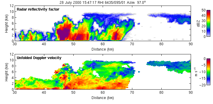
At the University of Reading, we are exploring ways to capture the turbulent and dynamical processes in clouds using steerable Doppler radars. Steerable Doppler radars can be pointed directly to the cloud of interest, allowing us to probe it over and over and study its development (see for instance this animation, created by Robin Hogan from scans using the Chilbolton Advanced Meteorological Radar). The Doppler measurements provide us with line-of-sight winds where small variations are indicative of turbulent circulations and tracking these variations from scan to scan enables us to estimate the updraft inside the cloud (Hogan et al. 2008 (4)). Meanwhile, the distribution of Doppler measurements at a single location informs us of the intensity of turbulence in terms of eddy dissipation rate, which we can use to evaluate the forecast models (Feist et al. 2019). Combined, we obtain a unique view of rapidly evolving clouds, like the thunderstorm in the figure below.
 Figure: Updraft pulses detected using Doppler radar retrievals for a cumulonimbus cloud. Each panel shows part of a scan with time indicated at the top, horizontal distance on the x-axis and height on the y-axis. Colours show eddy dissipation rate, a measure of turbulence intensity, with red indicative of the most intense turbulence, using the method from Feist et al. (2019). Contours show vertical velocity and arrows indicate the wind field, using a method adapted from Hogan et al. (2008). The dotted line across the panels indicates a vertical motion of 10 meters per second. Adapted from Liam Till’s thesis.
There are numerous reasons why clouds appear where they do, but it is evident that turbulence plays an important role in the cloud life cycle. By probing individual clouds and targeting the turbulent processes within, we may be able to better grasp where and when turbulence matters. Our radar analysis continues to inform model development (Stein et al. 2015) ultimately enabling better decision making, whether it’s to bring in the washing or to postpone a trip due to torrential downpours.