
Here, I discuss the possible fate of the debris of flight MH370 if indeed it crashed in the Southern Indian Ocean, West of Perth.
To do this, I use a numerical model (MITgcm) to advect particles using observed currents of past years (these currents are estimated from satelite altimetry, AVISO dataset). Satellite altimetry measures the (small) variations of the sea surface height over 10s of kilometers, from which we can compute the surface geostrophic currents.
To simulate the behavior of the debris, I assume that initially (at the time of the crash) the debris are spread over a very small area (500 m wide). These small clusters will be released in two places, to the North (30S) and to the South (32S) of the search area (where the plane is though to have crashed, see big red dots in first figure below). Finally, to test the sensitivity of the results to the state of the ocean, I use currents from March 1992, March 1993,…, and March 2007.
The figures below shows the computed trajectories. Each spaghetti is a cluster of 5 particles (you can’t distinguish the particles on this scale) over a 30-day period. The thick dashed black box represents approximately the search area. To give a sense of the scale, the squares (light dashed lines) in the close up view are about 100×100 km. A video of these float trajectories is available here: http://youtu.be/hInOLnwAbRc


It is clear that the debris could travel in any direction. They could follow a nearly straight line or go around in circles. In some cases, the debris move very slowly, covering as little as a few 10s of km in 30 days. In other cases, they move by as much as 400 km. These trajectories are the results of mesoscales eddies. These eddies are quasi-circular currents with a diameter of about 50 km. They are the equivalent of cyclones and anti-cyclones in the atmosphere. Particles at the center of an eddy might not move at all. Those at the rim of an eddie could travel relatively fast (0.5 m/s). Particles outside an eddy could move slowly (if far from eddies) or very fast (if caught in between two counter-rotating eddies).
Note that, even though the clusters are released in the middle of the search area, some are able to leave the search area within 30 days.
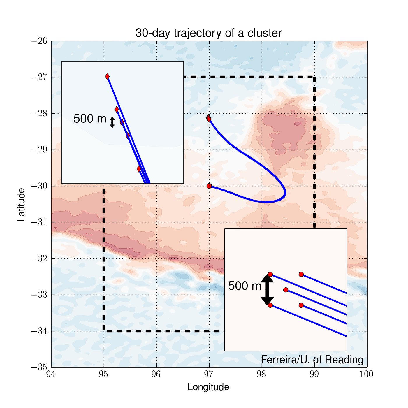
If we zoom on a cluster, we can see how the particles within a cluster are pulled apart. In the particular example on the right, the debris are initially well ordered in a 500 m wide square (bottom right insert). By day 30, the debris have been stretched 3 km apart (top left).
There are a few take-home messages:
- two things happen in these simualtions: 1) the small clusters of particles widen with time and 2) the small clusters travel very long distance,
- assuming the initial cluster of debris was 500 m wide, it could have grown to 1 to 3 kilometers by now (30 days),
- the small clusters could travel 100s of kilometer within 25 days, in ANY directions (although it could have travelled as little as of few 10s of km from its initial position),
- the small cluster could be OUTSIDE of the search area (if indeed the plane had crashed within the search area),
- each March current gives a different outcome,
- if a cluster of debris is found, it could have been anywhere in 300 km radius 30 days ago.
This figure shows the averaged size of the clusters and how it evolves with time. The result from the numerical simulation is shown in blue. The clusters are initialized with a size of about 400 m. By now (30 days), the patch of debris may be about 1.5 km wide. The red curve is an exponential with an e-folding timescale of 20 days.

A few caveats are worth mentioning. Here the direct influence of the surface winds on the particles is neglected. One can imagine that light debris (e.g. a cushion) would be pushed around more efficiently by the winds than by the currents. Wind-driven Ekman current are also neglected. Finally, the satellite altimetry from which the currents are estimated does not capture the smallest scales. Because of the spacing between the satellite tracks, some details (the submesoscale currents) are missing. If anything the above calculations give a lower bound on dispersal of the debris.