Palm oil plantations in Liberia – are buffer zones the answer?

Elaeis guineensis

Elaeis guineensis

Ahead of the launch of a report by Geoff Griffiths and Ruth Evans on the environmental and social impacts of a proposed Palm Oil plantation in Liberia, Geoff featured in two interviews for the BBC World Service.

The Newsday interview was broadcast at 6am on Monday 24 June (55 minutes into the programme). Listen to the Newsday programme (available until 29 June.)

The World Business Report with Mike Johnson, a ‘head-to-head’ between Geoff and a representative from Sime Darby (Malaysia Palm Oil Company) was broadcast at 22:32 on Monday 24 June (15.35 minutes into the programme).   Listen to the World Business Report programme.

“Our work suggests that buffer zones of 1 to 4 km around local settlements would help local people retain farmland and some access to forest resources. Our innovative environmental assessment also identifies key areas for biodiversity, carbon storage, water supply and livelihoods. Protecting such areas would help to reduce negative impacts.” says Geoff. Read more on Phys.org

Read the full report: Palm oil, land rights and ecosystem services in Gbarpolu County, Liberia

Read about Geoff

Read about Ruth

Photo credit: Marco Schmidt / Foter.com / CC BY-SA

NERC Airborne Research and Survey Facility (ARSF) to assist with floodplain meadow research

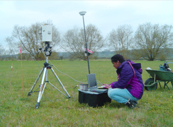
Determination of radiance spectra (using a GER 3700 hyperspectral radiometer) on Yarnton Mead, an ancient floodplain meadow near Oxford.   PhD-student Suvarna Punalekar (Felix scholar, University of Reading). These data serve as calibration for the airborne remote sensing data.

Determination of radiance spectra (using a GER 3700 hyperspectral radiometer) on Yarnton Mead, an ancient floodplain meadow near Oxford. PhD-student Suvarna Punalekar (Felix scholar, University of Reading). These data serve as calibration for the airborne remote sensing data.

Anne Verhoef, Kevin White and Suvarna Punalekar a PhD student funded by the Felix Scholarship scheme, have been successful in an application to the NERC Airborne Research and Survey Facility (ARSF). The ARSF will fly the NERC -funded network of sensors project (FUSE) project site at least 3 times (weather permitting), possibly more often. Airborne remote sensing provides an efficient method for the rapid collection of data over a specified area.

The FUSE project is based at Yarnton mead an ancient hay meadow that is part of the Oxford Meadows Special Area of Conservation. The team are investigating the interactions between the hydrological, thermal and nutrient regime and the functioning of plant communities in this example of a floodplain meadow.
Some floodplain meadow ecosystems have evolved into highly bio-diverse plant communities due to the continuance of traditional management practices. These areas are important for flood storage and sediment retention. The UK now has less than 1500 ha of this unique habitat remaining and the habitat has been given protection under the European Habitats Directive. In order to conserve and better exploit the services provided by floodplain meadows, an improved understanding of its functioning is essential.

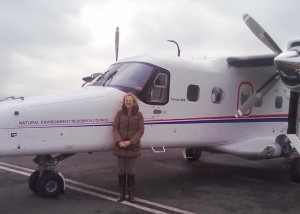
Anne Verhoef with the NERC Dornier 228 aircraft

Anne Verhoef with the NERC Dornier 228 aircraft

The NERC ARSF remote campaign with FUSE field observations gathered during 2013 will provide an important contribution to monitoring the biophysical properties as well as vegetation processes. The remote sensing and in-situ data will be used in conjunction with the SCOPE model, to ensure the derived information on the functioning of the floodplain ecosystem is mechanistically sound.

Read about the Fuse project

Hear the Naked Scientist’s interview with Anne Verhoef

See a video report on NERC’s scientific research plane, the Dornier 228 

Read about the SCOPE model

Read about ARSF