New publication Medieval Archaeology edited by Reading archaeologists

Medieval Archaeology, edited by Roberta Gilchrist (Research Dean) and Gemma Watson from the Department of Archaeology, is a new publication in Routledge’s Critical Concepts in Archaeology series.

The four-volume publication reprints 77 influential papers carefully selected to highlight the key issues and debates in the development and contemporary practice of later medieval archaeology in Europe (c. 1000–1550 AD).  The four volumes are designed thematically: ‘Defining Medieval Archaeology’, ‘the Medieval Landscape’, ‘Medieval Life’ and ‘Medieval Social Archaeology’. The publication includes papers by Reading archaeologists Roberta Gilchrist, Grenville Astill, Mary Lewis, Gundula Mueldner and Aleks Pluskowski.

The set is aimed at an international audience and is intended as a one-stop research tool to complement degrees in Medieval Studies and provide a background in medieval archaeology and material culture.

For more about the book, visit the publisher’s website: https://www.routledge.com/Medieval-Archaeology/Gilchrist/p/book/9780415718165

Travels to Tübingen

I’ve recently returned from Tübingen University in SW Germany: I had an invitation to visit from Professor Jörn Staecker, whom I’d last met when we were both giving lectures in Korkyt Ata Kyzylorda State University in Kazahkstan. Tübingen has a strong commitment to archaeology, with a research centre in medieval archaeology and I was also visiting because Reading has recently established a strategic partnership with the university to develop academic contacts. Last year Tübingen gained a prestigious government grant to run a multi-disciplinary research project on resources, their perception and exploitation. The project has many themes and some deal specifically with the medieval period: they involve the analysis of past landscapes in the area of the south Black Forest and the  impact of resource use and management by monasteries and castles in the area around the Bodensee (Lake Constance), on the border between Germany, Austria and Switzerland.

Tübingen Castle, the home of the university’s archaeology department

Tübingen Castle, the home of the university’s archaeology department

It was only in the 1180s that there was a general intensification of resource use and this could be related to the development of specific identities for both the urban workers and the peasantry which gave both the towns and countryside a different character.

I also had individual meetings with post-doctoral fellows and PhD students researching aspects of medieval landscapes and also workshops with other postgrad students working on the medieval aspects  of the resources project.

I also visited and discussed sites which I had long wanted to see, such as the great Cistercian monastery of Bebenhausen, where I was shown around by Christina Vossler who had written up the recent excavations for her PhD. We also visited the Benedictine monastery of Hirsau, famous for its pioneering  role in the spreading of the Cluniac reform in southern Germany. The monastery was founded in the early eleventh century and parts of that monastic church survive. However, by the end of the same century Hirsau had become such an important pilgrimage centre that a new monastery was built less than a kilometre away, a very unusual development. I was also shown Lichtenstein, the site of a medieval castle (surviving as a set of earthworks and some standing masonry) in a stunning and defensive position overlooking a steep-sided river valley. Close by there is a Gothick castle built in the 1840s by the Dukes of Würtemberg.

Bebenhausen: the abbey church

Bebenhausen: the abbey church

Archaeology (Palaeolithic, late prehistory, classical and medieval) is located in the castle of Tübingen , which probably originated in the eleventh century but was converted into a palace in the seventeenth century. It overlooks the historic town of Tübingen, which has a medieval market and collegiate church at its core and its streets are lined with large timber-framed town houses of the sixteenth century: in all, a remarkable survival of a late medieval town.

The nineteenth-century castle of Lichtenstein

The nineteenth-century castle of Lichtenstein

There will be further exchanges between the departments: Aleks Pluskowski and Alex Brown for example will go to Tübingen in January to talk about the Baltic Crusades project and Jörn Staecker will come to Reading for the first Medieval Social Archaeology Research Group workshop on religious transformations. Future exchanges for postgraduates were discussed as well as combined  undergraduate fieldtrips.


About today’s blogger

GrenvilleAstil_w Professor Grenville Astill specialises in monasticism, industry, urban and rural settlement in medieval North Western Europe. He leads one of the longest running and most extensive research projects on a medieval monastery at Bordesley Abbey (http://www.reading.ac.uk/bordesley/) alongside a reconsideration of the process of medieval urbanisation. He has also conducted a research project in Brittany which tracks change in the countryside from the later Bronze Age to the 1920s using a combination of archaeological, documentary and building evidence.

Why do towns move?

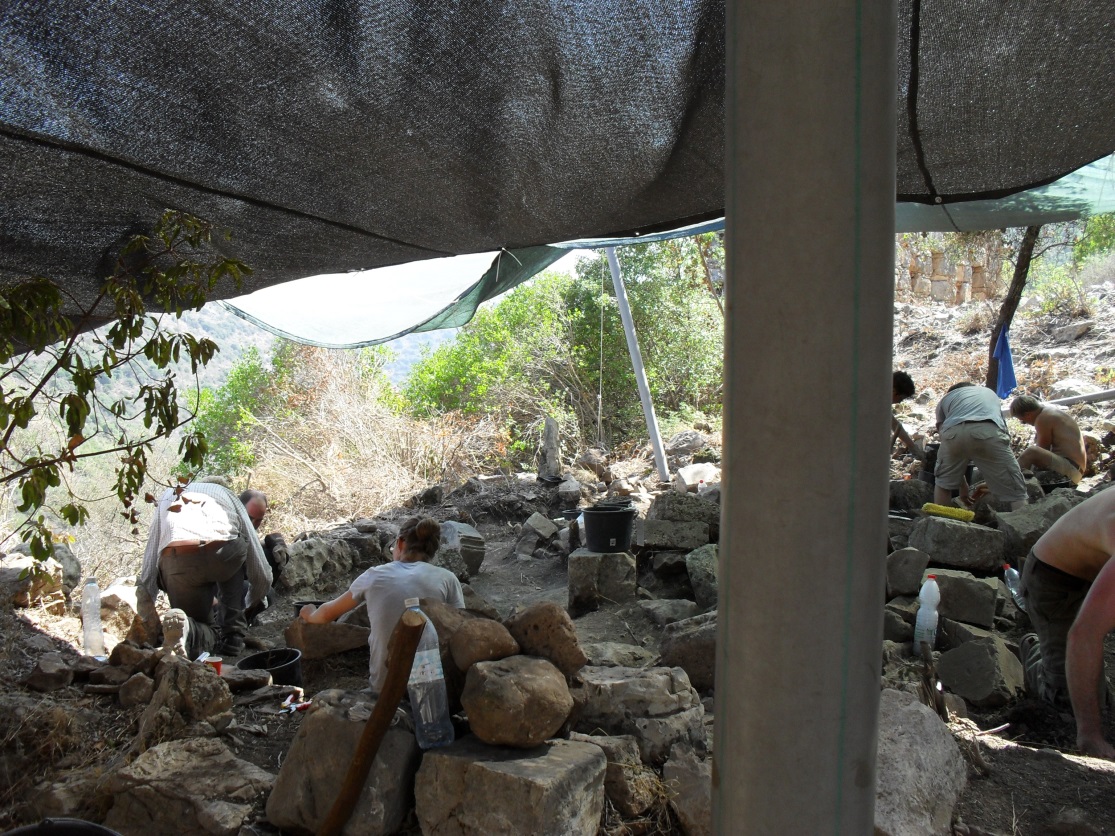
I’ve just attended a conference that marked the end of a two-year project which investigated why the viking-age trading town of Hedeby on the south side of the Schlei fjord (on the boundary between Germany and Denmark) was deserted in favour of a town on the north of the fjord, Schleswig in the eleventh century. The picture shows the abandoned site of Hedeby in the foreground, enclosed by a great semicircular bank, with the medieval and modern town of Schleswig in the background.

The town of Hedeby in the foreground and Schleswig in the background

The town of Hedeby in the foreground and Schleswig in the background

The research was funded by the German Volkswagen Foundation and much effort by the Schleswig-Holstein Landesmuseum went into making the excavations of the waterfronts and quays at Schleswig publicly available and also organised the scientific analysis of the metal and glass finds from both Schleswig and Hedeby.

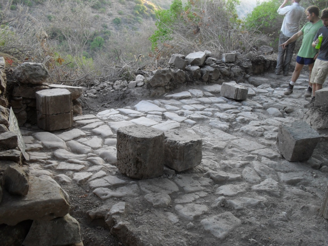
The entire area of Hedeby is now owned by the Landesmuseum and the staff arranged a new metaldetecting survey of the intramural area in order to gain material from the latest time when the town was occupied. The latest levels had been disturbed by past ploughing and so the extent of eleventh-century occupation had previously been underestimated. A great quantity of metalwork was recovered and  it now possible to say that Hedeby was abandoned after AD1020. Previously it was thought that the town declined in the 980s and that the move to Schleswig was more gradual.

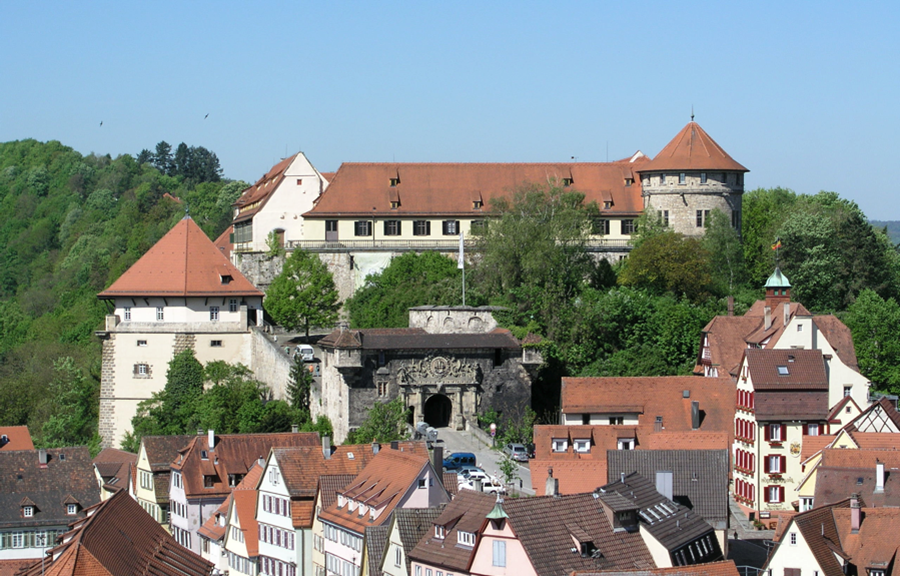
The conference took place in the Landesmuseums’s headquarters in the Schloss Gottorf, a place which started as a moated medieval manor house of a bishop and was then turned into a huge mansion in the late seventeenth century. The space is vast for the display of exhibits (including a separate building for the Nydam boat, found in a nearby bog in the 1830s)

PhD students and staff from the museum and universities presented the impressive results from the project and there were also visiting lecturers who reported on current work on eleventh-century towns in Denmark, Norway, Sweden, Belgium, Germany, Poland, Russia and the UK. I was asked to provide an overview on the state of early medieval town studies in England.

Schloss Gottorf, Schleswig, headquarters of the Schleswig-Holstein Landesmuseum

Schloss Gottorf, Schleswig, headquarters of the Schleswig-Holstein Landesmuseum

The scientific analysis of the finds was particularly interesting and contributed much to our knowledge of trade through northern Europe, as shown for example by the changing sources of raw materials such as silver and lead. In the eleventh century most of the metals came from the Rhenish massif and emphasised the relations of Hedeby with the German kingdom.

While there was some similarities in the metalwork and glass from Hedeby and Schleswig, there were also significant differences: Hedeby’s copper alloys were more tin-rich than Schleswig’s which had more lead; while Hedeby’s glass contained a variety of constituents, that at Schleswig was all lead glass. And while there is much evidence for the casting of bronze at Hedeby, most of that material in Schleswig was in sheet form and must have been beaten into shape. All this has immense importance for our knowledge of medieval technologies, but the anomalies might also be explained by different people producing metalwork in the two places and could help explain why the town moved.

The most interesting ideas for the abandonment of Hedeby focussed on its highly congested and polluted condition, not only in the town itself but also in the harbour which had become choked with wrecks. But it is also possible that the idea of what a town should be like was changing. In the early eleventh century many towns were founded or redeveloped in the region – places such as Ribe, Roskilde (Denmark) and Lund (Sweden) – and of course Schleswig. These were founded by kings and bishops as their centres, and these had a different character and purpose from Hedeby.

I learned a lot from the presentations and the prolonged discussions and disagreements. And I was not the only one to benefit because in the following week I was including this new information in my lectures.

About today’s blogger:

GrenvilleAstil_wProfessor Grenville Astill specialises in monasticism, industry, urban and rural settlement in medieval North Western Europe. He leads one of the longest running and most extensive research projects on a medieval monastery at Bordesley Abbey (http://www.reading.ac.uk/bordesley/) alongside a reconsideration of the process of medieval urbanisation. He has also conducted a research project in Brittany which tracks change in the countryside from the later Bronze Age to the 1920s using a combination of archaeological, documentary and building evidence.


Student Report – Excavations at Montfort

James Billson, currently studying for his MA in the Archaeology of Medieval Europe, spent time this summer working at the excavations at Montfort. Read on for his report!

“During 2014 I was a part of the excavations conducted at the Teutonic castle of Montfort, in Northern Galilee. Montfort is a Mountain spur castle which takes advantage of the local topography; it is flanked by Nahal Kziv to the north and Khalet Khzam to the south.

This castle was occupied from roughly 1220 to 1271; it saw two Muslim sieges, one in 1266 which it survived, and another in 1271, falling to Baybars. Chronical tell us that this spur castle served as the headquarters for the order in the holy land, occasionally being used as the residence of the Hochmeister (the grand master of the order).

Montfort1

Figure 1: Sole standing wall of the ‘hall’. Note the staircase leading to the doorway, formerly a window which is thought to have been converted by the knights for this use. Also note the central pillar, as an indicator of the scale of this room, for more of an indicator see figure 2.

Previous excavations were conducted at this site in 1877 by Horatio H. Kitchener and in 1926 by Bashford Dean (the curator for the arms and armour department of the Metropolitan Museum of Art in New York), he was hoping to recover a suit of armour. In 1994 limited excavations were conducted in the hall prior to restoration work commencing; the castle is in a state of ruin, much as it was left by Baybars following its fall.

Montfort2

Figure 2. (See figure 1 description)

Excavation work commenced in 2011 following five years of surveying. I was fortunate enough to get a place on this excavation, which for the 2014 season focused on the area immediately behind the ‘gatehouse’ to the castle, on the slopes of the mountain. This area was thought to have been the stables for the garrisons mounts, and certainly finds including a horseshoe suggest this.

I was a part of this excavation for two weeks during which time I was able to see the transformation of the site from tree stumps and slumping, to the revealing of the paved medieval floor surface, and it being reduced to its original high.

Montfort3

Figure 3: Half removed level, when I arrived.

Montfort4

Figure 4: Nearly fully reduced level, with ashlar blocks, parts of the collapsed archways. (Note: not in original positions, moved during excavations for ease of access).

This was a fantastic opportunity for me to expand my experience within field archaeology; not only that but to increase the variety of experience that I possess, and increasing my adaptability. It is rare to find a site in England where you need to trek across low mountains in high heat! I was also able to apply lessons taught during my time at the Silchester field school with regards to taking levels!

I would like to thank the SAGES bursary for providing me with a bursary for this trip which in many ways made it possible for me to go. I would also like to thank Dr Alexs Pluskowski for putting me in touch with Dr Adrian Boas who ran the excavation (a thank you to him as well!) and finally to all those who took part in the excavation alongside me – without them I doubt it would have been so much fun!”

– James Billson