PhD summer travels

Matthew Jacobson is a current PhD student researching climate change and socio-economic transformations in the Late Antiquity of the Middle East. Read on to find out what he got up to over the summer…

Whilst on holiday in Singapore earlier this year, I visited the Earth Observatory of Singapore (EOS) at Nanyang Technological University (NTU) and gave a presentation; this was on climate change in Arabia during the 7th century CE and the potential impacts of this on individuals, society and religion. The hospitality of Dr. Xianfeng Wang who hosted me was unparalleled, and I thoroughly enjoyed my time. I was given a tour of their laboratories, which were vastly different to Reading’s due to the influence of humidity on stable-isotopes – whereas our drilling lab is the same as any other room, to enter theirs you had to enter the academic equivalent of a decompression chamber and change your clothes (+shoes).

Luckily, before my presentation I saw a talk by Professor Charles Elachi (former head of NASA Mars Mission) and valuably noted what went down well in the presentation – the main point being that they found it hilarious if you referenced their Uni! Another lesson learnt following the presentation is to ensure you use all your allotted time for presentations: I finished slightly early and had to suffer 22 minutes of questions which meant they got particularly tough towards the end. Whilst in Singapore, I also visited the Asian Civilisation Museum (see below) and it was the best Museum I have ever visited, I could not recommend it more to anyone visiting the country (especially archaeologists)!

Later in the year, I also visited Princeton University in the states; where I was invited to the climate change and history research initiative (CCHRI) annual symposium to give a similar talk to the one I gave in NTU. This time I was lucky enough to be co-presenting with Professor John Haldon (Princeton) who is an esteemed historian, which saved some of the nerves – it also saved me from the horrible historical questions that came later! Both presentations went well, and I was happy with how I did! One of the patterns that I have observed whilst giving presentations is that people often ask about the aspects they understand least about – seems obvious but it’s more than that. Archaeologists/historians tend to ask me about the climate science whereas the climate scientists in Singapore asked lots of questions about the historical/archaeological aspects – prepare for any eventuality!

Matthew J Jacobson

Meet our #UoRWomen – Part 2!

Last year we profiled some of our staff to celebrate International Women’s Day. This year, we asked some of our brilliant PhD students about their research and their inspirations.  Read on for a selection…

Josie Handley

What is your research specialisation/topic?

Through my PhD I am assessing the impact human activity and climate change has had on the sustainability of terraced agriculture in the Peruvian Andes through the analysis of phytoliths, pollen, non-pollen palynomorphs, and charcoal analysis.

What made you choose this area?

Since undergraduate level, I have been interested in how past civilisations interacted with each other as well as their environments and, in particular, how this may be able to tell us more about environmental changes currently taking place, or those that may take place in the future. This inspired me to undertake an MSc in Environmental Archaeology here at the University of Reading. Whilst working on my master’s dissertation with my now PhD supervisor, Dr Nick Branch, I fell in love with Peru and its history and because of this he encouraged me to apply for a PhD.

 What is a current exciting development in your area?

In recent years, several new climatic records from speleothems, marine cores, and lake cores, have been published from Peru and South America. These illustrate how the climate has changed over the course of the Holocene; information that was lacking at the beginning of the decade. This is valuable information for those that want to understand whether agriculture has been resilient to climate change in the past.

 What advice would you have for young women wanting to study Archaeology in the future?

To get as much experience as you possibly can early on, whether that be through volunteering on digs or work experience in labs. I found that getting involved with local events and helping out in the lab have not only been beneficial training experiences but was also a lot of fun!

 Who inspired you to get to where you are now?

My parents have always motivated me and supported the decisions I have made, both for my education and my career; this has been absolutely fundamental in getting me to where I am today. I was also lucky enough to have two very inspiring female geography teachers in secondary school that sparked my interest in earth sciences at quite a young age.

What do you enjoy doing in your spare time?

When I am not working on my PhD I enjoy getting out into the countryside, going for walks and getting some fresh air, it is really important to find time for you whilst studying; it’s helpful in clearing the brain for a while! I also enjoy baking and being creative.


Claire Nolan

What is your research specialisation/topic?

My research examines the relationship between heritage and wellbeing, exploring the therapeutic value and potential of the prehistoric landscapes of Stonehenge, Avebury and the Vale of Pewsey, in the present day. It is particularly concerned with how the historic environment impacts people, personally, and what it means for them.

What made you choose this area?

My love of prehistory and psychology, my passion for helping people and a hunch that heritage is fundamental to our wellbeing and development.

What is a current exciting development in your area?

The heritage and health sectors are beginning to work together increasingly to find new ways to promote wellbeing and justify the deeper impacts of heritage.

What advice would you have for young women wanting to study Archaeology in the future?

Do what you love – if it inspires you, just go for it!

Who inspired you to get to where you are now?

The late Dr Tessa Adams. Celebrated psychoanalyst, theorist, and my former masters supervisor, Dr Adams was a force of nature, had a brilliant mind, and recognised the potential links between archaeology and wellbeing. I have also been inspired by the work, support and encouragement of Dr Jim Leary, Prof Tim Darvill and the late Prof Peter Woodman.

What do you enjoy doing in your spare time?

Walking in prehistoric landscapes!


Rebecca Scott

What is your research specialisation/topic?

My main interest is the use of soils and sediments to understand the archaeological record. My PhD draws on this by investigating the use of fire by early humans in the Palaeolithic. In the earlier parts of this period (the Lower Palaeolithic and parts of the Middle Palaeolithic), we simply don’t find much evidence for it – why? My research, therefore, focuses on the effects of fire on different soils and sediments, and the conditions under which evidence for humanly-controlled fires are preserved. I study this by using experimental archaeology – I build fires and try to identify the factors affecting their visibility.

What made you choose this area?

Although my background is in the environmental and earth sciences I have always had a keen interest in archaeology. I became fascinated by Quaternary geology and Pleistocene climates during my undergraduate degree and I am particularly interested in the interactions between humans and the environment – both how humans have shaped their environments and, conversely, how environments have shaped humans, particularly via subsistence strategies.

What is a current exciting development in your area?

Research involving the early use of fire has had a resurgence in recent years. We now have a range of scientific techniques at our fingertips which we can use to help us answer the many questions we have about this important development in human history.

What advice would you have for young women wanting to study Archaeology in the future?

Go for it! Get experience if you can, work hard, read widely, and most importantly – ask questions!

Who inspired you to get to where you are now?

My mum who always encouraged me to read and pursue my interests (however weird and wonderful they may be!), and of course all of the pioneering and forgotten women of science – the Trowelblazers, like Mary Anning and Charlotte Murchison – who were disregarded, actively discouraged, and written out of the textbooks.

What do you enjoy doing in your spare time?

In my spare time, I enjoy relaxing at home with my cat and some good music, and cooking/experimenting in the kitchen.


Candace McGovern

What is your research specialisation/topic?

I am a Biological Anthropologist and currently researching puberty and childbirth in Roman-Britain.

What made you choose this area?

As an Ancient History undergraduate, I was assigned to read Sarah Pomeroy’s Goddesses, Whores, Wives, and Slaves which was a life changing moment for me as I was also becoming more active in the LGBT community. Since that moment, I have been interested in studying those less represented or marginalized. Childbirth has been primarily studied from an evolutionary perspective by males, my work aims to widen the scope of research we can gain from the topic.

What is a current exciting development in your area?

Working on addressing the stereotypes associated with obstetric hazards and early marriages among past populations.

What advice would you have for young women wanting to study Archaeology in the future?

For young women who are considering Archaeology, or a related subject like Biological Anthropology, I encourage them to pursue their passion. Develop a sense of inner strength and perseverance, so when they might be the only woman in a class they have the courage to speak out. Also, help each other out instead of tearing each other down. I always thought I was rubbish at science once I got to secondary school; however, now I love biological sciences and I am really glad I had the opportunity to continue on with it.

Who inspired you to get to where you are now?

I can’t credit a specific person but there have been many strong women along the way who have inspired me. I have always been headstrong and inspired by my grandmother who left home at 15. She joined the army a few years later, one of the first women in the US to do so and traveled all over in the 1940’s and 50’s. It was all really ambitious for a young farm girl. I was also lucky to have a few really good mentors in school who saw my potential and encouraged me to stick with it, even when I was really close to failing.

What do you enjoy doing in your spare time?

As a PhD Researcher I don’t have much free time as I also work as a tutor for SEN students. However, I really enjoy travelling and making yummy vegan food.

Visiting Research Fellow Heinrich Härke will excavate an early medieval town on the northern Silk Road

After an exploratory visit to Kazakhstan (reported here in 2009), Heinrich obtained funding from the Wenner Gren Foundation (USA) for an initial excavation season in 2011 at Dzhankent, just east of the Aral Sea. This proved highly successful in showing the potential of the site for a major project, and it provided new dating evidence (see the interim report).

Location of Dzhankent in Central Asia.

The first series of radiocarbon dates from Dzhankent, and pottery finds from sections inside the town walls have key implications for the starting date of the town: its origins are not in a 9th century fortified capital of intrusive Turkic nomads (which is suggested by writings of 10th century Arab geographers), but in an open settlement of a local sedentary fishing population in the 7th century. This is changing our ideas on the medieval urbanization of this region, and instead of looking for explanations in nomad state formation started by the arrival of the Turkic tribe of the Oguz from Mongolia, we now have to look for other factors two centuries earlier. And the most important event affecting this region on the river Syr-darya in the 7th century was the establishment of the northern Silk Road along the river, around the northern shores of Aral Sea and Caspian Sea, and continuing from there southwest to Byzantium, or northwest along to Volga linking into Viking trade routes in Eastern Europe.

Excavations in 2019 of the citadel wall of Dzhankent where the cat remains were found.

Excavations in 2019 of the citadel wall of Dzhankent where the cat remains were found.

Now Heinrich has obtained funding from the Deutsche Forschungs-Gemeinschaft (DFG) for a major three-year project to explore the relationship between this deserted town on the steppes close to the Aral Sea, and the wider world of trade in the 7th to 11th centuries. The main collaborative partner will again be the regionally important Korkyt-Ata State University of Kyzylorda. There is a whole series of key questions to be tackled: How long did that fishing village exist on this spot before it was turned into a trading site? Does the archaeological evidence suggest the presence of traders from the southern Silk Road civilization of Khorezm (Chorasmia)? There are substantial quantities of Khorezmian pottery in the occupation layers, and even the lay-out of the later fortified town appears to copy a Khorezmian type of urban lay-out. When did the Oguz nomads arrive to make this trading town their capital? Did they live in the citadel? Did they contribute livestock trade to the regional exchange patterns? Where are the cemeteries which might prove or disprove the multi-ethnic nature of this town? Where is the river channel which must have run past Dzhankent before the delta dried out, and where is the river port implied by a short note in one 10th century text? Is the hump outside the east gate of the town a caravanserai? And why did the town falter in the 11th century?

Professors G. Astill (UoR, right) and J. Staecker (Tübingen, left; † 2019) visiting the site in 2011.

These questions require a multidisciplinary approach, and Heinrich envisages close collaboration of the German and Kazakh archaeologists with geophysicists, geomorphologists and soil scientists from Russia, American animal bone specialists based in Germany, a German radiocarbon laboratory, and numismatists and historians from Britain. It is hoped that the answers will have an impact not just on debates within Central Asian archaeology, but well beyond. After all, the 7th to 11th centuries AD were the period when a trading network flourished in northwestern Europe – and Dzhankent, with its connection to the northern route leading to the Volga, may have provided a link from the Silk Road to the East European and Scandinavian trade network of this time.


Update on new fieldwork in Kazakhstan (2018-19)

Drone photo of Dzhankent (copyright M. Goffriller).

Since 2018, the international multi-disciplinary team of the Dzhankent project has been working hard on site as well as in stores and labs, helped by local workers and student volunteers. Several carefully placed trenches have revealed small houses of Central Asian type, one of them with a fragment of decorative wall painting. Large buildings such as temples or palaces have not been discovered so far. The southern town wall was found to stand on top of an occupation layer with 8th century pottery, implying the existence of an open settlement before the building of the walled town in the late 9th or 10th century. Finds from the buildings confirm the presence of three main pottery styles which suggest a mixed population made up of locals, nomads, and southern traders. Regular links to the south, by then Islamic, are also shown by a 10th-century pot with three chicken eggs bearing Arabic lettering, by about half a dozen vessels with Arabic graffiti, and by Samanid coins of the 10th century.

Mechanical coring in 2019 inside Dzhankent.

Extensive prospection (magnetometry, electric resistivity, electrotomography, georadar) and manual coring in 2018 highlighted the dense arrangement of buildings within the town walls, and a depth of occupation layers of several metres across the site. So, in order to obtain meaningful information on the history of Dzhankent within the project period of three years, the team changed its fieldwork strategy in 2019 by shifting the emphasis to coring. Our geomorphologist (Prof. Andrej Panin) laid a grid of coring points across the site and used a lorry-based mechanical drill to obtain cores down to natural, through all occupation layers. More than 100 samples from these cores are currently being C14 dated and analysed by soil scientists for their composition, aiming for an outline history of occupation of all areas of the town.

But there is already enough information to draw up a provisional model of the origins and development of Dzhankent. The later town of the 10th century grew out of a large fishing village which, as early as the 7th/8th centuries, had trade links to the south, to the Iranian civilization of Khorezm (Chorasmia) on the Amu-Darya river. Khorezmian traders became interested in Dzhankent because it was located on the river Syr-Darya which, from around AD 600, was part of the route of the Northern Silk Road, connecting Central Asia (and ultimately, China) to the Volga, the Caspian and Black Seas, and the Mediterranean. Turkic nomad rulers of the Oguz tribe instigated the building of a fortified town at this location around AD 900, making it the centre of their steppe empire. Dzhankent thrived for more than a century, perhaps also playing a role in the north-south slave trade from the Baltic region and Eastern Europe to Central Asia, until it was abandoned in the 11th or early 12th century – for reasons which we still have to find out.

Dzhanik: the earliest cat on the Northern Silk Road

Remains of the early medieval cat from Dzhankent (copyright A. Haruda)

The sharp-eyed archaeozoologist on the team, Dr Ashleigh Haruda (Martin Luther University Halle-Wittenberg, Germany), spotted the bones of a feline while looking through the large quantities of animal bones from the site. She immediately realized the significance of the find and assembled an interdisciplinary team to extract all possible information from the largely complete skeleton. As a result, we now have an astonishingly detailed biography of a tomcat that lived and died in the late 8th century AD here in a village on the Syr-Darya river. X-rays and 3D imaging revealed a number of healed fractures of bones, meaning that humans must have looked after the animal while he was unable to hunt. In fact, he was looked after quite well: he had reached an age of several years, helped by a high-protein diet, probably fish (as shown by stable isotope analysis). And his DNA shows that he was most likely a true representative of the species Felis catus L., the kind of modern domestic cat – not a tame wildcat. This makes him the earliest domestic mouser in Eurasia north of Central Asia and east of China, about 1200 years ago.

Full open-access publication: https://www.nature.com/articles/s41598-020-67798-6#citeas


The abode of Genii and Fairies

Sometimes, remarkable things come from a little conversation.

I looked like I’d been pulled through a hedge backwards. I felt like it too, standing in my shabby overalls, willing the smoking camp-fire to stay alight for a day’s archaeological experiments in the Harris Garden.  And my supervisor taking a snap-shot of me to post to Twitter – thanks, Jim.  So, to lighten my mood, I said,

“I’ve come across a couple of references to sarsen stones being brought to the Duke of Marlborough’s estate at White Knights.  I wonder what happened to the stones?”

And pointing over his left shoulder towards the tangle of trees behind, Jim said,

“They’re over there in the wilderness.”

Now my research is into the use of sarsen stone, a hard, siliceous sandstone commonly found as large boulders in areas of southern England, and best known as the trilithons and lintelled circle at Stonehenge.  How exciting, to discover tantalisingly brief references to Georgian landscape design using sarsens: and then find out that those rocks were still here two hundred years later!

It’s remarkably easy to find the stones on campus.  Go to Biological Sciences and, passing the building on your right, take the footpath leading into the trees.  Follow it for a couple of minutes, and you will see a pile of large stones in the trees to your right.  You are in The Wilderness, and this is The Grotto.

The Grotto, built for the Marquis of Blandford in his woodland garden in White Knights park (photo, Katy Whitaker)

The Wilderness – called The Woods by the fifth Duke of Marlborough who planted up White Knights park – was a designed landscape.  The Duke (at that time the Marquis of Blandford, as his father was still alive) moved into White Knights in 1798 and promptly lavished enormous sums on the house and 300 acre grounds. He spent 21 years transforming the park into “a fairy-tale garden”; really, a series of gardens within a garden, including The Woods with its walks, lawns, plantations, themed flower borders, bowers, and romantic garden buildings (including one for his orchestra to play in).  The Grotto, Grade II-listed, is one of the few remaining structures.

The Grotto in its heyday, painted by Thomas Hofland. Scattered sarsens, looking much as they do in the wild in Wiltshire, adorn the approach, whilst the Grotto itself is decorated with huge clam shells and crystal “spars” (Hofland, 1819, Plate 19) (Image: University of Reading, Special Collections).

Nevertheless, it is much changed in two hundred years.  It used to have branches of coral hanging from the upper stones, seaweed mixed in with the ferns, and was decorated with shells and crystals.  We have this contemporary description of “the abode of Genii and Fairies” thanks to a book about the park written by Barbara Hofland, illustrated by her husband Thomas: you can read it in MERL Special Collections.  The Grotto has lost all bar its huge sarsens, and stands forlornly overlooking not a stream-head and fountains leading to the lake but a rather marshy hollow you would do well not to get too close to.

Part of Mrs Marsland’s fernery, built by her gardener Mr Lees using sarsens from the Marquis of Blandford’s stone row (photo, Katy Whitaker).

Walk a few metres to the south, and you will encounter another arrangement of large sarsens.  This peculiar garden feature, like a stone circle, has a more complex story.  The Duke had used these sarsens to build a stone row, each half of the row either side of the gate to The Wood.  The Duke was a Fellow of the Society of Antiquaries, after all, and sarsens are so appropriate for ‘archaeological’ monuments.  This piece of modern prehistory, described somewhat unrealistically as “a miniature Stonehenge” by The Gardener’s Chronicle correspondent, was one of many eye-catching features in the grounds. In 1878, however, when the estate had been broken up into separate properties, the Honourable Mrs Marsland’s gardener Mr Lees took these boulders in hand.

The entrance to The Wood, marked by a stone row of sarsens looking like the entrance façade of West Kennet neolithic long barrow (Robertson, 1846, title page) (Image: University of Reading, Special Collections).

After the Duke went bankrupt in 1819 the estate changed hands until, in the 1860s, it was divided into six plots.  One plot was most of The Woods, and in it was built a large house called The Wilderness, rented by Mrs Marsland.  Mr Lees decided to use the derelict stone row – reputedly 104 stones – to build a fernery.  At no small effort, the sarsens were uprooted and re-planted close to The Grotto.  Not only has the Duke’s grand house gone, demolished in 1840, but also The Wilderness, pulled down before 1959.  Only the indurate, obstinate, sarsens remain.

And amazingly, I can show you where the sarsens came from.

There is an eye-witness account of the stones being taken from their original location in Wiltshire and being brought to White Knights.  So now we return to those tantalising references that I had stumbled across in the library.  Sir Richard Colt Hoare, an antiquarian who wrote a two-volume history of the antiquities of Wiltshire, actually witnessed the sarsens being loaded onto wagons to be taken away for the Duke’s pleasure at White Knights.  Colt Hoare was visiting the prehistoric monument “Devil’s Den”, which stands in a long dry valley called Clatford Bottom about 3 miles to the east of Avebury.  From there, Colt Hoare rode up the valley towards the higher ground where many thousands of sarsen stones lay scattered about on the surface.

Part of the Valley of Stones, at the northern end of Clatford Bottom, Wiltshire (photo, Katy Whitaker).

Here he saw three wagons loaded up with sarsens destined for White Knights, and, fortunately for us, decided to mention this in a footnote in his magnum opus.  Given how many stones there are on campus, and how heavy these dense, cumbersome, boulders are, many more wagon-loads must have been shifted.  But it was a long way and a hard road in those days of horse-power.  There is a hint, however, about how the Duke got the precious cargo from the wilds of Wiltshire to the sophisticated wildness of his pleasure gardens.  In 1901 Professor T. Rupert Jones FGS reported a story told to him by Sir Walter Money FSA: that a row of sarsens in The Wilderness at White Knights had been supplied from Hungerford and Newbury by the Kennet River Navigation “in early times”.

Sarsens can be found around Hungerford and Newbury, but it is more likely that Money’s tale is about the Clatford sarsens, being shipped along the Kennet and Avon Canal that passed from Wiltshire through these towns on the way to Reading.  From 1810, the canal made it possible to ship goods from Bristol in the west to London in the east, by linking the older Avon Navigation to the Kennet Navigation and into the River Thames.  This was safer than the sea journey via the Bristol Channel, through the English Channel, and up the River Thames to London.  The Duke could have arranged for stones to be carted from his Wiltshire estates down to a wharf, perhaps Honeystreet (from whence sarsens were shipped in the early twentieth-century for repairs at Windsor Castle), loaded onto barges, and floated all the way to Reading.

The fairies and woodland spirits have not entirely deserted The Grotto.  A few ferns are still watched over by their sentinel sarsens.  I hope that the Whiteknights stones remember their origin, and their journey.  In the meantime, we have a little bit of Wiltshire in Reading by which to remember the profligate Duke and his pleasure gardens.

Katy Whitaker

March 2017


‘A.D.’. 1878. The Wilderness, near Reading. The Gardners’ Chronicle, 28 December 1878.

COLT HOARE, R. 1819. The Ancient History of Wiltshire., London, Lackington, Hughes, Harding, Mavor, and Jones.

FREE, D. W. 1948. Sarsen stones and their origin. Wiltshire Archaeological and Natural History Magazine, 52, 338-344.

HOFLAND, B. 1819. A descriptive account of the mansion and gardens of White-Knights, a seat of His Grace the Duke of Marlborough., London, Printed for His Grace the Duke of Marlborough, by W. Wilson.

OSBORNE WHITE, H. J. 1907. The Geology of the Country around Hungerford and Newbury. London: His Majesty’s Stationery Office.

ROBERTSON, J. G. 1846. The Botanic Gardens and WIlderness of Whiteknights. A Day At White Knights. Reading: Berkshire Directory Office.

RUPERT JONES, T. 1901. History of the Sarsens. The Berks, Bucks and Oxon Archaeological Journal, 7, 54-59.

SOAMES, M. 1987. The Profligate Duke. George Spencer-Churchill, fifth Duke of Marlborough, and his Duchess, London, Collins.

Meet our #UoRWomen!

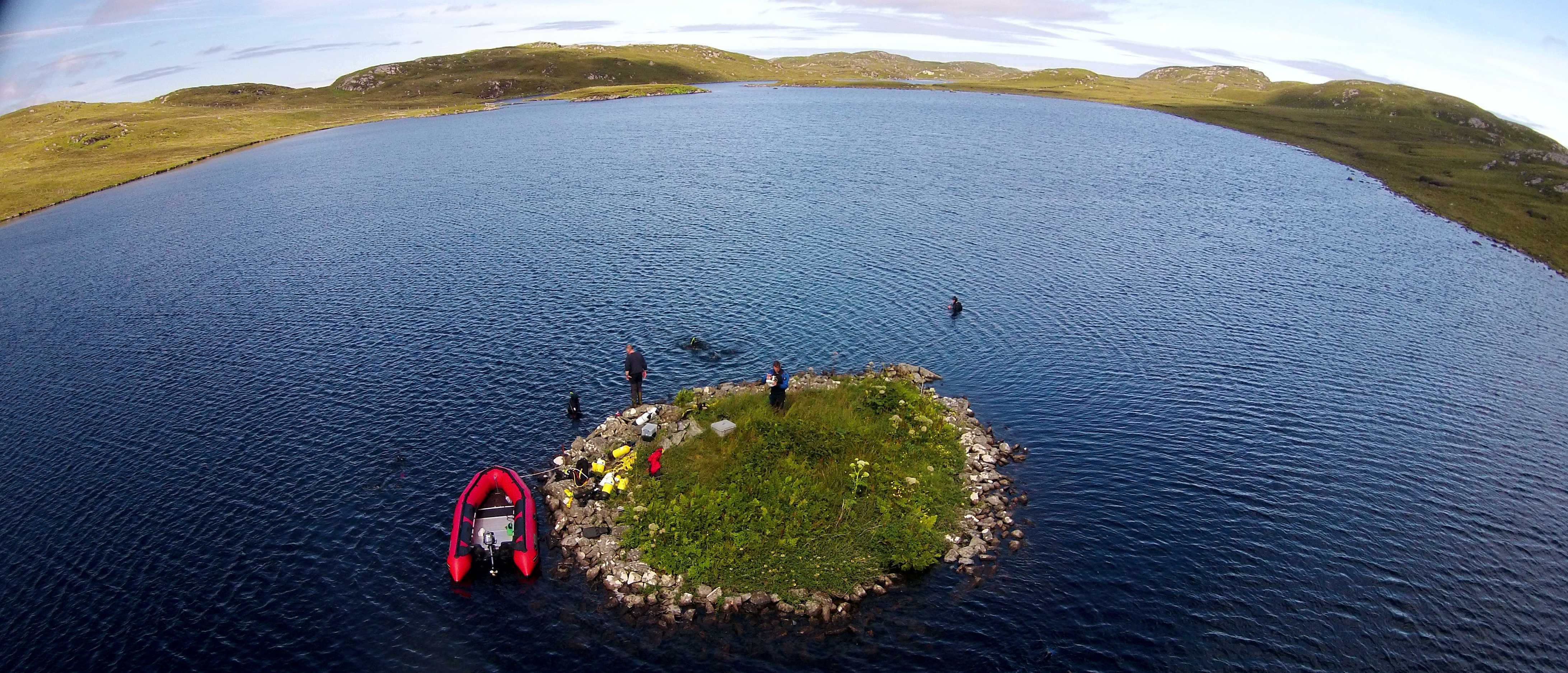
To mark International Women’s Day this year, we asked some of our brilliant staff to answer a few questions about their research, their career highlights, and their inspirations. Read on for a selection…
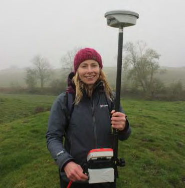
 

Ms Elaine Jamieson

Research/teaching specialisation

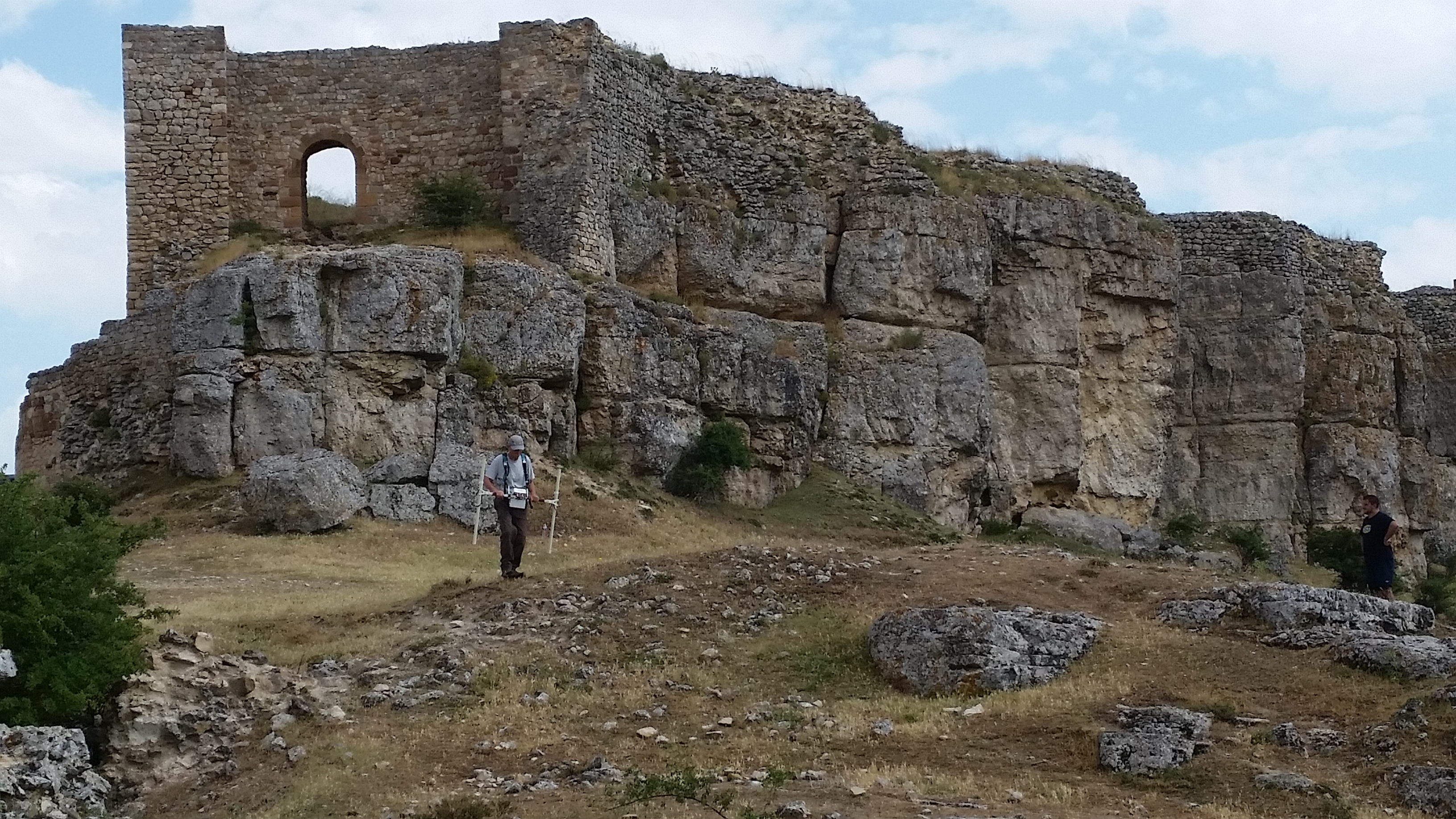
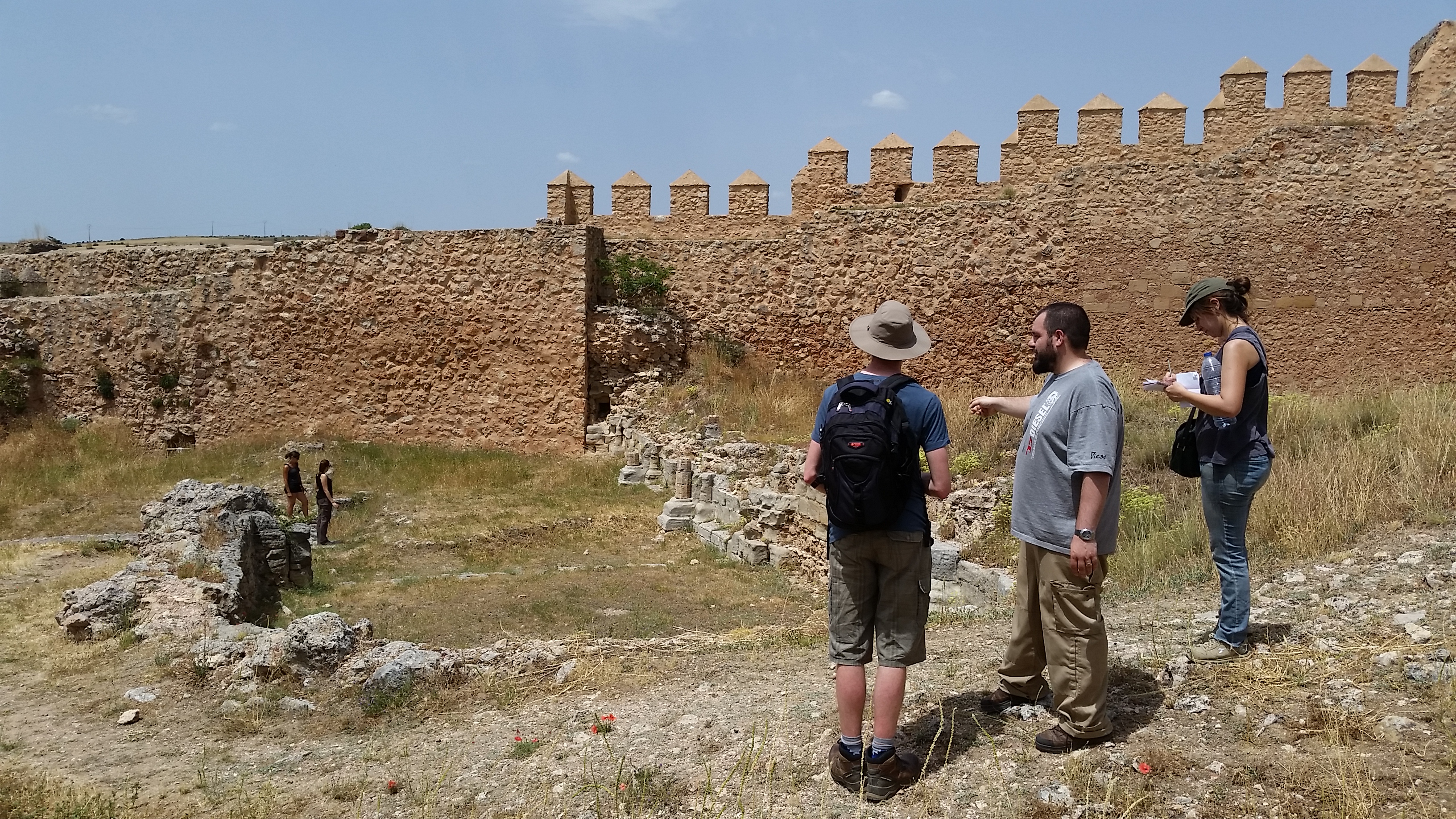
I am interested in inter-disciplinary approaches to landscape archaeology, with a particular specialism in analytical earthwork survey. Although I have worked on sites of all periods, my current research is focussed on the archaeology of medieval monuments and landscapes.

What made you choose this area?

As a student I did my first archaeological survey work on Exmoor with the Royal Commission on the Historical Monuments of England, and found myself tramping across the open moor surveying everything from prehistoric cists to post-medieval industrial sites. That experience shaped my future career and left me with a love of landscape archaeology.

Was there a moment when you realised that you had become successful academic / research staff?

When my first monograph was published.

What is an exciting development currently in your area?

I am currently working on the Leverhulme Trust funded project Extending Histories: From Medieval Mottes to Prehistoric Round Mounds. The recent discovery by the project team that Skipsea Castle motte may have its origins in the middle Iron Age raises interesting questions about the composite nature of medieval castles, as well as contemporary perceptions of ancient places and landscapes.

What advice would you have for young women wanting to become involved in this area?

If you have keen observation skills and an inquisitive mind then landscape archaeology, particularly non-intrusive survey and investigation work, can be a really rewarding area of study. I would say just get out there and start exploring the landscape around you!

What do you enjoy doing in your spare time?

I enjoy spending time outdoors, watching rugby union and relaxing at home.

Who inspired you to get to where you are now?

The many wonderful landscape archaeologists I have worked with over the years, but particularly Paul Everson who first sparked my interest in medieval landscapes.


Dr Hella Eckardt

Research/teaching specialisation: 

Roman Archaeology

What made you choose this area?

I studied Latin at school and read books about what life in ancient Rome would have been like – but really wanted to see for myself how ordinary people lived.

Was there a moment when you realised that you had become successful academic / research staff?

Securing a permanent job!

What is an exciting development currently in your area?

I have loved having so many Roman PhDs in the department and within Roman archaeology generally there has been a real resurgence in artefact studies.

What advice would you have for young women wanting to become involved in this area?

My advice would be the same for men or women: this is a brilliant job – but it is important not to take on all the competing demands and targets – or you will simply not have a life!

What do you enjoy doing in your spare time?

Gardening and spinning (cycling, not textile working).

Who inspired you to get to where you are now?

My parents were very influential – they actually met on an excavation and both had a deep interest in history.


Dr Wendy Matthews

Research/teaching specialisation

Origins of early agricultural and urban lifeways/microscopic analysis of building and settlement histories and the ecological and social strategies and relations and lives that shaped them.

What made you choose this area?

My love of the Middle East and the powerful forensic-scale insights that micromorphological analyses provide into study of the lived histories of past peoples and environments.

Was there a moment when you realised that you had become successful academic / research staff?

As we are always learning and there are always new discoveries and ways of looking at things, there always seems to be more to strive for!

What is an exciting development currently in your area?

New high-resolution integrated archaeobotanical studies of the diverse plants used in the past and their ecological and social significance.

What advice would you have for young women wanting to become involved in this area?

Engage in current exciting interdisciplinary research and partnerships and link your research to meaningful past, present and future global challenges.

What do you enjoy doing in your spare time?

Walking in the country, kayaking, art, and many years ago – windsurfing and horse-riding.

Who inspired you to get to where you are now?

Professor Nicholas Postgate, University of Cambridge and Dr Marie-Agnès Courty, CNRS


Dr Catherine Barnett

Research/teaching specialisation

The practical application of Archaeological Sciences (in my case archaeobotany, geoarchaeology and dating) to sites of all ages

What made you choose this area?

It was a natural progression from a background in environmental sciences coupled with a real curiosity about our shared past. I first contemplated a career in forensic biochemistry but archaeological science struck me as just as much an exercise in detection and a lot less messy.

Was there a moment when you realised that you had become successful academic / research staff?

One of my most nerve-wracking days was giving a talk at the Palaeolithic-Mesolithic day conference at the British Museum while first working as a sessional lecturer and doing my PhD. To my surprise, I did not go up in a big ball of flames but instead vastly more experienced and well-known colleagues from the profession showed a genuine interest in what I was doing and talked to me at length after the talk. I’d found my people!

What is an exciting development currently in your area?

The systematic application of AMS radiocarbon dating to well-stratified remains associated with prehistoric sites is profoundly changing our understanding of the timing and nature of developments in human adaptations to rapid climate change and in securing food supplies in an evolving landscape.

What advice would you have for young women wanting to become involved in this area?

Be curious and get as much experience as you can on digs or volunteering in the lab. Personally I’ve found the science side a great way into archaeology, and there are many possible careers within the subject.

What do you enjoy doing in your spare time?

Spare what? I love spending time with my herd of little boys and prowling the landscape with friends and dogs. I won’t deny visiting archaeological sites and museums on my days off too.

Who inspired you to get to where you are now?

My parents, both of them scientists in different fields showed me there is no limit to what any of us can do but it was a series of kind and enthused university lecturers who gently steered me in the right direction to get where I wanted to be.


Dr Mary Lewis

Research/teaching specialisation

Child bioarchaeology/human osteology

What made you choose this area?

My love of history, biology and medicine

Was there a moment when you realised that you had become successful academic / research staff?

Do you ever? But it was exciting the first time one of my papers was cited!

What is an exciting development currently in your area?

The use of stable isotopes to enable us to ask detailed questions about people’s diet, health and migration patterns, it has completely transformed the discipline.

What advice would you have for young women wanting to become involved in this area?

Be persistent, it takes time but opportunities do come available. Be prepared to work your way up.

What do you enjoy doing in your spare time?

Gardening, walking the dog and running

Who inspired you to get to where you are now?

A female bioarchaeologist who was an amazing and generous mentor. Still is.
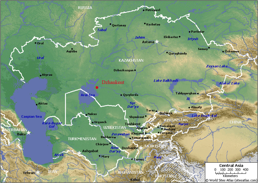
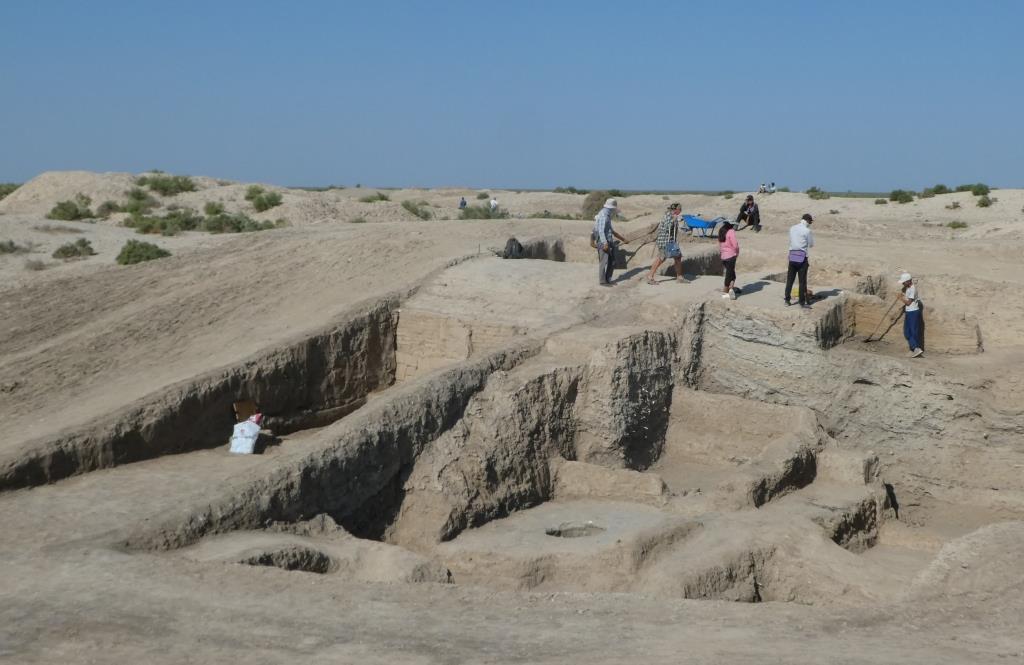
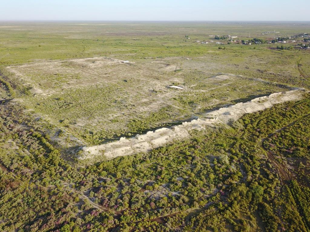
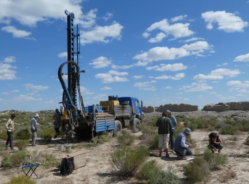
New publication Medieval Archaeology edited by Reading archaeologists

Medieval Archaeology, edited by Roberta Gilchrist (Research Dean) and Gemma Watson from the Department of Archaeology, is a new publication in Routledge’s Critical Concepts in Archaeology series.

The four-volume publication reprints 77 influential papers carefully selected to highlight the key issues and debates in the development and contemporary practice of later medieval archaeology in Europe (c. 1000–1550 AD).  The four volumes are designed thematically: ‘Defining Medieval Archaeology’, ‘the Medieval Landscape’, ‘Medieval Life’ and ‘Medieval Social Archaeology’. The publication includes papers by Reading archaeologists Roberta Gilchrist, Grenville Astill, Mary Lewis, Gundula Mueldner and Aleks Pluskowski.

The set is aimed at an international audience and is intended as a one-stop research tool to complement degrees in Medieval Studies and provide a background in medieval archaeology and material culture.

For more about the book, visit the publisher’s website: https://www.routledge.com/Medieval-Archaeology/Gilchrist/p/book/9780415718165

Underwater survey reveals new Neolithic crannogs

Over the summer, Dr Duncan Garrow spent two weeks carrying out underwater and boat-based survey work on the Isle of Lewis in the Outer Hebrides, in conjunction with his long-term collaborator Dr Fraser Sturt (Southampton) and team. They were investigating potentially the most important new Neolithic sites found in Britain for many years.

IMG_0836

‘Crannogs’ – artificial island settlements constructed in lochs – are a numerous, geographically widespread and intriguing category of archaeological site. Unusually, this one site type was constructed in many different periods of Scotland’s prehistoric and historic past. Most scholars generally consider them to have been built, used and re-used from the Late Bronze Age (c. 1000 BC) to the medieval period (c. AD 1500).


Hugely significantly, our survey of three sites on the Isle of Lewis confirmed that the origins of some of these sites in fact lie 3000 years earlier than previously thought, in the Neolithic (c. 3700 BC). Over 400 crannog sites are recorded in Scotland, and many more no doubt lie undetected. The Outer Hebrides represent a particular hotspot in their distribution, with 150 potential sites identified across the island chain. Mostly unexcavated, it now seems possible that many of these are also in fact Neolithic.

bhorg_survey

This project was only possible due to the curiosity of a local diver and keen archaeologist Chris Murray. Chris noted that a number of small islets in the lochs of Lewis appeared to have causeways going out to them, and to be a very regular shape. To find out more, he took his diving equipment and began to examine the bottom of the loch. The finds he made included a range of spectacular pottery, much of it dating to the Neolithic. He brought these finds to the attention of the archaeological community, with specialists in the museum in Lewis and at the National Museum of Scotland recognising their rare and important nature. It was this point that our joint project was born – we applied for and gained funding from the Honor Frost Foundation.


The newly discovered Lewis sites are extremely impressive – our underwater geophysical survey demonstrated that they are massive piles of rock (c. 15m across and up to 6m high) constructed within what would have been lochs in the Neolithic. Their monumental scale is comparable with local stone-built passage tombs of the same date. Our diver surveys identified worked timbers indicating that the mound structures were revetted; stone causeways out to two of them were also observed. Substantial quantities of pottery and quartz have been found on the loch beds around them. The preservation of ceramics – some vessels complete, many largely intact – is perhaps unique within the British Neolithic.


Since our work in 2016 was non-intrusive survey work rather than excavation, many unanswered questions remain:


– Were these Neolithic crannogs settlements (like their later equivalents) or a new kind of (ritual?) site?

– Does any settlement architecture survive? What buildings and/or other features can be detected?

– What practices were carried out on the islets and how do these relate to the substantial quantities of material recovered from the loch beds nearby?


If these Neolithic artificial islands were settlements, they transform our understanding of social relations at that time – what drove people to isolate themselves from the rest of the community in such a dramatic way shortly after the region was first settled on a substantial scale? Alternatively, if they are specialised, occasional-use sites, what purpose did they fulfil and what roles did they play alongside other monuments? Could they have been meeting/feasting places or venues for other ritual practice, perhaps even including burial?

DCIM100MEDIA

We have applied for further funding in order to undertake small-scale trial excavations on the two most promising sites next summer (2017). Watch this space for further information as more is revealed about these new, exciting discoveries.


If you’d like to find out more about our 2016 survey, it is due to feature on the BBC4 programme ‘Digging for Britain’ to be shown some time this winter (possibly early December last time we were told…).

Finding Nero: Silchester Stories

Fortune favours the bold

As a research and fieldwork active archaeology department, we are extremely fortunate to have one of Britain’s best preserved Roman and Iron Age towns on our doorstep – Silchester, or Calleva of the Atrebates, is less than 10 miles from the Department of Archaeology’s door. The department has been carrying out fieldwork at Silchester, led by Professor Michael Fulford, for nearly 40 years – and this largely undisturbed greenfield site provides many opportunities to pose new research questions, and then to answer them through cutting edge fieldwork.

Excavation planning: Step 1 – bring in the machine!

Excavation planning: Step 1 – bring in the machine!

Posing palace questions

For the last 4 summer seasons we have been searching for structural evidence that the Roman Emperor Nero (Emperor from 54 to 68AD) commissioned a palatial residence in the provincial capital of Calleva Atrebatum. Our excavations in Insula IX between 1997 and 2014 had thrown up tantalising evidence for this in the form of high quality building stone incorporated into the foundations of later Roman buildings, as well as pottery tiles stamped with Nero’s name. These tiles are found nowhere else in Britain, and their discovery hints at a high level of imperial involvement – and even investment – into the town. But where exactly was Nero’s palace?

Testing hypotheses

Archaeologists test hypotheses – and ours was that Insula III, centrally located within the town, held the secret – and possibly also the Nero commissioned palace. The Victorians had excavated here in the late 19th and early 20th centuries, and their resultant town plan suggested the presence of a stone founded building of good size. And indeed we thought we might have found it when, in 2013, we began digging in the south-east corner of Insula III and uncovered the colonnaded remains of a mid-1st century AD building, which, at first trowel, looked substantial and significant.

Location, location, location

However 4 seasons of work later, we can unequivocally state that Insula III did not contain a luxurious home to rival those of Rome, and built for a supportive British ruler or noble with Nero’s patronage. Instead we found an unfinished and fairly flimsy structure, built over layers of clay and gravel dumped to offset the soft and slumping fills of the underlying Iron Age pits and wells. It must have been a bitter blow for the builders of Nero’s time to realise that prime building land in the centre of the Roman town, next to the forum, was unsuitable for solid masonry structures. Instead we surmise that the area lay largely unused until the late Roman period when the desire for prime real estate overrode the restrictions of the earlier centuries and allowed the construction of gravel founded timber buildings, jostling for space in this most desirable of town locations.

New knowledge

Archaeology is a voyage of discovery and even if we don’t find what we hoped or expected, there is always a net gain in knowledge. This summer was our last chance to find Nero, and through the use of our – by now – tried and tested methodology of investigating the archaeology of Insula III by simply re-excavating the trenches dug by our antiquarian forbears and using the emptied trenches as ‘key-holes’ into the undisturbed layers, we uncovered a new and detailed sequence from the natural geology through to late or post Roman occupation, followed by 2 phases of Victorian excavation.

Seasons in the sun

We dug for 3 weeks in August and September of this year – and, as it turned out, we had the very best of an English summer: some hot days, lots of bright sunshine, and very little rain. A relatively small research excavation such as this also provides a great opportunity to give employability placement opportunities to our part 2 and Part 3 students, particularly those hoping to enter a career in commercial archaeology. But – to be honest- everyone should add an excavation to their CV – working as part of a team, communicating, solving problems: these are skills all graduates should have on leaving university. Plus, it is enormous fun – working together towards a common research aim, in what can sometimes be challenging physical conditions – what’s not to like?

Caedmon planning

Caedmon planning

 Turf, topsoil and talent

We opened 3 trenches – each with their own objectives – and we had a workforce of up to 20 on site, including a team working with our Finds and Visitors. The stage was set! Step 1 was to get the machining right – using a JCB to strip the turf and topsoil off is a challenging task. Take too much off, and you risk losing vital late and post Roman evidence; take too little off and you are condemning your team to days of backbreaking digging of sterile topsoil deposits and the risk of not finishing on time… With the help of a truly talented digger driver, we got it exactly right, and within a day we could quite clearly see the outlines of the diagonal Victorian trenches as darker stripes cutting through the topsoil and subsoil. Also immediately visible were striations and patterns of gravel which, on cleaning, began to show themselves to be outlines of a late Roman building completely missed by the Victorian excavators whose sole work purpose was to discover large pieces of masonry and exciting artefacts.


Hard at work on a summer’s day

Hard at work on a summer’s day

Antiquarian antics

By the end of the excavation, each trench had a story to tell, and when we left site with a complete record – plans, photographs, samples, finds, record cards – we left behind a very light touch on the archaeology of this major Roman town. We learnt a great deal about the nature of the Victorian intervention, as we tried to second guess their strategies – they do not record exactly how and where they dug – only what they found.

Sifting through the finds in their backfill is equally remarkable in terms of what they threw back in – what they deemed unimportant – or unrecognisable, becomes a treasure trove for us. The antiquarian archaeologists before us gave us no light and shade, no detail of the lives of the people living there. We can now fill in those gaps.

Roman New Build

As with elsewhere in Insula III, we identified substantial clay levelling of a 2nd century AD date, over an uneven surface, and not much construction work until the late Roman period – when a series of gravel-filled foundation trenches were dug to support a large, rectangular building in the north-west corner of the insula. This building had clay and gravel floors (most of which did not survive) and was subdivided into a number of rooms. Associated with it were a sequence of substantial postholes cut into the edge of the gravel surfaced street, dug and re-dug, used and re-used over time, recognising, marking and regularly replacing a boundary. The Victorian excavators of the 1860’s and the 1890’s did not recognise this as a building as such – and so we felt a great sense of achievement when adding it to the known plan of late Roman Silchester. Discovering a previously unknown Roman building is not something you do every day!

Losing Nero

Every excavation has its disappointments – and ours was no exception, We had begun this project in 2013 in the south-east corner of Insula III, looking for a palace of Nero, and we ended in 2016 in the north-west corner knowing that we had not found this building – at least not in Insula III – but knowing that there is enough material evidence to suggest that it is likely to be somewhere within the town. So – no wonderful treasures, no palaces of kings – this time – but we now know what Insula III was all about, and another piece of the jigsaw has been slotted into place. And we had a lot of fun doing so; thanks to a fantastic team!

Team 2016

Team 2016

Amanda Clarke

Landscapes of (Re)conquest: Fieldwork at the castles of Molina de Aragón and Atienza, central Spain, July 2016

In July, a team consisting of staff and students from the University of Reading (Aleks Pluskowski, Rowena Banerjea, Guillermo García-Contreras Ruiz, Rob Fry, David Thornley (formerly at Reading) and Caedmon Bradley), students from the universities of Granada and Montpellier, spent a week in the province of Guadalajara, central Spain, prospecting and surveying two castles associated with the medieval Christian – Muslim frontier. The project was funded by the Society of Antiquaries and the Erasmus Programme, as pilot studies within the “Landscapes of (Re)conquest project” which is investigating the character of medieval frontiers in South Western Europe. The central part of the Iberian Peninsula represents an exceptional area for investigating the dynamics of frontiers, colonisation and social reorganisation during the formative period of the Middle Ages, when political control of territory fluctuated between Islamic and Christian authorities. Our fieldwork focused on two castles – Molina de Aragón and Atienza – that were linked to medieval frontier authorities during both Islamic and Christian periods of rule. Both sites are defined by the presence of substantial enclosed wards, largely devoid of structures above ground. The use of these spaces and therefore the roles of these fortified sites during the various phases of occupation remain unknown, and the complete lack of palaeoenvironmental investigations has also detached them from their landscape context. The aim of the project was to conduct geophysics surveys within these wards, to obtain environmental data from excavated irrigation channel and terrace within the vicinity of the sites, and to collect samples of building fabric and document phases of construction. This information would be used to characterise how the landscape was used and organised by Islamic and Christian frontier authorities.

20160706_170234

Most of our fieldwork was focused on Molina de Aragón, which consists of a fortified complex, located on a hill overlooking the valley of the River Gallo in the Upper Tagus, one of the principle mountain ranges in Spain and recently designated as a UNESCO Global Geopark due to its unique geological formations. The role of the site changed over time, from a rural fortification during the Islamic period, ruled largely by Berbers (8th–10th centuries), to a focal point for the defence of Al-Andalus against the expansion of Christian kingdoms from the north (10th–11th century) and subsequently the capital of an independent Islamic state, the Taifa of Molina, following the collapse of the Umayyad Caliphate. In 1129, Molina was conquered by King Alfonso I of Aragon. After fierce territorial disputes, it was bequeathed to the Lara family who maintained a virtually independent frontier lordship into the 14th century and developed the associated town. Molina passed to the Kingdom of Aragon for a short period (c. 1366–1375), after which it was incorporated into Castile, and finally into Spain. After functioning as a military barracks throughout the 19th century, the fortress was abandoned from the beginning of the 20th century. Rob Fry and David Thornley conducted magnetometry surveys within the wards of the castle, whilst the rest of the team focused on excavating and sampling an irrigation channel at the edge of the medieval town, taking cores to identify suitable deposits for further environmental sampling and sampling a terrace for OSL dating and geoarchaeological analysis. Environmental sampling was led by Rowena Banerjea with students from Granada and Montpellier. Caedmon Bradley documented the walls of the castle at Molina de Aragón with photogrammetry for his third-year dissertation.

20160706_164424

The second fortified complex included within the project – Atienza – is located within an expansive valley of the mountain range of the Sierra Norte. From the 8th century it was settled and used as a rural fortification by the Berber tribe of Banu Salim. During the Umayyad emirate and caliphate (9th c-10th century), Atienza was an important strategic centre on the border between al-Andalus and the Christian kingdoms. In 1086, the fortress was conquered and became part of Christian Castile. Subsequently, it became the centre of a frontier lordship, securing the border against both neighbouring Muslim territories and the Christian Kingdom of Aragon (11th-12th century). Atienza remained loyal to the kings of Castile in times of internal civil war (13th-14th century), and its prosperity was represented by the construction of fourteen churches, alongside the expanded castle and urban defences. From the 15th century its strategic and economic importance dramatically declined. In the 19th century it was significantly affected by the War of Independence. Here, Rob Fry and David Thornley conducted magnetometer surveys within the castle itself, its outer wards and some of the adjacent parts (now abandoned) of the medieval town. The aim of the surveys was to identify the degree of disturbance and the presence of buried structures where traces of occupation may have been preserved, to inform future excavations.

20160704_131719

The results of these pilot projects are currently being analysed, but they represent an important foundation for more extensive future investigations into the role of these centres of authority in the medieval multicultural frontiers of Iberia.

Silchester Excavation Project Shortlisted for 2016 British Archaeological Awards

OLYMPUS DIGITAL CAMERA

Judges have today released the shortlist for this year’s British Archaeological Awards showcasing the very latest discoveries and innovations in archaeology across the UK, with Reading University’s long-term Silchester excavation shortlisted for Best Archaeological Project 2016.

The results will be announced at the British Archaeological Awards ceremony at the British Museum in London on 11 July, compèred by ‘Meet the Ancestors’ archaeologist and TV presenter Julian Richards.

John Lewis, Chair of the British Archaeological Awards judging panel for the Best Archaeological Project Award commented on the Silchester project,

The aim of this long-running project is the publication of the total excavation of a large sample (25%) of one insula (block) to characterise the changing nature of the occupation of the Roman town at Silchester. The Judges were impressed with the way the project maximised environmental techniques and the development and use of a sophisticated database to aid analysis and make the findings accessible for future generations. The project has had a long-standing programme of public engagement, with many thousands of visitors each year.

Deborah Williams, Chair of the British Archaeological Awards added,

“The entries this year reflect the incredible wealth and range of archaeology that is going on across the United Kingdom, the quality and expertise of our world-leading archaeologists, and the ever increasing fascination of the public with the history and archaeology of their local area.

“Increasingly archaeologists are responding to this interest by developing new ways to help people to take part in research and excavations, start up their own projects, and share and understand new discoveries – and this shines through in our shortlisted entries. All the finalists have a common theme – involving and enthusing young people and the public in their archaeological heritage.

The British Archaeological Awards entries are judged by independent panels made up of leading experts from across the archaeology field in the UK, including both professional and voluntary sectors and aim to celebrate and share the best of British archaeology with the public.


See the shortlisted projects at www.archaeologicalawards.com and follow the Awards on twitter @BAAWARDSUK

BAA_Logo