A Book Fair, a Children’s Author and a Map of the Campus

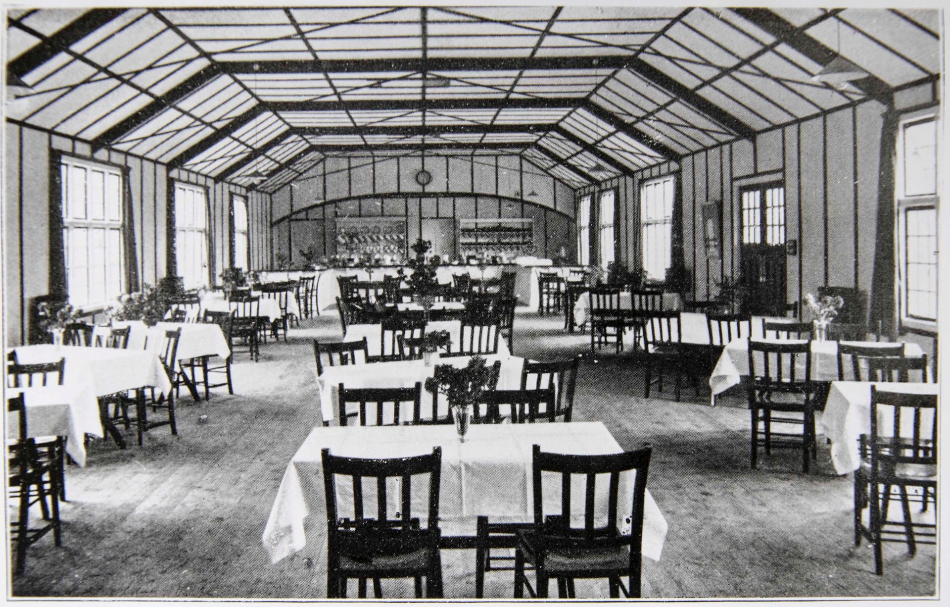
On the 7th July 1977, the University of Reading hosted the William Smith’s Children’s Book Fair. The venue was the Great Hall on the London Road Campus.

Details of this can be found in the archive of Christine Pullein-Thompson in the University’s Special Collections. Christine, together with her twin sister Diane and older sister Josephine was a children’s author, renowned for her popular pony stories. The Pullein-Thompson sisters were local to the area, having grown up in the village of Peppard in Oxfordshire where they lived in a house with its own stables. They were riding horses and writing stories about them from an early age.

Christine lived from 1925 to 2005 and was the most prolific of the three sisters, producing over 100 books with translations into 12 languages.

The Book Fair

On 12th May 1977 Granada Publishing Ltd., Christine’s publisher, wrote to her address in Middle Assendon, Henley. They had arranged for her to attend the Children’s Book Fair in Reading in July, and enclosed maps of the location of the University and the position of the Great Hall at London Road.

She was to conduct a ‘guess the weight of the pony articles’ competition, with Granada supplying 50 of her books as prizes. There would also be ‘further stock available for direct sale.’

header only
University of Reading Special Collections

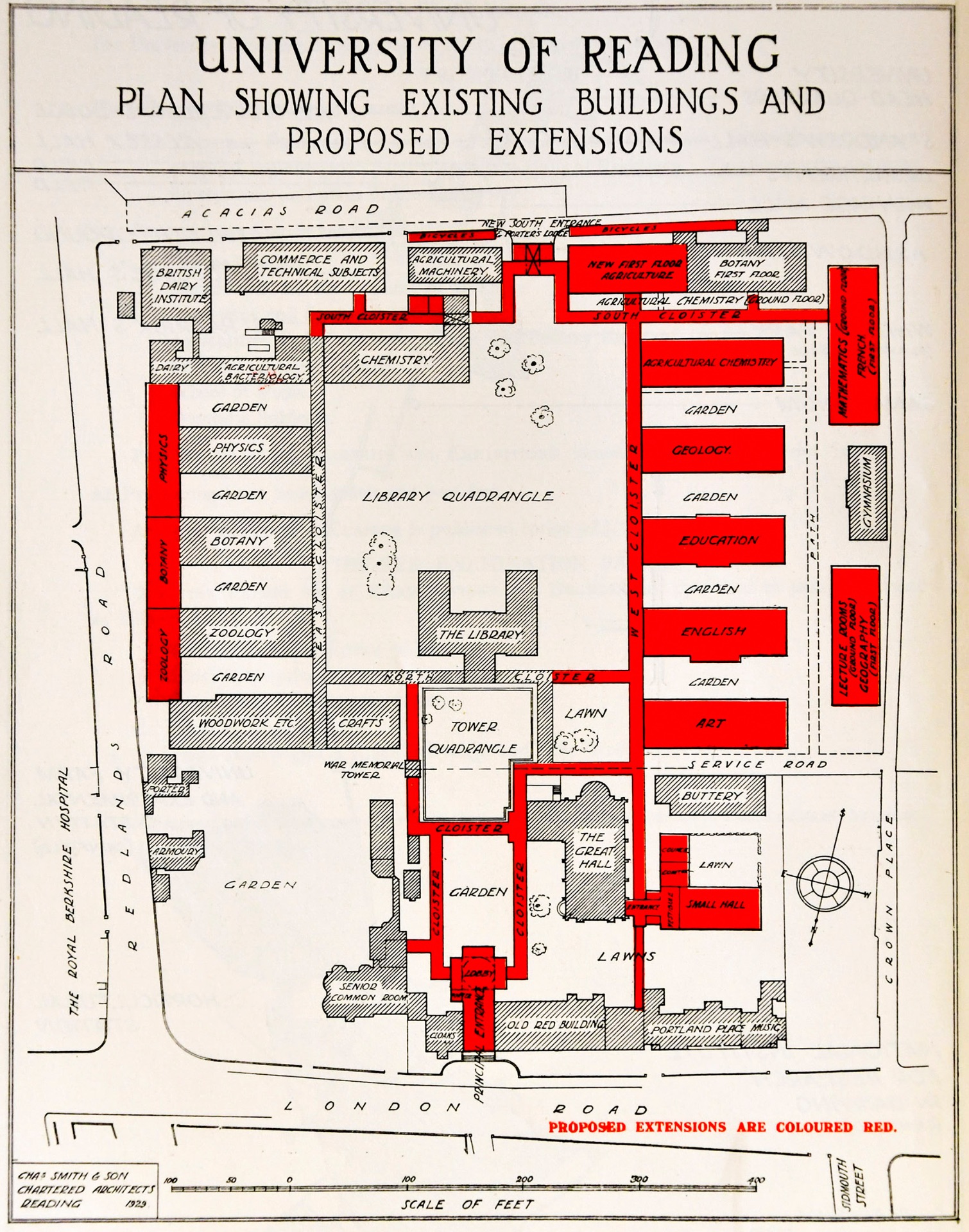
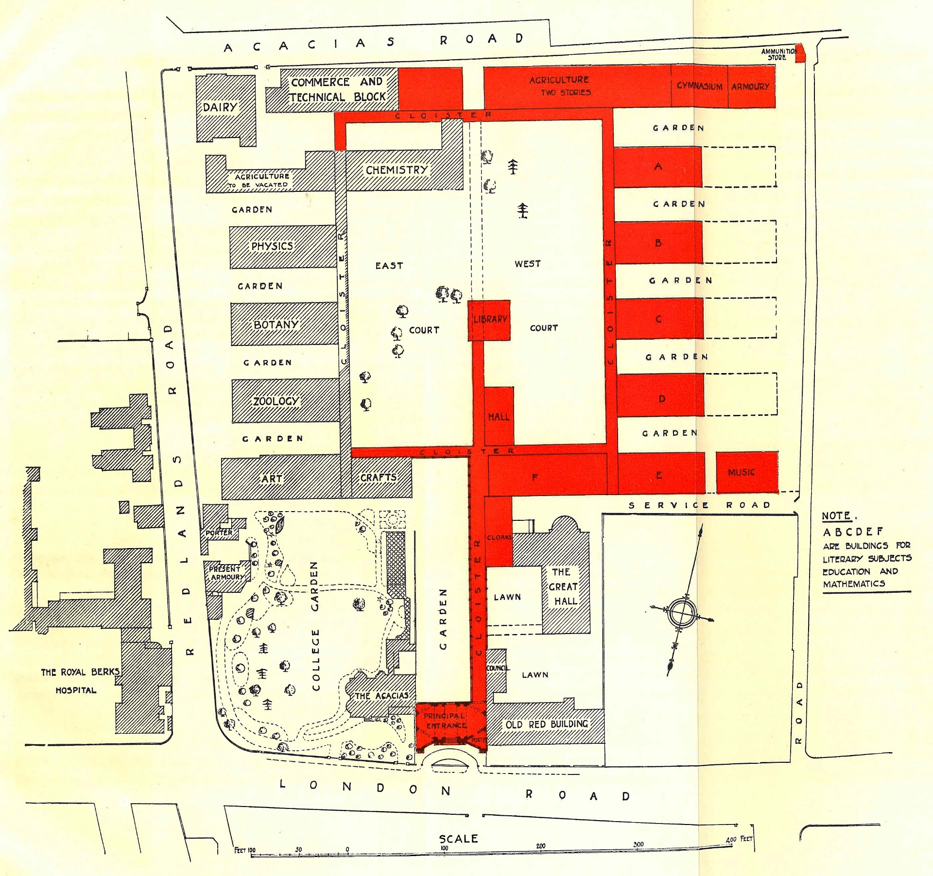
The Map of the Campus

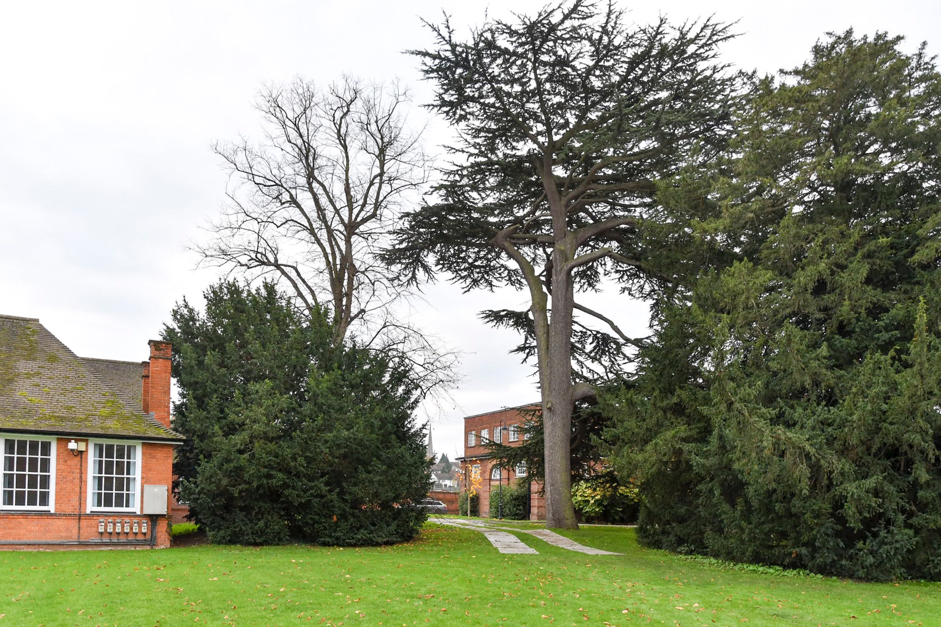
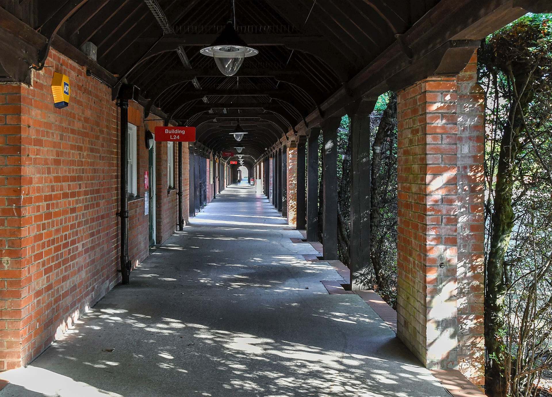
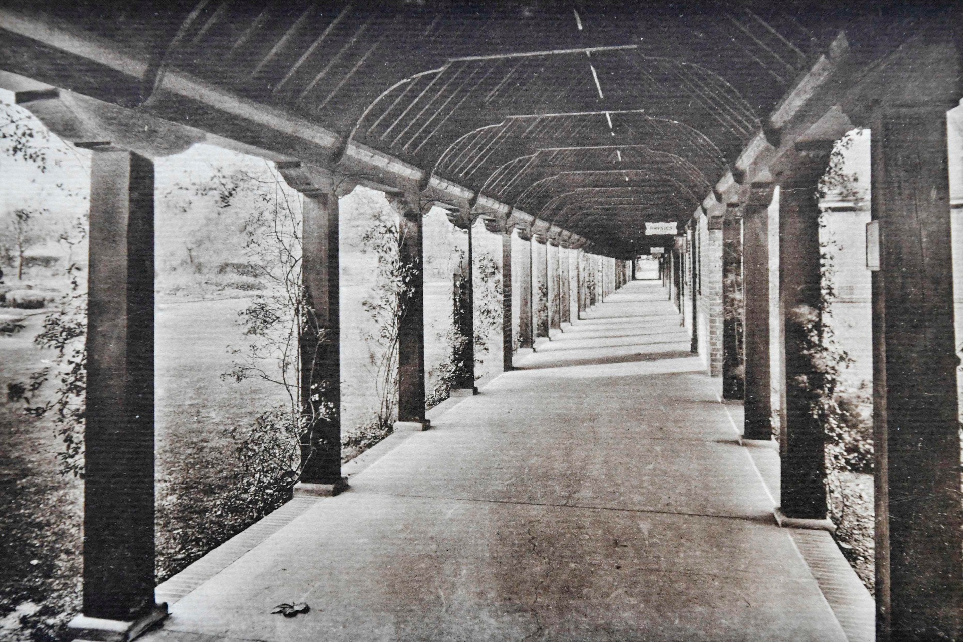
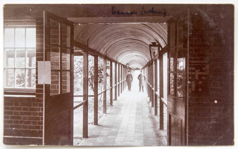
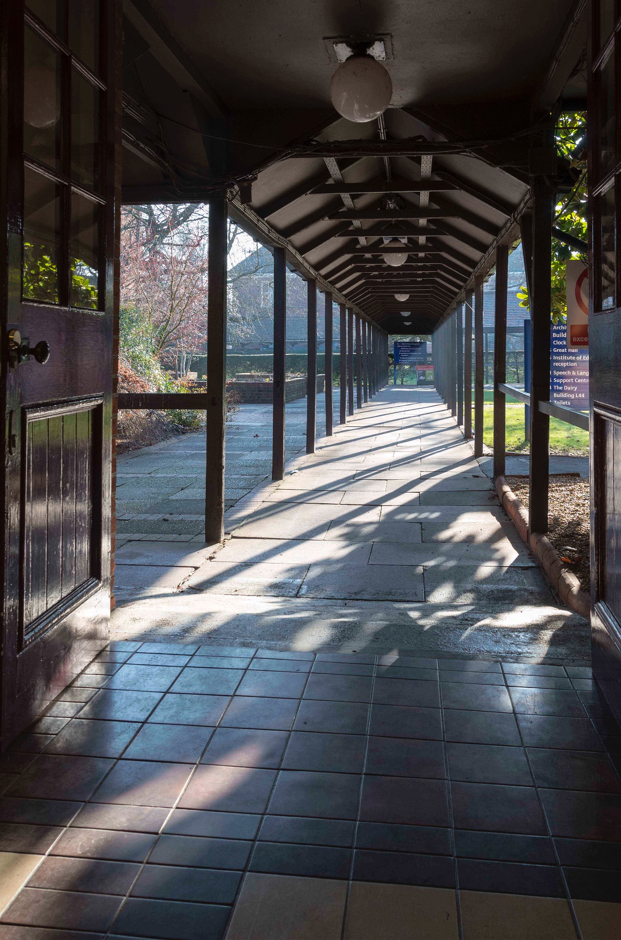
The plan of the London Road Campus in 1977 was new to me. I find it interesting because it is a previously missing link between the pre-Whiteknights maps of the 1930s and ’40s and my own memories of the site from when I joined the School of Education in 1987.

unedited original
Plan of the London Road Campus adapted for the Children’s Book Fair of July 1977 (University of Reading Special Collections)

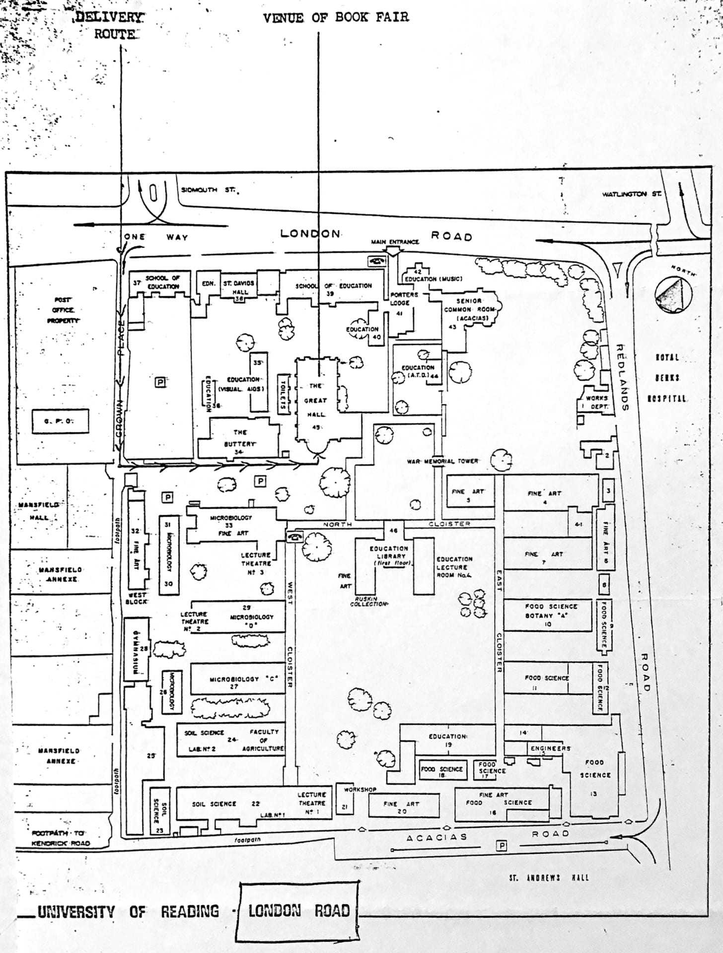
This is also the first map I have seen that includes numbered buildings. And most of them bear the same numbers as today (L16, L19, L22, L33, etc.). This original numerical system counted in a roughly clockwise direction beginning with the Works Department in the top right hand corner and ending with Acacias (L43, the Senior/Staff Common Room), and L44, commonly known as ‘The Dolls’ House’.

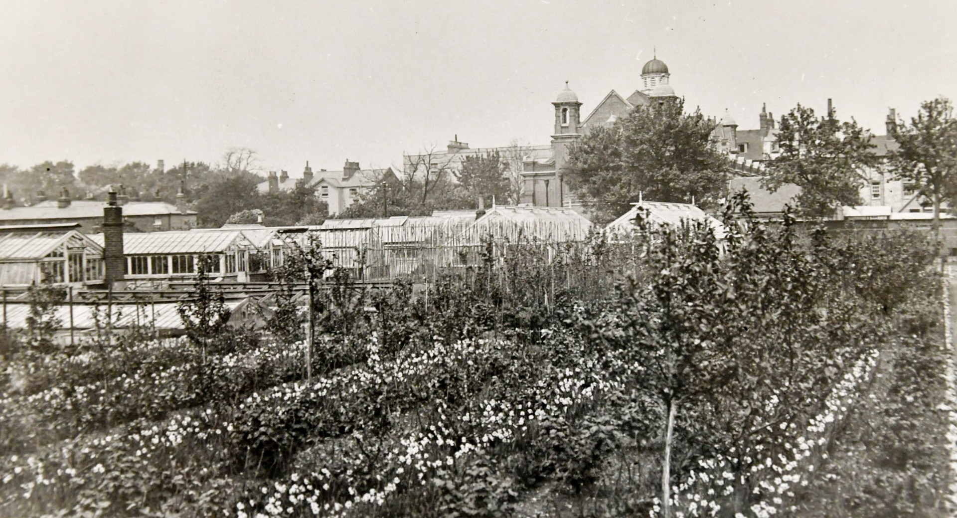
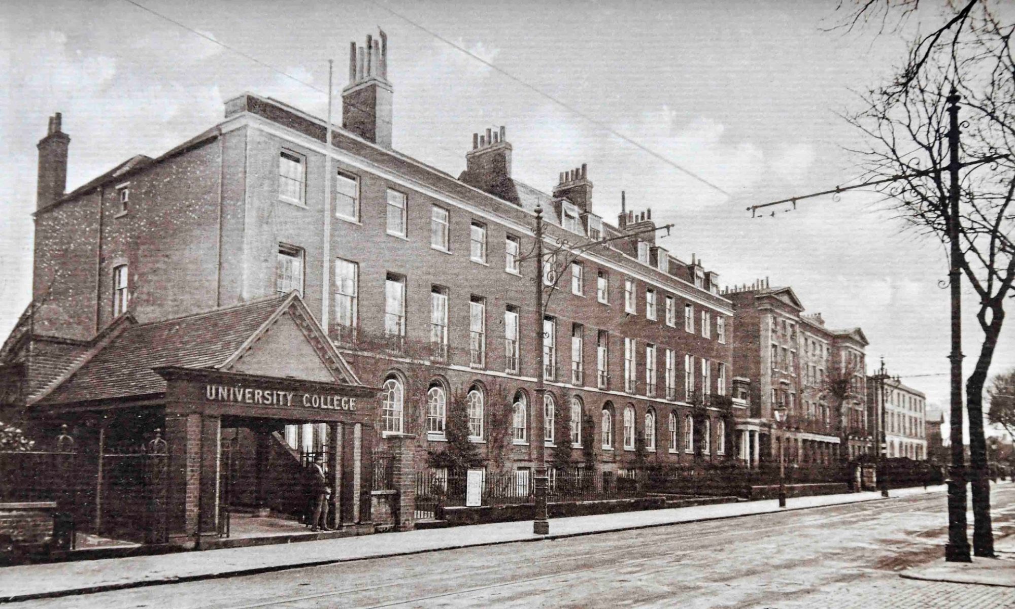
If this numbering system seems less obvious now it is because many buildings no longer exist or are no longer occupied by the University – the Buttery (Building 34 between the Great Hall and L33) burnt down in 1982 and along London Road, the Old Red Building and Portland place have become private accommodation.

cropped
The ‘New’ Buttery that burnt down in 1982 (University of Reading Special Collections)

Some other adjustments had to be made too. For example, Fine Art Buildings 4.1, 6 and 7 are now, in 2024, occupied by Art Education and bear the single designation, L4.

detail
Detail of the eastern side of the site. Today, Art Education is housed in Buildings 4, 4.1 & 7 (now L4)

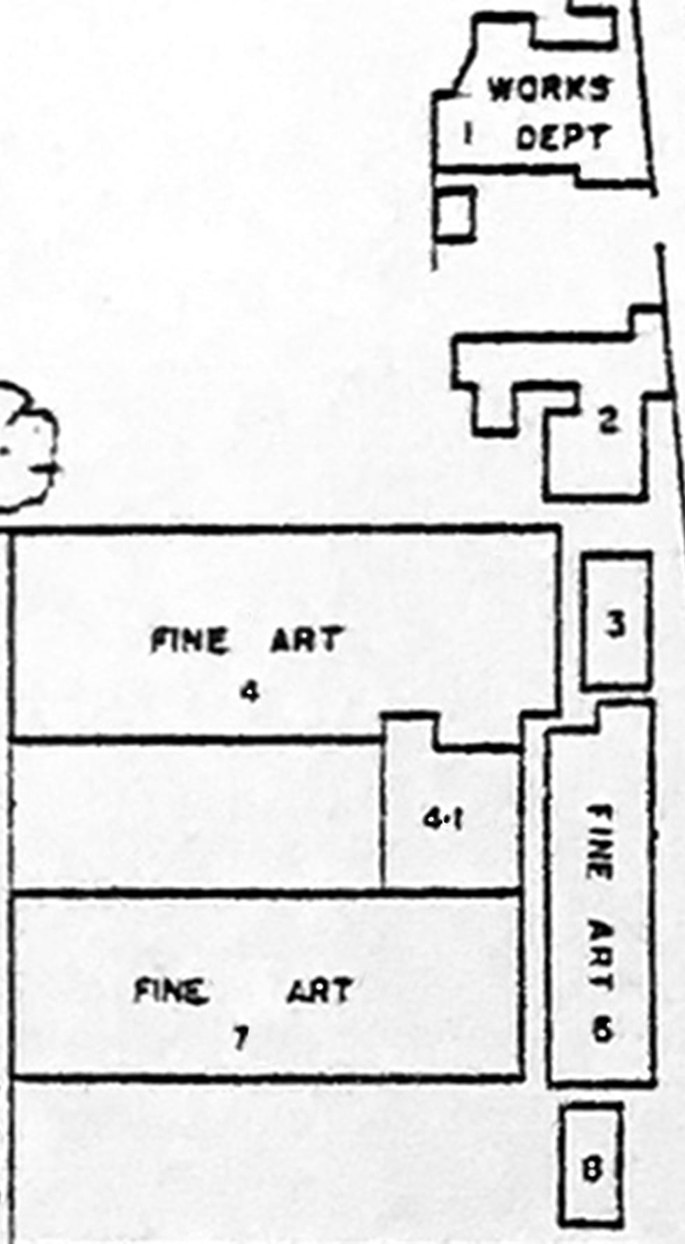
In earlier maps of the 1930s and 40s, Buildings 4 and 7 had been separated by a garden and labelled Fine Art and Zoology respectively; building 4.1 that linked them had yet to be constructed. Buildings 3, 5 and 8 on the map have all disappeared.

L4 today
Art Education (L4), situated at the northern end of the East Cloister, January 2024

Other notable absences from today’s campus that must be especially salient for members of the Institute of Education are the two Food Science buildings between L16 and L19, and the Fine Art block between L16 and L22. The full extent of demolitions can be seen below.

marked in blue
The buildings marked in blue have since been demolished

Consequences of the move to Whiteknights

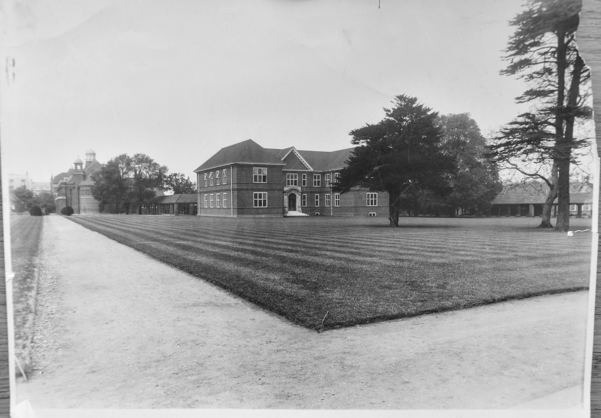
The purchase of Whiteknights Park by the University had been completed in 1947. Building on the site began in 1954 and in 1957 Queen Elizabeth II performed the official opening of the Faculty of Letters, now the Edith Morley Building.

The effect of the gradual migration of departments from London Road to the new campus can be visualised in the version below of the 1977 map. The site was now dominated by five departments:  The School of Education, Fine Art, Food Science, Microbiology and Soil Science.

coloured version
A version of the 1977 plan showing occupation by a small number of departments following completion of buildings at Whiteknights

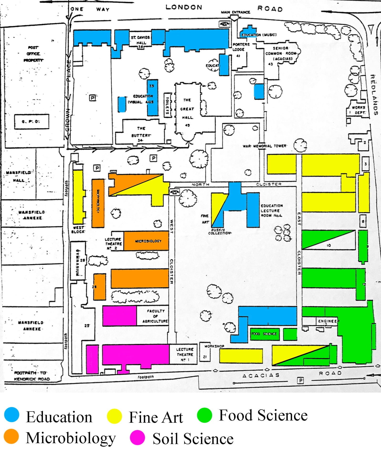
The School of Education had been founded in 1969 through the amalgamation of the regional Institute of Education, established in 1948, and the University’s Department of Education. It is possible that at least one of the buildings labelled Fine Art was, in fact, devoted to Art Education. This was certainly the case in 1987 when part of the ground floor of L16 was occupied by Fraser Smith and his fellow Art Education colleagues James Hall and Richard Hickman.

Sources

Gillet, C. R. E. (1949). Reading Institute of Education. In H. C. Barnard (Ed.), The Education Department through fifty years (pp. 45-47). University of Reading.

Holt, J. C. (1977). The University of Reading: the first fifty years. Reading: University of Reading Press.

University of Reading Special Collections. Christine Pullein-Thompson Collection, Correspondence with Publishers, Granada: MS 5078/107.

Florence Mary Faithfull (c.1892-1918)

As we start the final week of Women’s History Month, this is an opportunity to feature someone mentioned to me recently by Dr Rhianedd Smith (University Museums and Special Collections Services) .

Florence Faithfull is the only woman whose name appears on the War Memorial on the London Road Campus and University College Reading’s Book of Remembrance.

War memorial
London Road, the Roll of Honour beneath the Clock Tower
Book of Remembrance
Book of Remembrance of those Members of The University College Reading who fell in The War 1914-1918

She was born in the early 1890s and lived at number 26 Upper Redlands Road, Reading with her parents and siblings.

A former student of University College Reading, Faithfull is recorded in the Annual Report for 1910-11 as receiving the Certificate in Commerce.

Certificate result

During the First World War, she enrolled as a nurse in the Voluntary Aid Detachment and was stationed in Mesopotamia (Iraq) at the British General Hospital. She died at Basra in January 1918 at the age of 26, the result of a tragic boating accident.

The circumstances of her death were that the Matron and twelve of the hospital nurses had been invited to the Officers’ Hospital to meet those convalescing and to have tea. They were transported by motor launch, but on the way back there was a collision with a steam tug and four of the nurses lost their lives. A Court of Inquiry recorded a verdict of accidental death resulting from an error of judgement by the helmsman of the launch.

Florence Faithfull’s medal card containing the words ‘Died on service’ is held in the National Archives.

Medal card

Her death is remembered in 1920 in the ‘Old Students’ News’, though there is a mis-spelling of her name.

Old Students

As noted above, her name has been entered in the Book of Remembrance (again with the mis-spelling). Regrettably there is no photograph.

Faithfull

Thanks

To Dr Rhianedd Smith for telling me about Florence Faithfull and suggesting her as a topic.

To Paul Johnson, Image Library Manager, National Archives, for permission to reproduce the image of the medal card.

Sources

Biographical information about Florence Faithfull was obtained from the University of Reading’s Enterprise Catalogue.

Book of Remembrance of those Members of The University College Reading who fell in The War 1914-1918. University of Reading Special Collections, MS 5339.

Medal card of Faithfull, Florence, M. Corps: Voluntary Aid Detachment. National Archives, Catalogue reference: WO 372/23/13539

University College, Reading. Old Students’ News, No. 6, Jan., 1920.

University College, Reading. Report to the Court of Governors for the Year ended September 30th, 1911.

‘The Acacias Road’

The present-day Acacia Road lies opposite the Royal Berkshire Hospital towards the bottom of Redlands Road. It serves the rear entrances to the London Road Campus and the Abbey School, and the side access to the Museum of English Rural Life. It is a cul-de-sac, but a footpath at the far end leads to Kendrick Road.

The Acacias Road

The 1904 map below is the earliest University College map I’ve found that names the road. Subsequent plans before the purchase of Whiteknights always refer to ‘The Acacias Road’ or ‘Acacias Road’ rather than the present form.

Extract from 1904 map
Detail from a plan of the land and buildings donated by Alfred Palmer (from the Official Gazette, Feb 1904, p. 6)

In the image below, St Andrew’s Hall is on the immediate left, the Dairy Department (British Dairy Institute) on the far right, and the ‘Commerce and Technical Block’ (later, in 1926, described as ‘Geography, Technical, Domestic & Technical Subjects’) is in the centre.

Just as today, it was a parking area.  In 1987 when I joined the University, signs on the wall of St Andrew’s urged drivers to avoid reversing into parking spaces so that exhaust fumes wouldn’t penetrate students’ rooms.

Early image of Acacia Rd
Undated image of ‘Acacias Road’ (University of Reading Special Collections).

The  gate on the right was the ‘Southern Entrance’ and was referred to in the Vice-Chancellor’s 1928 report on new buildings as being ‘recently closed to all except service traffic (chiefly coal carts), on account of its inconvenience and unsuitability’ (pp. 13-15).

Plans for a new entrance complete with porters’ lodge further along the road were published but never materialised.

Photographs of students wheeling milk churns along the road are displayed in today’s Dairy and published elsewhere. The one here shows students packing French-style cheeses in 1934:

Indoor shot of the Dairy
The British Dairy Institute, October 1934: students packing Pont l’Évêque and Coulommier cheeses (University of Reading Special Collections, ref. P FS PH1/K6181).

Not that English cheeses were neglected! An early College report shows that a wide range  was produced:

Shows cheese varieties
Data submitted to the Board of Agriculture, 1903 (Official Gazette, 1903, p. 206).

One of the cheese presses from the Dairying Department can still be seen in the Museum of English Rural Life in its ‘Forces for Change Gallery’ on the ground floor.

MERL today
The corner of Redlands Road and Acacia Road: the entrance to The Museum of English Rural Life, January 2023.
Acacia Road Today
Modern version
Acacia Road, November 2018; on the left are the ‘ReadyBikes’ (a scheme that was was abandoned in 2019.

St Andrew’s Hall was closed (to protests!) in 2001 and the Museum of English Rural Life and Special Collections Services moved onto the site three years later.

side entrance to MERL
Acacia Road, December 2022: Fred van de Beer (in blue), Collections Care Manager at the MERL, oversees the return of a wagon that had been away on loan.

The Dairy is still called ‘The Dairy’ and is now one of the University’s catering venues.

The former Domestic and Technical Building is now L19, and accommodates Institute of Education staff, Campus Reception and Support Services. Before the re-location of Education to the Bulmershe Campus in 1989, L19 housed Art Education, Modern Languages and the Reading Centre run in those days by Betty Root.

As can be seen from a comparison of the two views of Acacia Road, L19 would still be recognisable to previous generations of staff and students despite the loss of a chimney and  windows.

L19 Comparison
L19 and the Dairy then and now.
Sources

Brown, C. C. (2006). Four score and more: a chronological celebration of the University of Reading on the occasion of its eightieth birthday. Reading: University of Reading.

Childs, W. M. (1928). Report on New Buildings, submitted to the Council of the University by the Vice-Chancellor in January 1928 (Ref.:  UHC CM GOV 8).

University College, Reading. Official Gazette. No. 27. Vol. II, July 4, 1903.

University College, Reading. Official Gazette. No 34. Vol. IIi. 22nd February, 1904.

Bee Hotels now in Position!

Further to the earlier post about the Bee Meadow, I can now report that on Monday 9th January 2023, Bee Hotels were placed in their permanent positions on the London Road Campus and in the garden of the Museum of English Rural Life (MERL). They were installed by Robin Dean, bee expert.

Preparing to install the Bee Hotel
London Road, January 2023:  Dr Jo Anna Reed Johnson (Director of Climate and Sustainability Education) and Robin Dean.

At London Road, the hotel is situated on the south wall of L33 (ICT & Modern Languages).

Bee Hotel in position
Permanent site of the Bee Hotel at London Road.

In the MERL gardens, Robin was assisted by Cathy Smith who coordinates volunteering on the garden projects.

Robin, Cathy & Bee Hotel at MERL
Robin Dean and Cathy Smith in the MERL garden.

The Bee Meadow Project is funded by the Friends of the University of Reading and the University’s Teaching and Learning Fund.

Hotel partially filled
Bee Hotel at the MERL, permanently fixed and partially filled.


More about London Road’s Missing South Cloister

An earlier post dealing with the period from 1905 to 1926 showed that a South Cloister had been planned from earliest days of the London Road Campus. A further post covering 1926 to 1947 showed how these plans changed over time and were never carried out. The purchase of Whiteknights in 1947 put paid to further developments.

In the meantime Sharon Maxwell, Special Collections Archivist, has found three items that fill some of the gaps and provide more clarity:

    • Notes dated 1907 by the Architects, W. Ravenscroft and C. S. Smith, on the New Hall and Buildings (Ref.:  UHC Box 1466).
    • A Report on New Buildings, submitted to the Council of the University by the Vice-Chancellor in January 1928 (Ref.:  UHC CM GOV 8).
    • A full-sized original plan of the site that includes proposals for a new South Entrance, a South Cloister and the West Cloister, dated 1929 (Ref.:  UHC – PLANS Box 1).
The site plan of 1929
large plan
Plan of 1929 (University of Reading Special Collections).

The plan shows how the route of a proposed South Cloister is linked to the creation of a new South Entrance on Acacias Road. It is similar to other plans of 1926 and 1929 except that its large size allows additional detail. One interesting feature that weren’t on the other maps is the inclusion of a ‘creeping way for pipes’ running from the East Cloister to the West Cloister and eventually turning south to link with the Agricultural Chemistry and Botany Building (now L22).

detail
Detail from the  above plan. ‘Chemistry’ is now L19; ‘Commercial and Technical Subjects’ is L16; ‘Agricultural Machinery’ is a parking area.
The Architects’ Notes dated 1907

This wasn’t the only mention of  a ‘creeping way’, however ; the Architects’ Notes of 1907 found by Sharon Maxwell mentions them in the context of both the Great Hall and the East Cloister:

‘A creeping way has been formed under the whole length of the Cloister, in which all pipes, both hot water, gas, and cold water supply are laid. Here are also all the electric cables, for supplying both these one-storey buildings and the new Hall. Thus periodical inspection is made a simple matter, and any future extensions or improvements are facilitated.’ (p. 6).

enlargement
Architects’ notes from 1907 (University of Reading Special Collections).
The Vice-Chancellor’s Report on New Buildings, 1928

The relevance of the proposed new creeping way is that its course had also been considered (and rejected!) as a possible route for the South Cloister. This is made clear from the third document located by Sharon Maxwell:  the Vice-Chancellor’s 1928 report to Council.

This report makes the case for a new ‘southern entrance gateway’ complete with porters’ lodge (possibly residential) on the grounds that, with halls of residence and homes of staff mainly to the south of the site, Acacia Road had become the main means of access. The gateway would be linked to the South Cloister, as shown in the above plans.

As can be seen, however, one problem was that the cloister would have needed to cut through the spur of the Chemistry Building (now L19).

spur
August 2022: looking towards the Dairy from L22; in the foreground is the L19 spur; on the right is L16.

Nevertheless, it was concluded that no other route was feasible, the route following the course of the proposed creeping way having been ruled out:

‘It was suggested formerly that the link from Long Cloister to long cloister might pass immediately to the north of Chemistry (East). This route, however, would mean (1) obstruction to the lighting of these chemical laboratories, (2) a serious diminution of the Library Quadrangle, and (3) the destruction of one, probably more than one, of the trees which form a beautiful group to the north-west of Chemistry (East). These trees are a yew, a walnut, a cedar, and a lime. Their preservation from age to age should be a matter of duty to all who care for the amenities of the University.’ (Vice-Chancellor’s 1928 report to Council, p. 14).

The position of the four trees can be seen clearly in the enlarged area of the 1929 plan (see above). The image below shows the same area today but I don’t know whether any of the trees are the same.

trees
December 2022: on the left is the former Chemistry Building (now L19); in the background behind the trees is the former Agricultural Chemistry Building (now L22).

The South Cloister and the new entrance never came to pass. Fortunately, neither did a suggestion in the same report to improve the North Entrance on London Road by demolishing Green Bank and the School of Music.

Thanks

Many thanks to Sharon Maxwell and the Reading Room team for all their help.

From College Garden to Bee Meadow: History Repeating itself

Walking along the West Cloister at London Road, you will notice signs stating that grass has been left to grow between Buildings L24 (The Learning Hub) and L27 (Global Recruitment), as well as between L27 and L29 (Music).

Sign
London Road, November 2022.
Pollinator lawn
Garden area between L27 & L29, November 2022.

Further along the cloister, towards the north, between L29 and L33 (ICT & Modern Languages), is the Bee Meadow. This was officially opened on World Bee Day, 20th May 2022, together with the unveiling of a Bee Hotel whose construction had been assisted by local primary school children in a design competition on the theme of ‘Save Britain’s Pollinators’.

Alice & Robin
May 2022. The official opening of the Bee Meadow:  Robin Dean (Bee Expert) with the Bee Hotel; Alice Williams (Institute of Education) provides shelter.

The Bee Meadow Project is directed by Dr Jo Anna Reed Johnson, Director of Climate and Sustainability Education at the Institute of Education. It is funded by the Friends of the University of Reading. The project engages trainee teachers who will encourage young people to consider climate change through the perspective of bees.

With the help of the University’s Teaching and Learning Fund, the project is beginning to co-create teaching and learning activities and resources through a collaborative process, which reflects the pedagogical approach for education for sustainable development.

The History of this Part of the Campus

That the area along the West Cloister should become the focus of bees and pollination seems particularly appropriate given its history.

As I showed in my post about the missing South Cloister, it wasn’t until 1927-8 that plans for the West Cloister and its buildings were finally approved by Council.  Before that, early maps in College publications label the land as:

    • ‘The College Garden (for horticultural teaching and practice)’ (1902);
    • ‘Horticultural Ground’ (1903);
    • ‘Horticultural Department University College’ (1904);
    • ‘Horticultural Gardens’ (1906);
    • ‘Part of Horticultural Garden and Glasshouses’ (1907);
    • ‘Reserved for building’ (1926).
Extract
Detail from a ‘Sketch Plan of Reading Shewing University College’, published in the College Calendar, 1906-7.

By the time the College moved from Valpy Street to London Road in 1905, the land on the west side of the campus was already being leased from the Palmer family as a practical area for students in the Department of Horticulture.

potting shed
Undated image of horticultural students at London Road (University of Reading Special Collections).

The glasshouses mentioned above must have been heated through the winter as the Garden’s expenditure accounts (see below) include fairly large sums for coal and coke.

The glasshouses with the Great Hall in the background, can be seen in these two images:

Nursery
Undated photograph:  notes on the back suggest it was taken at some time between 1909 and 1913 (University of Reading Special Collections).
greenhouses
Undated photograph (University of Reading Special Collections). The glasshouses were demolished in 1917.

These plots were much more than a location for staff to demonstrate and for students to practise; it was a commercial enterprise. Some of the College’s earliest financial reports contain separate details of income and expenditure for the College Garden.

In this statement for the academic year 1903-4, the income from selling produce amounted to more than two-thirds of the net value of fees from Horticulture students.

Income
College Garden Income, 1903-4.

The next photograph has the following inscription on the back:

‘Crop of Tomatoes in newly-planted Vinery – variety : Winter Beauty Horticultural Gardens at the College, London Road (c.1907)’.

tomatoes indoors
Winter Beauties c.1907 (University of Reading Special Collections).

I believe the greenhouse below to be the Vinery – you can just make out the tomatoes, but I am not sure where it was located. The foreground looks like the original rose garden, in which case this might be near where the Peace Garden is now. There is no date or description on the back.

vinery exterior
The Vinery (University of Reading Special Collections).

In 1917 Horticulture left the Campus and moved to Shinfield. As the next photographs show, the gardens were grassed over before construction started on the West Cloister. These images were taken after the New Library was completed in 1923. It can be seen on the right and now houses Architecture:

1923-9

2nd view
Undated images, taken at some time between 1923 and 1929 (University of Reading Special Collections). The Great Hall is in the background on the left.
But What about the Bees?

Before I discovered the financial accounts referred to above, I had wondered whether beekeeping had been part of the Horticulture Department’s activities.

I’d noticed from lists of examination results that insects were on the syllabus:  annual reports from Reading College between 1899 and 1901 include Entomology in the Certificate in Horticulture; there were also Certificate Examinations in Entomology and Associate Examinations in Agricultural Entomology.

The first mention of bees was for the academic year 1903-4:   the University College Gardens Accounts record that £4 16s 1d was spent on bees (nearly as much was spent on insecticides!):

expenditure
College Garden Expenditure, 1903-4.

There are further references in the accounts for 1905-6 and 1906-7, now under the general heading of ‘apiculture’ rather than just ‘bees’. By 1907 the amount spent on apiculture had increased to £7 5s 5d.

There are no further mentions of bees or apiculture in these records. That doesn’t necessarily mean that apiculture had ceased, simply that the accounts were presented differently and in less detail in the Annual Reports. In addition, the accounts for 1906-7 are joint accounts for London Rd and the Fruit Station at Shinfield. So it is possible that some of this activity had moved there.

Nevertheless, there is clear evidence that apiculture did take place on the London Road Campus at the beginning of the 20th Century; in 2023 when the flowers bloom, the bees will have turned full circle!

Thanks

To Dr Jo Anna Reed Johnson for help with details of the Bee Meadow Project.

Sources

Giles, A. K. (2000). From ‘Cow College’ to Life Sciences: a chronicle in celebration of seventy-five years and a new name for The University of Reading’s Agricultural Faculty. The Faculty of Agriculture and Food (Life Sciences), University of Reading.

Reading College. Annual Reports and Accounts from 1899-1900 to 1901-2.

Reading College. Calendar from 1899-1900 to 1901-2.

University College, Reading. Annual Reports and Accounts  from 1903-04 to 1907-08.

University College, Reading. Calendars from 1902-3 to 1925-26.

University College, Reading (1907). Students’ handbook. First issue: 1907-8.

University of Reading Special Collections. Report on New Buildings submitted to Council of the University by the Vice-Chancellor, February 1928 (UHC CM GOV 8).

University of Reading Special Collections. University History MS 5305 Photographs – Groups, Whiteknights Aerial, Halls, Agri – land – aerial – horticulture/farming.

University of Reading Special Collections. University History MS 5305 Photographs – London Road.

Stoking the Boilers

The clocks have gone back; December will soon be here; the nights are getting chilly; at London Road the heating has been on for a while now.

Spare a thought for those who once stoked the campus boilers!

engineers
University of Reading Special Collections.

This image, dated c.1915, was taken in one of the Boiler Rooms at London Road. A note on the back describes these two men as the ‘Engineers’:  they are Edward J. Godden and Frederick T. Millard and, apparently, the photo was taken shortly before the latter’s call-up to serve in the armed forces during WW1.

Edward Godden had started as a porter in 1907 before becoming Engineer in 1910, a post he retained until 1926. Frederick Millard returned as his assistant at the end of the war and also remained until 1926.

I don’t know the location of this particular Boiler Room but architects’ notes of 1907 state that:

‘Messrs. Perkins, Warner, and Pfeiderer, of London, installed the heating apparatus in the Old Red Building’ (p. 2).

There were also three independent boilers ‘in a basement’ to heat the buildings along the East Cloister (see map of 1907). Ventilation was improved by electric exhaust fans to remove foul air. Coal for the boilers was delivered via the south entrance in Acacias (now Acacia) Road between the dairy and the present-day L16.

map
Site plan published in the Students’ Handbook of 1907-8.

I am not sure whether there was a boiler under the Great Hall which is described as being heated and ventilated by hot water and air:

‘A creeping way beneath the floor gives access to every part of the heating arrangements, and a large fan in the basement, worked by an electric motor, drives fresh air into the Hall over the radiators, the air being first washed by a water screen.’ (1907, p. 4).

The tone of these notes shows how proud the architects were of the facilities across the campus. No doubt ventilation was particularly important in buildings such as Fine Arts (now L4: Art Education) which were still lit by incandescent gas burners.

Those with electric light could suffer power cuts, however. The Great Hall had electric lighting but always kept a single gas jet burning during events in case a power outage should result in panic.

Sources

University College, Reading. Calendars 1907-8 to 1925-6.

University College, Reading (1907). Notes by the Architects (W. Ravenscroft and C. S. Smith) on the New Hall and Buildings.

University College Reading. Students’ handbook. First issue:  1907-8.

University of Reading Special Collections. University History MS5305 Photographs – Portraits Box 1.

On Armistice Day

Memorial
The War Memorial, November 2022
George and Walter Lucking

A year ago I published a post about George Lucking and the University of Reading War Memorial.

Mr Lucking had been a porter on the College’s Valpy Street premises from 1904, just before the move to London Road, and became Head Porter on the new campus in 1907. He remained in post until 1924.

His son Walter is recorded on the roll of honour beneath the clock tower and in the Book of Remembrance of members of the College who fell in the War of 1914-18.

Walter
University of Reading, Special Collections

I recently discovered another image of George Lucking in the form of the sketch below. It is undated, but he looks of a similar age to his portrait with the clock tower bell in my earlier post so it is likely that it was completed in the early to mid-1920s.

Sketch
University of Reading, Special Collections:  Undated sketch of George Lucking, Head Porter at London Rd.
W. M. Childs

As Principal of University College Reading it was W. M. Childs who suggested a memorial to the members of the College who had fallen in the 1914-18 War.

It would, he proposed, consist of a tower with a clock and a great bell. And the tower, should ‘make its appeal simply through its visible strength, its austerity, and its proportions.’ (1933, p.255).

He records that,

‘More than 500 of our members, past and present, served in our fleets or armies and upon our war memorial are the names of 144 who lost their lives.’ (W. M. Childs, 1933, p. 218)

In his memoir, Childs focuses on the effect of the war on the college and on those who died, but it is left to his son, Hubert, to record the emotional effect the horrors of war had on him:

‘A fortnight’s lecturing to troops in forward areas in France, which he undertook under the Y.M.C.A. auspices early in 1918, served to increase his abhorrence of the terrible destruction, waste and squalor that the conflict was causing, and added to his eagerness for a return to normal life. ‘ (H. Childs, 1976, p. 120).

Horse
The Peace Garden at London Rd. 11/11/2022:  Memorial Sculpture designed and constructed by Secondary PGCE students using recyclable materials.
Sources

Childs, H. (1976). W. M. Childs: an account of his life and work. Published by the author.

Childs, W. M. (1933). Making a university: an account of the university movement at Reading. London: J. M. Dent & Sons Ltd.

University College, Reading. Calendars from 1904-5 to 1923-4.

University of Reading Special Collections. University History MS 5305 Photographs – Portraits Box 1.

University of Reading Special Collections. MS 5339 Book of Photographs of Members of University College, Reading who fell in the 1914-18 War.

Whatever happened to the South Cloister? Part 2: 1926-1947

On becoming a university (1926)

With buildings in place to the north, south and east of the central quadrangle, and cloisters joining them on the east and north sides, the development of the west side of the campus had become a priority. Childs reported to Council on the inadequacy of teaching areas, and in 1928 submitted a paper that stressed the need for a permanent, wide-ranging solution that had no place for short-term ‘tinkering’ (Holt, 1977, p. 34). Council’s immediate response was to set up a New Buildings Committee and an appeal for funds –  £200,000 would be needed (including £55,000 for maintenance of the new buildings).

The Proceedings of 1927-28 refer to a ‘block plan’ prepared by the architects Messrs. Chas. Smith and Son that had been approved by Council. Proposals included:

‘… the whole of the University buildings, from entrance to entrance, to be linked together by permanent cloisters …. a cloistered quadrangle enclosing the major part of the open space to the south of the library’. (p. 47)

The block plan was published in the University Gazette in 1929:

Whole plan

The proposed route for the South Cloister shows an interesting deviation from the development plan of 1911; it now passes through the spur of today’s L19 before turning towards a proposed new south entrance with its own porters’ lodge:

close-up

Between 1929 and 1932, and with the help of donations, buildings for Geology (now L27), Geography and Agricultural Chemistry (L24) were completed along the West Cloister.

The undated plan below shows the campus at some time between 1932 and 1934. The names of some of the departments allocated to buildings are different from the earlier block plan. For example, today’s L29 is labelled ‘Geography and Letters Lecture Theatre’ instead of ‘Education’.

Smith & Bott
Undated plan published in Smith & Bott, 1992, p. 60.

In 1934 the Friends of the University provided £750 for an extension to the cloister on the west side of the Library Quadrangle.

Friends cloister
September 2022: ‘The Friends’ Cloister’, looking towards L33. A Plaque (see below) is on the second pillar on the left.

Friends plaque

In spite of progress along the West Cloister, space was still in short supply. In the Proceedings of 1936-7 the Vice-Chancellor (Franklin Sibly) notes:

‘Owing to the growth of classes in the School of Art and the Department of Zoology, the need of new buildings is extremely urgent; and there is also a pressing need of suitable accommodation, in a new building, for the Department of Psychology.’ (p. 31).

Further developments were reported in the University Proceedings.

    • 1938-9:  a two-storey building (now L33) was approved for Zoology and Psychology. Accommodation for Art would extend into the old Zoology Building on the East Cloister.
    • Work started in July, but stopped in October 1939 because of the outbreak of war. The Vice-Chancellor noted that the need for space was ‘acute’.
    • The University spent £3,250 on air-raid precautions and fire-fighting equipment.
    • 1939-40:  work on the new buildings resumed and ‘a basement air-raid shelter’ was added to the plans.
1939
1939: preparing the ground for the New Zoology Building (now L33) (University of Reading, Special Collections).
    • 1940-41:  the buildings were completed.
    • 1941-42:  the accommodation became available for use during the Lent Term of 1942.
1941
May 2019:  L33 (formerly ‘The New Zoology Building’)
But Still no South Cloister

Despite the West Cloister being in place, the proposed South Cloister appears to have been relegated to a short ‘covered way’. This is shown in a Development Plan of 1944 published in Holt’s (1977) history of the University.

1944 whole campus
1944 Development Plan (Holt, 1977, plate no. 25)
enlargement
Enlarged section showing the Covered Way near the proposed South Entrance on Acacia Road

Following the end of the Second World War in 1945, space became even more of an issue:  large numbers of ex-servicemen and women who had postponed entry wanted to take up their places. Many were refused admission because of lack of hall places, classrooms and laboratory space. At the same time, the Government was expanding university provision and Reading would be expected to double the number of students from pre-war levels.

There was no more room for expansion at London Road and attention became focused on acquiring the freehold of Whiteknights Park. Thanks to a Treasury loan this was completed in February 1947. Presumably there was little appetite now for completing the cloisters on the original campus!

The Institute of Education moved back to the London Road Campus from Bulmershe in January 2012 following a multi-million pound refurbishment and was soon accompanied by Architecture.

Students and staff moving from L14, L16 or the Dairy to L22 and L24 are still at the mercy of the elements.

W
September 2022:  the West Cloister from outside the Learning Hub (L24)
Sources

Brown, C. C. (2006). Four score and more: a chronological celebration of the University of Reading on the occasion of its eightieth birthday. Reading: University of Reading.

Childs, W. M. (1933). Making a university: an account of the university movement at Reading. London: J. M. Dent & Sons Ltd.

Holt, J. C. (1977). The University of Reading: the first fifty years. Reading: University of Reading Press.

Reading University Gazette. Vol. II.  No. 2. March 21, 1929.

Smith, S. & Bott, M. (1992). One hundred years of university education in Reading: a pictorial history. Reading: University of Reading.

University of Reading. Proceedings of the University, 1925-26 to 1946-7.

Whatever happened to the South Cloister? Part 1: 1905-1926

Anyone based at London Road who has had to walk from the Dairy to L22 in the pouring rain must have wondered why no-one had ever thought of building cloisters on all four sides of the Campus.

Not HDR
A dry day in August, 2022:  the path from the Dairy, passing between L16 and L19, and leading to L22

In fact, a complete set of cloisters surrounding the central quadrangle had been planned ever since the occupation of the London Road Campus in 1905. According to W. M. Childs’s memoir it had been part of his vision right from the start. Referring back to ‘Our New Home’ he writes :

‘The time might come when cloister and pavilions would form one side of a quadrangle extending over ground not yet ours, and cloistered the whole way round’ (Childs, 1933, p. 55)

The first cloister to be built was the East Cloister, shown in the image below and on a campus map published in the Students’ Handbook in 1907:

Early image E. Cloister
Early image of the East Cloister showing the sign for the Physics Building, (now L11). The camera must have been situated just beyond L14 and L19 (University of Reading Special Collections)
map
Campus Plan of 1907

As far as I can see, the first indication of a South Cloister in a development plan was in 1911. In it the East Cloister extends as far as the present L16, turns right and forms a straight corridor to the spur of L19. It then continues to the centre of what today would be L22 where it was to join the projected West Cloister.

development plan
Development Plan, 1911 (University of Reading Special Collections)

By about 1917, a cloister leading from the Porters’ Lodge was in place between the Great Hall and what, at that time, was the Rose Garden:

Rose Garden
The Rose Garden, circa 1917 (University of Reading Special Collections)

Note the original curved, corrugated roof compared with the pointed roof in this recent image taken from the same spot:

pointed roof
January 2019: the Cloister and Great Hall looking across the site of the former Rose Garden

The change to the structure of the roof can also be seen in these two images that show the underside of the same section.

sepia
Looking southwards from the Porters’ Lodge (Early Campus postcard: University of Reading Special Collections)
modern
January 2019: looking towards L46 (now the Architecture Building)

The original roof looks suspiciously like corrugated iron, and this is confirmed, somewhat disparagingly, by Elspeth Huxley’s fictionalised autobiography of her time at Reading in the 1920s. She refers to:

‘… lecture rooms and laboratories linked by what were known as cloisters but were merely brick-floored pathways roofed by corrugated iron.’ (p. 47)

Today’s West Cloister leads northwards from L22 to L33. In the  1907 map shown above, the area is described as ‘Horticultural Garden and Glass Houses’.  This is how it looked until 1917 when the Horticulture Department moved to Shinfield and the Glass Houses were demolished (Giles, 2000):

greenhouses
The site of today’s West Cloister. In the background is the Great Hall (University of Reading Special Collections)

Development of this part of the Campus had to wait until University status had been achieved, after which the need for more and improved accommodation became acute.

This will be detailed in the next post.

Sources

Childs, W. M. (1933). Making a university: an account of the university movement at Reading. London: J. M. Dent & Sons Ltd.

Giles, A. K. (2000). From ‘Cow College’ to Life Sciences: a chronicle in celebration of seventy-five years and a new name for The University of Reading’s Agricultural Faculty. The Faculty of Agriculture and Food (Life Sciences), University of Reading.

Huxley, E. (1968). Love among the daughters. London: Chatto & Windus.

Tranter, H. (2010). The architectural development of University College, Reading, 1902-1926. Unpublished Dissertation for the Postgraduate Certificate in Architectural History, University of Oxford.

University College Reading (1907). Students’ handbook. First issue: 1907-8.