Why the weather forecast will always be a bit wrong

Weather forecasting is extremely hard – it is a prediction of something that is inherently unpredictable. Reading scientist Jon Shonk explains why forecasts will never be completely accurate, despite improvements in forecast skill over the decades.

The science of weather forecasting falls to public scrutiny every single day. When the forecast is correct, we rarely comment, but we are often quick to complain when the forecast is wrong. Are we ever likely to achieve a perfect forecast that is accurate to the hour?

Continue reading

How to discover a new ‘species’ of cloud – a sky spotter’s guide

Dr Graeme Marlton explains how different clouds are named and why cloud classification matters in a new post for The Conversation.

Image credit: Cliff CooperCC BY 2.0 

Clouds form in a multitude of different shapes and sizes, their infinite combinations and position across the sky offering a visual drama in response to the light conditions. But despite their apparent randomness, a detailed naming convention is in place to categorise them.

When a cloud ultimately can’t be fitted into one of the many existing categories, it can be nominated for a classification of its own. In 2017, the World Meteorological Organisation (WMO) added 12 new types of cloud to the International Cloud Atlas, the world standard guide for cloud classification. And I worked as part of a small team investigating the science behind one newly categorised cloud, Asperitas, which exhibits wave-like perturbations, reminiscent of a rough sea in the base of the cloud.

Clouds are named using a Latin-based system proposed by Luke Howard in 1803, which laid the foundations for the WMO cloud atlas in 1939. Clouds are separated into ten basic genera, which are shown in the image below, and are described by their shape and altitude.

For example, Cumulus, from the Latin for heaped or puffed, describes clouds with a “cotton wool” appearance. Stratus describes a low-level layer cloud with a uniform, even base that covers much of the sky. Nimbus means rain-bearing, so a cloud called Nimbostratus is a layer cloud that produces rain or, sometimes, snow.

Read the rest of this post and see images of the different cloud types on The Conversation, where this piece was first published on 27 March 2018. Dr Graeme Marlton is a Postdoctoral Researcher in the University of Reading’s Meteorology department.

Can we really use El Niño to predict flooding? And five things I learnt writing a Nature paper.

Water@Reading PhD student Rebecca Emerton is often asked how she got a paper published in Nature at such an early stage in her career. She shares her top five tips for getting published in a major journal and tells us about the research that caught the editor’s eye.

Continue reading

The ‘Beast from the East’ and freakishly warm Arctic temperatures are no coincidence

Last week’s untypically cold weather was coupled with warmer than usual temperatures in the Arctic – perfectly illustrating that the atmosphere is one continuum and that disturbances in one region of the world can have a dramatic impact in another, says Peter Inness, Lecturer in Meteorology, in a new post for The Conversation.

Simon Harrod  licensed under CC-BY-2.0

During the past week, bitterly cold weather has engulfed the UK and most of Northern Europe. At the same time, temperatures in the high Arctic have been 10 to 20°C above normal – although still generally below freezing.

The co-occurence of these two opposite extremes is no random coincidence. A quick climate rewind reveals how an unusual disturbance in the tropics more than a month ago sent out shock-waves thousands of kilometres in all directions, causing extreme weather events – not only in Europe and the Arctic, but in the southern hemisphere too.

Continue reading

What can studying past climates tell us about climate changes happening today?

By Professor Sandy Harrison

I am delighted to be spearheading a forthcoming workshop to be held at Reading University in July that brings together observationalists and modellers working on palaeoclimates, model development and assessment of future climate changes to address this question.

Climate models are mathematical representations of the interactions between the atmosphere, oceans, land surface, ice – and the sun. The models used for future climate projections were developed and calibrated using climate observations from the past 40 years. They are also the only tools available to project the human impact on the environment changes over the 21st century. These models perform well in terms of global features (e.g. magnitude of global warming), but model performance at a regional scale is poor.

Continue reading

Did climate change have a role in the West African floods of 2012?

By Hannah Parker, Walker Institute, University of Reading

During the wet season of 2012 heavy rainfall across West Africa led to flooding with devastating impacts. More than 3 million people were affected, with hundreds of thousands made homeless (Figure 1). When extreme events such as this occur, it is important to question whether climate change had a role to play. At the Walker Institute we have investigated the impact of climate change on this event, by assessing whether the probability of such high precipitation in the 2012 rainy season was affected by anthropogenic emissions.

Impacts of heavy rainfall-induced flooding across West Africa in 2012

Observations show that there was anomalously high rainfall across much of West Africa during the 2012 rainy season. To look at changes in the probability of such high precipitation, we used hundreds of climate model simulations of the year 2012. By comparing simulations with and without anthropogenic greenhouse gas emissions, we were able to assess whether the probability of the event had been changed.

We found that the probability of such high precipitation in West Africa had been decreased by climate change. This was the case under both general climate conditions (using simulations with the atmosphere coupled to the ocean, therefore including all climate variability), and with conditions specific to 2012 (using atmosphere-only simulations with observed sea surface temperatures (SSTs)). Using different model ensembles, the decrease in probability was found to between a factor of 0 and 16.

However we also found some disagreement between the climate model ensembles. When considering the world without anthropogenic emissions, in the atmosphere-only simulations the effect of anthropogenic emissions had to be removed from the SSTs as well as the atmosphere. We estimated the effect on SSTs using coupled climate model simulations, which showed a decrease in the probability of high precipitation in 2012. However we also used an estimate based on the observed trend in SSTs, and in this case the probability of high precipitation was shown to have been decreased by anthropogenic emissions. Further analysis showed that this discrepancy was likely due to the climate models having much greater warming trends than observations did in the Niño3.4 region in the Pacific Ocean.

Understanding how individual events such as this have been affected by climate change is relevant for policymakers to better understand climate change impacts on extremes. In particular, comparing results from different climate model ensembles is important if we are to better understand such attribution results and their uncertainties, to characterise whether or not they are robust. Few event attribution studies have done this to date, but this will be key if results are be used appropriately in climate policy to address the impacts of such events.


Shocking! Could an electric charge make clouds rain?

Clouds could be given a helpful jolt of electric charge to increase much-needed rainfall in dry parts of the world, thanks to an award-winning research proposal by scientists at the University of Reading.

The new study will investigate how charge modifies the growth of tiny water droplets into larger drops that fall as rain. It will use a supercomputer to simulate the cloud processes in detail, with specially developed robotic aircraft to sample and charge the clouds.

The Reading team was one of three groups awarded funding in this year’s US $5-million-dollar United Arab Emirates (UAE) Research Program for Rain Enhancement Science, at a ceremony in Abu Dhabi on Tuesday 17 January. Reading will receive US $1.5m.

The story has been given wide coverage in the region’s media. Read news story in ‘The National


Professor Giles Harrison is interviewed at the ceremony in Abu Dhabi

Giles Harrison, Professor of Atmospheric Physics at the University of Reading, said: “Our project is about changing the balance of charges on the tiniest cloud droplets, a neglected aspect of clouds which could revolutionise our ability to manipulate rainfall in areas that need it most.

“The UAE’s programme is ambitious and imaginative, and has already brought many international scientists together on this important topic.”

READ MORE on our News website >

The new research proposal was based on a study published in the Quarterly Journal of the Royal Meteorological Society in May 2015.

What is wrong with Donald Trump’s denial of climate change?

By Professor Catriona McKinnon (Director, Leverhulme Programme in Climate Justice)

Later this week, a climate denier will become the President of the United States. Donald Trump claims that ‘nobody really knows’ whether climate change is happening, and has asserted in the past that climate change is a hoax. To make things worse, Trump has filled his cabinet with several climate deniers, and his transition team have raised fears of a ‘witch hunt’ of climate experts in the Department for Energy.

170116 MCKINNON Trump CNN

Today, a letter to the Prime Minister Theresa May, signed by leading figures in the UK climate research community – including some at the University of Reading – expressed fears about what this could do to the evidence base for global climate policy making. If the new Trump administration follows up on his campaign pledges to tear up existing US climate policies, the future could be bleak for the Paris Agreement, which may be the best and last hope for global action on climate change.

Many people in the climate research community are appalled by the climate denial of Trump and his incoming cabinet. But what, exactly, is wrong with it?

The climate denial of Trump and his cabinet is not bad science: it is not science at all

One thought might be that Trump’s climate denial is outrageously bad science. The essence of science is contestation and disagreement, and science in a state of health makes space for mavericks who strike out with bold new hypotheses, sometimes enabling great leaps forward. Should we be horrified by Trump’s denial because he does not fit this mould? This would be a serious mistake. The climate denial of Trump and his cabinet is not bad science: it is not science at all.

Such views  have grown from a set of organised, well-funded, strategic, deceptive, ideological practices undertaken by a range of conservative think tanks in the US, funded by those with fossil fuel interests, and which have perverted climate legislation in America. The tactics these deniers employ include claims of conspiracy among climate scientists, appeal to fake experts, cherry-picking data, and outright deception.

High stakes of climate risks

So he says he doesn’t believe the experts. So what? To understand why Trump’s climate denial is so heinous we must be alive to the severity of the climate crisis and how little time is left to take meaningful action to contain it.

Continue reading

Record-breaking year when drought became flood

The Met Office confirmed this morning that 2012 was the wettest year on record for England, and the second wettest ever for the UK as a whole. Dr Roger Brugge, from the University of Reading’s Department of Meteorology, analyses the weather records from the University’s own climatalogical station during 2012.

2012 was a year in which precipitation and its impacts were uppermost in the minds of most people. With 821 mm of rain falling at the University of Reading, it was the wettest year since 2000 when 852 mm fell. The only other wetter years since 1917 at the university were in 1951 (when 896 mm fell), 1927 (858 mm) and 1960 (with 841 mm).

In Reading the year began with three dry months, with May also being on the dry side. Worthy of note in March were the 23rd and 24th (when 20.1°C was reached each day) and the 28th (when 21.4°C was recorded). The latter date came close to passing the highest March temperature on record at the University in 1965, when 22.8°C was recorded. Both January and March average 1 degC above normal – they were the only months of 2012 that could be said to be much warmer than normal.

April brought the imposition of hosepipe bans – whereupon it promptly turned wet with 120 mm of rain falling in the month, making it the wettest April locally since 2000. This was followed by a dry May – the eleventh dry month since the beginning of March 2011. With more days reaching 25°C in May than in any other May over the past 50 years hopes were beginning to build of a good summer, albeit with drought restrictions.

But it was not to be. June turned wet with 123 mm of rain falling, making it the wettest June in the town since 1971 with the longest rainless spell lasting just two days. In fact all the cloud in June made it duller than March. But at least by early July all hosepipe bans had been lifted.

July was quite cool and also wetter than average although August was slightly drier than normal. But, again, the perception was of a poor, dull summer. August, despite temperatures being close to average, was the sunniest month of 2012 (with 193 hours of sunshine) – meaning that 2012 was the first year locally since 1988 in which no month recorded 200 hours of sunshine. So maybe impressions were right?

September brought close to normal rainfall amounts, but the final three months of 2012 were wet – with local flooding, especially in December as rain continued to fall on saturated ground. With both October and December recording over 100 mm of rain (with 128 mm October was the wettest month of the year) Reading experienced four months in 2012 reaching this mark – the first time this has happened for at least 95 years.

Early December brought a hint of winter when the maximum temperature on the 12th being just -1.6°C, the coldest December day since 1991.

Overall, temperatures were slightly lower than normal (by 0.2 degC) making it the coldest year since 2010 (which was 0.7 degC colder). Sunshine totals came out at just above average – largely thanks to the sunny months of March and September.

  • Highlights of the weather in 2012:
  • 821 mm of rain made it the wettest year since 2000 when 852 mm fell.
  • The only other wetter years since 1917 at the university were in 1951 (896 mm), 1927 (858 mm) and 1960 (841 mm).
  • 21.4°C on 28 March was close to the highest March temperature on record at the University (22.8°C in 1965).
  • April was the wettest April locally since 2000.
  • May was the eleventh dry month since the beginning of March 2011.
  • June was the wettest June in the town since 1971. June was duller than March this year.
  • 2012 was the first year locally since 1988 in which no month recorded 200 hours of sunshine.
  • The final three months of 2012 were wet with local flooding.
  • There were four months during 2012 when over 100 mm of rain fell, the first time this has happened locally for at least 95 years.
  • The maximum temperature of -1.6°C on 12 December made this the coldest December day since 1991.
  • Overall, temperatures were slightly lower than normal (by 0.2 degC) making it the coldest year since 2010 (which was 0.7 degC colder).
  • Sunshine totals came out at just above average – largely thanks to the sunny months of March and September.

This summary of the weather of 2012, produced by Roger Brugge and Mike Stroud, is based on daily observations made at the University of Reading climatological station. For more details on the observations of 2012 contact r.brugge@reading.ac.uk.

The cost of a flight

Dr Emma Irvine is a post-doctoral research assistant in the Department of Meteorology at the University of Reading.

In January this year a new measure to tackle climate change came into force. Designed by the European Union, it targets the 220 million tonnes of CO2 emitted annually on flights departing from or arriving to a European airport (figure from 2006).  The new measure is to include aviation CO2 emissions in the EU’s emissions trading scheme; the aim is to achieve real reductions in the CO2 emitted by this fast-growing industry. Put simply: the cost of a flight, for both airline and passenger, now includes CO2.

Why is there a need for such a scheme in the first place? In 2006, globally, aircraft emitted around 700 million tonnes of CO2 into the atmosphere, 30% of which was from flights originating or departing Europe. Putting this into context, global aviation contributed approximately 2% of man-made CO2 emissions (in that year).aeroplane

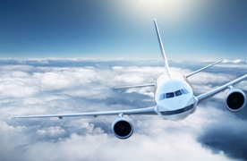
This is a small proportion; the UK’s share of aviation CO2 emissions is much less than the contribution from, for example, heating our homes (14.8%) or generating electricity (about 26%).  So, why all the fuss? First, the aviation industry is growing by around 5% per year, meaning that its share of CO2 emissions could rapidly increase. Second, the climate impact of aviation, a topic of research at the University of Reading, is not just from CO2 emissions. The non-CO2 climate effects of aviation, like water vapour, ozone creation and contrails, increase aviation’s total contribution to human-induced climate change to up to 15%.

The good news is that the aviation industry isn’t sticking its head in the sand. It has set its own stringent targets that new aircraft entering service in 2020 should produce 50% less CO2 (per passenger kilometre) than aircraft in 2000. The question is, left to its own devices, will the aviation industry really be able to make a significant dent in its CO2 emissions? The EU thinks not.

Now for the technical bit: the Emission Trading System (ETS) limits (‘caps’) overall CO2 emissions in Europe from certain industries; under this cap and trade scheme, companies buy carbon credits to cover their CO2 emissions up to the cap, and may trade surplus carbon credits on the carbon market.  So how does this work for airlines? The total amount of CO2 that can be emitted by aviation is now capped at 97% of the annual average emitted in 2004-2006; this includes CO2 emissions from all flights which arrived at or departed from a European airport (i.e. it counts the total CO2 from the flight, not just the portion of the flight that was in European airspace).  85% of this cap is distributed to airlines as free allowances, proportional to that airline’s share of the emissions in 2010.  The remaining 15% of the cap will be auctioned.

At the end of April 2013, each airline must surrender sufficient carbon credits to cover their 2012 CO2 emissions. Therefore if an airline wishes to expand its operations in Europe, it must either buy carbon credits at auction (or trade from other airlines who have reduced their emissions and thus have surplus credits) or from another industry sector. The implementation is fairly complicated but the rationale behind the scheme is simple: the less CO2 you emit, the smaller your costs, and in a competitive market this should effectively drive CO2emission reductions.

So far so good. But that’s not the end of the story. Internationally, the inclusion of aviation into the EU ETS has been highly controversial; the EU’s decision to introduce a regional scheme is seen by many as taking unilateral action that is both unfair and counterproductive. Legal action, brought by US airlines, was defeated by the European courts in December, however the US government may still make it illegal for US airlines to comply with this new EU law (interestingly, Delta has coincidentally introduced an unspecified $3 per passenger surcharge, ‘just in case’). China doesn’t want its airlines to pay, and has both suspended a large order of (the European-based) Airbus aircraft, and refused to allow its airlines to comply. UK airlines, with the noted exception of Ryanair, have been mostly supportive; BA has previously voluntarily participated in a UK-based ETS.  It is expected that airlines will pass on the costs of participating in the ETS to its passengers in the form of surcharges. So far surcharges have been at the bottom end of the range of estimates of 2 Euros to 3% of the ticket price, and in any case will be insignificant compared to UK air passenger duty (currently £60 for a flight to New York).

It is unclear how this story will end. At a debate I attended at British Airways last December, the overwhelming majority agreed that market-based measures are the best way to tackle CO2 emissions, even if few people believed that the EU would manage to implement the aviation ETS without some concessions or modifications. Some concessions seem likely as international opposition to the scheme is not only increasing but becoming more organised: a coalition of countries (including the US, China, India and Russia) recently met to decide on ‘retaliatory action’ against the EU, threatening to escalate the situation into a full-scale trade war. Meanwhile, aviation’s governing body ICAO says it is accelerating efforts to design a global ETS-style measure for aviation and will present its proposals by summer (full story at http://www.greenaironline.com/news.php?viewStory=1417).

Even the EU acknowledges that a global solution is clearly the best way forward. The EU ETS could just be the catalyst to make that happen.