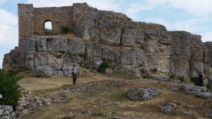
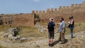
In July, a team consisting of staff and students from the University of Reading (Aleks Pluskowski, Rowena Banerjea, Guillermo García-Contreras Ruiz, Rob Fry, David Thornley (formerly at Reading) and Caedmon Bradley), students from the universities of Granada and Montpellier, spent a week in the province of Guadalajara, central Spain, prospecting and surveying two castles associated with the medieval Christian – Muslim frontier. The project was funded by the Society of Antiquaries and the Erasmus Programme, as pilot studies within the “Landscapes of (Re)conquest project” which is investigating the character of medieval frontiers in South Western Europe. The central part of the Iberian Peninsula represents an exceptional area for investigating the dynamics of frontiers, colonisation and social reorganisation during the formative period of the Middle Ages, when political control of territory fluctuated between Islamic and Christian authorities. Our fieldwork focused on two castles – Molina de Aragón and Atienza – that were linked to medieval frontier authorities during both Islamic and Christian periods of rule. Both sites are defined by the presence of substantial enclosed wards, largely devoid of structures above ground. The use of these spaces and therefore the roles of these fortified sites during the various phases of occupation remain unknown, and the complete lack of palaeoenvironmental investigations has also detached them from their landscape context. The aim of the project was to conduct geophysics surveys within these wards, to obtain environmental data from excavated irrigation channel and terrace within the vicinity of the sites, and to collect samples of building fabric and document phases of construction. This information would be used to characterise how the landscape was used and organised by Islamic and Christian frontier authorities.
Most of our fieldwork was focused on Molina de Aragón, which consists of a fortified complex, located on a hill overlooking the valley of the River Gallo in the Upper Tagus, one of the principle mountain ranges in Spain and recently designated as a UNESCO Global Geopark due to its unique geological formations. The role of the site changed over time, from a rural fortification during the Islamic period, ruled largely by Berbers (8th–10th centuries), to a focal point for the defence of Al-Andalus against the expansion of Christian kingdoms from the north (10th–11th century) and subsequently the capital of an independent Islamic state, the Taifa of Molina, following the collapse of the Umayyad Caliphate. In 1129, Molina was conquered by King Alfonso I of Aragon. After fierce territorial disputes, it was bequeathed to the Lara family who maintained a virtually independent frontier lordship into the 14th century and developed the associated town. Molina passed to the Kingdom of Aragon for a short period (c. 1366–1375), after which it was incorporated into Castile, and finally into Spain. After functioning as a military barracks throughout the 19th century, the fortress was abandoned from the beginning of the 20th century. Rob Fry and David Thornley conducted magnetometry surveys within the wards of the castle, whilst the rest of the team focused on excavating and sampling an irrigation channel at the edge of the medieval town, taking cores to identify suitable deposits for further environmental sampling and sampling a terrace for OSL dating and geoarchaeological analysis. Environmental sampling was led by Rowena Banerjea with students from Granada and Montpellier. Caedmon Bradley documented the walls of the castle at Molina de Aragón with photogrammetry for his third-year dissertation.
The second fortified complex included within the project – Atienza – is located within an expansive valley of the mountain range of the Sierra Norte. From the 8th century it was settled and used as a rural fortification by the Berber tribe of Banu Salim. During the Umayyad emirate and caliphate (9th c-10th century), Atienza was an important strategic centre on the border between al-Andalus and the Christian kingdoms. In 1086, the fortress was conquered and became part of Christian Castile. Subsequently, it became the centre of a frontier lordship, securing the border against both neighbouring Muslim territories and the Christian Kingdom of Aragon (11th-12th century). Atienza remained loyal to the kings of Castile in times of internal civil war (13th-14th century), and its prosperity was represented by the construction of fourteen churches, alongside the expanded castle and urban defences. From the 15th century its strategic and economic importance dramatically declined. In the 19th century it was significantly affected by the War of Independence. Here, Rob Fry and David Thornley conducted magnetometer surveys within the castle itself, its outer wards and some of the adjacent parts (now abandoned) of the medieval town. The aim of the surveys was to identify the degree of disturbance and the presence of buried structures where traces of occupation may have been preserved, to inform future excavations.
The results of these pilot projects are currently being analysed, but they represent an important foundation for more extensive future investigations into the role of these centres of authority in the medieval multicultural frontiers of Iberia.


