Streetview and A Sense of Place

I was reading the BBC News Magazine online this morning and came across this article about Google street-view, and how, in the author’s opinion, its immersive nature is changing the way we interact with places in a way that paper maps are not able to.  It’s an interesting article, and well worth a read, and I feel like I know what the author means.  Because I have a dislike of the unknown (and a tendency to over-plan), I sometimes use street-view to ‘practice’ an unfamiliar walking or driving route before I make the actual journey – bringing about a strange sensation of familiarity when visiting places that I have physically never been before.

Historypin Streetview

A photograph on the Bucklebury History Group Historypin channel, pinned to street-view.

Primarily though, the article made me think of the work we have been doing with Historypin as part of the A Sense of Place project, as it briefly mentions the fact that the galleries of some Museums are now available to tour on street-view, referring to the Google Maps Art ProjectHistorypin uses Google Maps as its mapping tool, and users can view some historic photographs pinned in street-view, seeing the old photograph overlaid onto the modern view of the same location.  In an earlier post we introduced the tours and collections feature on the MERL and Bucklebury History Group Historypin channels, and one of the nicest features of these is the potential to create a walking tour that a user can follow in street-view, viewing the overlaid historic photographs as they go.  I wonder how virtually interacting with places both now and in the past might add another level of complexity to the changing relationship with places that the author of the article claims the technology is fuelling.


As one blog dies, another is born…

You may have noticed over the past couple of months that our blog posts and updates have slowed down as we approach the end of the Sense of Place project.  But don’t despair!  We’ve all enjoyed contributing to the blog so much that we’ve decided to keep it going, in its new role as a MERL Projects blog!

We hope that you’ve enjoyed following the progress of the Sense of Place project, and we’ve really valued the comments and feedback we’ve received so far.  We’ve still got quite a bit more to tell you about the final stages of the project, but we’ll also be telling you about other projects that are happening at MERL.  In the very near future, Greta will be writing a post to introduce the new project that we have both started working on, Countryside21.

So keep reading, and keep commenting!

New Tours and Collections on Historypin!

As you will have read from Greta’s post Crowdsourcing with the Bucklebury History Group, we’ve been doing a lot of work over the past couple of weeks on our MERL Historypin channel.  A large number of the Collier photographs of Bucklebury have been re-pinned to more precise locations, and some of them are even pinned to street-view, where possible.  The next stage for us was to start to make proper use of some of the other features of Historypin, so Danielle and I spent an afternoon this week experimenting with ‘Tours’ and ‘Collections’.

Bucklebury ford

A Collier photograph of Bucklebury ford, recently re-pinned to street-view.

Tours and Collections are essentially features that enable users to group together and highlight particular sets of ‘pins’, according to whatever theme they choose.  The Collections feature is particularly suited to grouping pins by theme.  A Collection could be created to show a set of photographs taken by a particular photographer, or a set of similar objects.  The user can add some introductory text to explain the rationale of the collection and any other information they want to include.  The selected pins can then be viewed either in list-form or as a slideshow.

The ‘Tour’ feature initially appears to be similar, but its potential lies in the use of pins that are pinned to street-view.  Where relevant, the pins appear in the slideshow automatically in street-view, with a small map showing their location and a small space for extra text to its left.   If all the pins are on street-view, then, a tour can enable the user to virtually ‘walk’ down a street, fading pins in and out of view and following their progress on a map.

Describing the features doesn’t quite convey their potential to enhance a Historypin channel, so the best thing to do would be to take a look at some of the tours and collections Danielle and I created this week, on the MERL and Bucklebury History Group channels.  Simply go to the channels and select the ‘Collections’ or ‘Tours’ tabs.

MERL Channel collection

The ‘George Lailey, Bucklebury Craftsman’ collection, on the MERL Historypin channel.

The ‘History Walk around Bucklebury’ tour on the Bucklebury History Group channel is a particularly good example of what these features can do.  You’ll see that the tour includes photographs and objects pinned by MERL as well as those pinned by the History Group.  In this way, users are not confined to their own content, but can make use of any photographs and objects pinned on the website.

Bucklebury History Walk Tour

A Collier photograph of Bucklebury pinned to street-view, as seen in the ‘Bucklebury History Walk’ tour.

And there are a lot of pins to choose from.  According to the counter on the homepage, there are, to date, over 210,000 pins and comments on Historypin, and this can sometimes make the website (and individual channels) a victim of its own success.  The more that is pinned the better, but this makes it harder to sift through the content to find particular images.  If you look at the main list of pins on the MERL channel, for example, you will have to trawl through a lot of pages of object pins before you reach the Collier photo pins, which were added at an earlier date.  A major benefit of the tours and collections features is that they provide solutions to this problem.  They can highlight particular sub-sets of pins and make it much easier for their users to find what they might be looking for.  We think they also make the channel more interactive, informative and enjoyable to browse.

8000 and counting…

 As you might have guessed from recent blog posts, the past couple of months have been incredibly busy.  Over the last few weeks, then, it has been a real relief to get back to some solid days of cataloguing again, and as a result we have finally reached another milestone – 8000 records enhanced!  Hopefully we’ll pick up pace again over the next couple of months, as we really want to reach that target of 10,000 records by the end of the project. 


54/45

To celebrate, I thought I’d share with you an object record that always makes me smile. Whenever I’m getting fed up of cataloguing yet another auger or chisel, I return to this sketch for a bit of cheering up.

Object biography, place, and secret blogging!

The Sense of Place team pointed out to me earlier this week that I had been notably quiet in terms of posting on the project blog. In return I admitted that I had been secretly blogging quite a lot but on another blog that we have recently launched. Readers of the Sense of Place discussion posted here may also be interested to learn about this other ongoing project at the Museum, which culminates this week in the opening of a new temporary exhibition.

The exhibition is entitled What to Look For? Ladybird, Tunnicliffe, and the hunt for meaning and runs from 6 October 2012 until 14 April 2013. It represents the labours of many people including myself and my co-curator in this enterprise, Dr Neil Cocks of the University of Reading’s Department of English Language and Literature. By working with a range of colleagues and specialists, Neil and I have sought to present a diverse  range of responses to a single illustration of rural life. Indeed, the whole this focusses on just one small watercolour by the artist Charles F. Tunnicliffe.

The Huntsman

‘The huntsman, on his dappled grey..’ by Charles Tunnicliffe (Image © Ladybird Books Ltd)

This was one of many artworks created by him for Ladybird children’s books. The painting featured in What to Look For in Autumn, published in 1960. This was part of a four-book series printed between 1959 and 1961. It was written by the biologist Elliot Lovegood Grant Watson and charted seasonal change in the countryside.

The original Ladybird artwork is held alongside the collections of the Museum. This juxtaposition inspired us to invite specialists to examine a countryside image. Their responses form the core of the exhibition and together offer different answers to the question of What to Look For. They reveal the diverse stories that one illustration can tell.

This is not simply a history of Tunnicliffe’s artwork or an exploration of the rural history underpinning this particular image but seeks to be much more. Indeed, much like A Sense of Place it aims to stimulate debate and discussion and to raise a wider set of questions concerning what the Museum holds and how these rich resources might best be understood. With this in mind, the project blog related to the exhibition asks its readership how they might choose to look at this image or read the accompanying text? As the exhibition progresses we hope that you will share your responses and join the conversation here.

By way of apology to my Sense of Place colleagues and to you, our enthusiastic readers, for allowing my blogging efforts to be channelled in another direction, I offer you this link to a posting that I made earlier today in relation to the exhibition. It is concerned with the notion of object biographies and with the important role of ‘place’ in governing how we might come to think about the history of and value of material things. It therefore touches directly on ideas that have proven such an inspiration and driving force in this context and stands as testament to the influence that the Sense of Place team themselves have exterted on this parallel project.

I’ll be away for a couple of weeks but I’m sure the project team will be blogging in my absence, and I promise to join in this important discussion when I return. I might still write an occasional post on the other blog too!

Places and names

Given that we spend so much of our time looking at places on maps, it is hard not to pay attention to some of the more memorable place names.  There are some gems in the English countryside: places such as Nether Wallop in Hampshire, Wyre Piddle in Worcestershire, and my personal favourite address in Berkshire, Rotten Row, Tutts Clump.  It certainly leads one to think about the origins and etymology of those names.  We notice patterns when cataloguing collections from particular counties; there are lots of places in Sussex with the name component –hurst, and lots in Somerset that include Coombe or Combe.  Incidentally, hurst is a reference to a ‘wooded hill’, and Combe essentially means ‘valley’ (see below for a link to a great website you can search for information like this). 

As I mentioned in a previous post, I have recently spent a lot of time cataloguing ploughs, and one of the most interesting things about the earlier ploughs is that their names often include the name of the county in which they were designed to be used.  Ploughs might be heavy or light for different soil types or the gradient of the landscape.  It is interesting to think that the names of the places in which those ploughs might have been used often reflect those same features of the landscape.  At school in Redditch we were often told that the town was named for the bright red clay that passes for soil in the local area, and like Combe above, many other place names relate to hill and valley features.  As objects often show the links between people and places, so too do the names we call those places.


Gloucestershire Long Plough (54/91)

This is a Gloucestershire Long Plough (54/91), used at Bangrove Farm, Winchcombe. The farmer who used it said that the heavy plough was made to cope with the local clay-like soil, and that he had to hitch five Suffolk punch horses to it to get it going 'full pelt'.

Reading, like many other places, is formed of a personal name and the –ing component – it means ‘the people of Reada’.  Reada, according to an article in The Independent, was ‘an otherwise forgotten man… whose name suggests that he had red hair’.  This feels appropriate, given that I am a redhead myself.  Another somewhat amusing place name etymology is that of Nottingham.  It is formed of a personal name, the ­–ing component, and the –ham component.  In total, it formed Snotta-ingas-ham – the village of Snot’s people.  Nottingham is, all things considered, a rather better name.

It is outside the scope of this project to start recording the origins of the place names we are entering into a hierarchy.  A project which is carrying out this valuable task is the Survey of English Place Names, at the English Place-Name Society and the Institute for Name-Studies at the University of Nottingham (or, the University of the village of Snot’s people).  On their website, you can search a map with information about the origins of English place names.  There is also a wealth of websites and books out there with information about this fascinating area.  For me, it remains an interesting side topic to the main geographical cataloguing I do.  Noticing these sorts of patterns in the names of places in different areas of the country helps me to get an even better appreciation of the significance of place and the landscape for people’s lives, and consequently, the objects in MERL’s collections.

Perhaps there are some other great place names out there that you know about, or places that mean something to you – do comment on this post and share them.  We might even have catalogued an object from there – we can let you know!

Saddlery, wagons and ploughs, oh my!

Apologies for the Wizard of Oz reference in the title – I couldn’t help myself.  To finish the week, I thought I’d post an update on what I have been working on over the past couple of weeks.  We recently asked some of our MERL tour guides for feedback about what sort of objects visitors seem to be most interested in, with a particular interest in place.  The answer that came back was “wagons and ploughs”.  This didn’t really surprise me, as I remember on my own first visit to the museum I immediately wanted to find a wagon from Worcestershire, the county in which I grew up.  As it turns out, we don’t actually have a wagon from Worcestershire, but we do have plenty from many other counties.  I spent a few days enhancing the catalogue records for all the wagons in MERL’s collection, and after than moved on to the ploughs.

Cataloguing in this way does have certain advantages.  Spending a number of days immersed in information about a particular type of object gives you a much better chance of getting to understand those objects, and what is most relevant and important to record about them.  This is particularly useful when trying to tidy up the object name thesaurus for such objects.  In contrast, if you only catalogue one wagon in every 300 records it is much harder to get an overall picture of wagons and their variations.  Of course, it does help when you are interested in the objects you are spending up to week cataloguing exclusively.  On the other hand, cataloguing chronologically gives a really good insight into the history of the collection and how it developed over time, as well as being a logical and consistent way to progress towards our goal of 10,000 records by the end of the year.  It is interesting to consider how the order in which we catalogue objects might be influencing the way in which we are cataloguing them.

As well as the wagons and ploughs, I have also catalogued the objects in one particular gallery location: the saddlery case in the ‘Leather’ section of the Museum.  This is part of a small part of the project I am working on, where we’re trying to think of ways of making the enhanced catalogue records more accessible to visitors who are actually standing in the Museum, looking at the objects.  One of the ways we are thinking of doing this is using QR codes.  This is one outcome of our work with iMuse (see Working with iMuse and Historypin), and we have been able to think a lot about the benefits and practicalities of using QR code technology in a museum context.  Now that all of the objects in the saddlery case have been enhanced, we will be able to generate a QR code which, when scanned using a smartphone, will direct the visitor to the enhanced database entries for those objects.  As a starting point, this should enable them to access far more information about the objects than would be possible with in-gallery text labels.  Of course, QR codes aren’t perfect: not all of our visitors will have smartphones, for a start.  As an initial idea to trial, though, we hope that it will give us some useful feedback with which to move forward.

Saddlery Case

One of the displays in the Saddlery Case, one area of the gallery in which we will be trialling the use of QR codes.

Sense of Place and Farming Today

For those of you who don’t get up early in order to think about rural places and ponder countryside issues, you may have missed our very own Greta Bertram (Sense of Place Project Officer) on this morning’s edition of the BBC Radio 4 series Farming Today. Don’t worry though, you can still listen to her interview online.

As a Trustee of the Heritage Crafts Association, Greta’s interests within the Sense of Place project are increasingly centred on the diversity of  intangible heritage represented by the material holdings at MERL and how these skills may be seen to link to the places where such crafts first emerged or are still maintained in the present day. In her interview Greta hints at the potential for renewed vigour within the extant networks of regional craft skills.

As the project develops Greta will hopefully develop some of these ideas and issues and bring them to bear on the mapping of MERL’s historical holdings.

Understanding Bucklebury

Since we’ve gone a bit quiet about our progress on the cataloguing front recently, I thought I would let you know how we’ve been getting on over the past month or so.  We have slowed down somewhat as other aspects of the project start to pick up pace, but our current total sits at just above 4,500 records.  Initially progressing chronologically, we have worked through the records from 1951, when the Museum was founded, to 1954 in full, and have also completed parts of 1955 and 1956.  More recently, though, our focus has shifted to other areas of the collection.  Greta has been working her way through the Museum’s collection of baskets (about which I think she is planning a separate post), whilst Danielle and I have been completing the objects in the collection from the Berkshire village of Bucklebury, in preparation for our work with Historypin.

There are between 300 and 350 objects from Bucklebury in the collection.  It is hard to give a more precise figure, because more information becomes available as we work our way through the records.  We have just one object record file for objects from the Hedges Foundry, for example, but this actually relates to 26 individual wooden patterns.  In addition to the objects from the Hedges Foundry, which was situated in Bucklebury Village, much of the rest of the material comes from the bowl turner George Lailey and the handle maker Harry Wells.

I spoke in a previous post, Cataloguing ‘place’, about our geographical hierarchy, which is largely based on the Getty Thesaurus of Geographic Names, with a few alterations and additions.  In the case of the Bucklebury material, we have decided to add still further levels of detail into our hierarchy.  This reflects the fact that we are in a sense using Bucklebury as a trial area, exploring some of the ways in which this approach can be implemented in collaboration with local communities, and we want to make our hierarchy as relevant as possible to their understanding of ‘place’ in Bucklebury.  Of course, in order to do this, we had to get a good grip on how ‘Bucklebury’ works, which was one of the main reasons for our visit a few weeks ago.

The church gate lantern in Bucklebury Village, made at the Foundry

When we first met the Bucklebury History Group, I naïvely asked ‘So, how exactly is Bucklebury laid out?’  My question was met with knowing smiles.  We had a look at a huge map of the parish, and immediately saw part of the problem, which Danielle also described in her earlier post, The Bucklebury Experience.  Bucklebury Village itself, situated on the banks of the River Pang, is actually quite small.  Upper Bucklebury, where many of the more modern houses are situated, is up to two miles away down narrow country lanes, in the middle of the Common.  A further hamlet, Chapel Row, sits to the eastern edge of the Lower Common.  A smaller hamlet, The Slade, sits on the western edge of the Upper Common.  And then, dotted in between, are other clusters of houses, each with distinct names and identities, but all considered to be a part of ‘Bucklebury’.  These include Turner’s Green, where Lailey’s workshop was situated, Byles Green, Miles’s Green, Workhouse Green, and the grandly named hamlet of ‘Scotland’.

Knowing this, it seemed insufficient to give ‘Bucklebury’ just one listing in the hierarchy.  Besides, the given latitude and longitude on the Getty Thesaurus was situated in a somewhat obscure spot in a field in the parish, which hardly seemed to reflect the complexity of the village’s geography.  Our tour of Bucklebury was incredibly useful.  Physically walking and driving around and between the places in Bucklebury gave us a far better understanding of the place than simply looking at a map.  Obviously this approach is impossible on a larger scale, but for the purposes of our work with the Bucklebury History Group and Historypin, it was invaluable.  The hierarchy we have come up with will hopefully enable the collections to be pinned to the map with as much accuracy as possible, reflecting the level of information we have about places in Bucklebury. 

One of two ancient fish ponds on the Lower Common

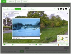
The broadest ‘Bucklebury’ thesaurus term in our hierarchy relates to everything within the parish boundary.  At a lower level, we list the larger distinct places: ‘Bucklebury Village [Bucklebury]’, ‘Chapel Row [Bucklebury]’, ‘Bucklebury Common [Bucklebury]’ and ‘Upper Bucklebury [Bucklebury]’.  Some hamlets, such as ‘Bushnells Green [Bucklebury]’ are also listed at this level because they are isolated within the parish, but other hamlets, such as Turner’s Green are first linked to bigger places with which they are associated.  For example, Turner’s Green is situated on the Common, so is listed as ‘Turner’s Green [Bucklebury Common [Bucklebury]]’.  The essence of our approach is to include as much detail as possible, so that we can find the precise latitude and longitude for distinct villages, hamlets, and even houses, which will ultimately enable the collections to be mapped as accurately as possible to the places with which they are associated.  It does feel as though we might have picked the most complicated village in England to use as a case study, but perhaps I am just expecting (or even hoping for) a logical simplicity that simply doesn’t reflect the realities of place.

A good way to end the week

If anyone has been following the progress of our cataloguing, you might like to know that today, we reached another milestone: 4000 records have now been enhanced!  Out of interest, the 4000th record was one of a small collection of materials and tools used in fishing fly tying.  Fly tying is, I must admit, a topic that until about an hour ago, I knew absolutely nothing about.  Whilst cataloguing, we’re learning a lot about the collection, so we’ll continue to blog about certain objects or collections that we each find particularly interesting.  For me, rather inexplicably, this has been wagons and wheelwrighting.  Expect a post in the near future…