Recently much attention has been paid in the news media to heavy monsoon rainfall and consequential devastating flooding over Pakistan, particularly over the northern-most provinces. Owing to the complex geography of the region, particularly that the huge Indus river travels down Pakistan from north to south, flood warnings have already been issued for far southern regions such as Sindh.
Most of the heaviest rainfall fell over three days in late July (28th-30th), particularly in the Gilgit Baltisan / Azad Kashmir and Khyber Paktunkhwa regions. The Northwest Frontier Province (NWFP) recorded July rainfall totals of 179.5% above normal. Even recording stations in northern Punjab received heavy rainfall, with some parts of Islamabad totalling more than 250mm on 30th July. It is important to realise that Pakistan expects to receive monsoon rains during the months of July and August, however the quantity and persistence of this rainfall has been most unusual.
So what have been the causes? La Nina cold events over the tropical Pacific Ocean, such as the one currently developing, can often be associated with heavier than normal monsoon rains over the South Asia region, however there is no reason to blame it for this particular event just yet. Near to the surface, the only clue in dynamical fields is given by the lower tropospheric winds, which suggest anomalous easterlies extending from the north side of the monsoon trough at the Himalayan foothills and extending well into northern Pakistan. This suggests an extension of monsoon conditions over India into Pakistan.
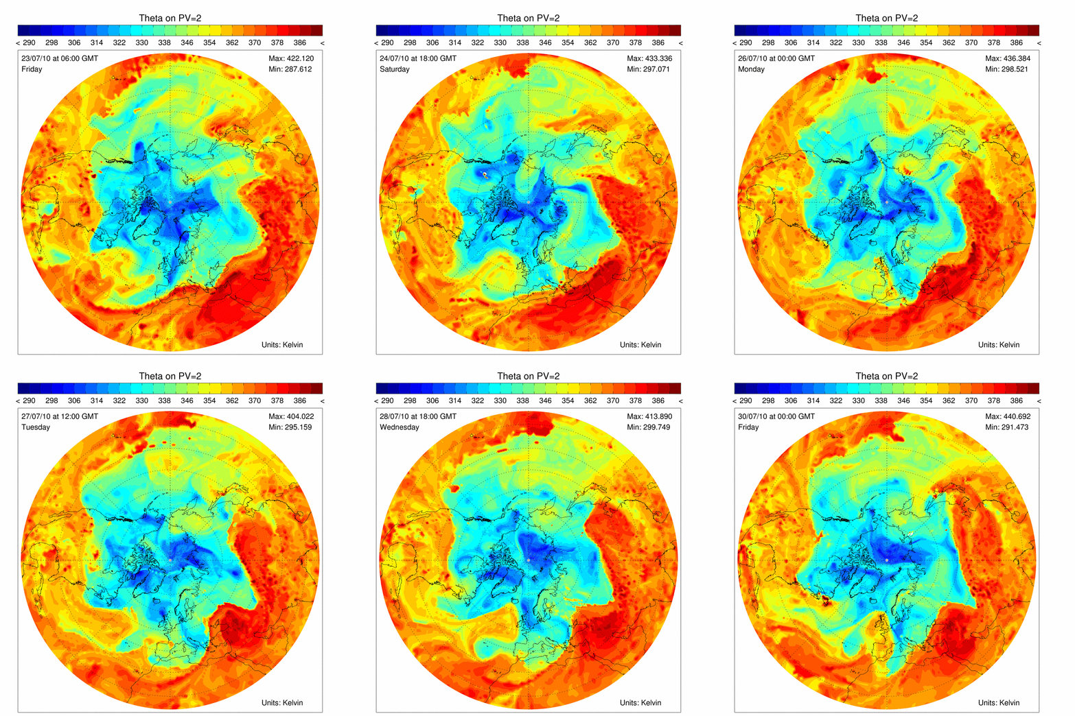
More insight can be gained by examining behaviour at upper levels. In the theta on PV2 animation of 23rd-30th July shown below, there is evidence suggesting a persistent upper level trough located over northern Pakistan, particularly during the latter stages of that week.

Figure 1: Potential temperature on PV2 surface animation: 23/7/2010-30/7/2010
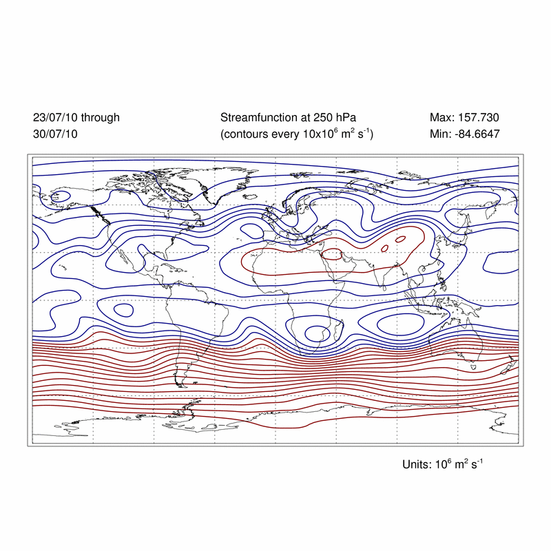
By examining the streamfunction at this level, an interesting picture emerges. The suggestion is one of an omega-shaped (Ω) blocking pattern centred near the Ural Mountains in Russia, implicated in recent soaring temperatures and wildfires during the persitant heatwave in Moscow and other regions. A pair of troughs is noted to the south-west and east, appearing as perturbations to the stationary wave running along the 35-45°N latitude band.

Figure 2: Weekly mean stremafunction at 250hPa: 23/7/2010-30/7/2010
Further analysis (not shown) demonstrates that this pattern has existed since early July, although in a weaker form.
The current outlook suggests further heavy monsoon rains over northern and some southern parts of Pakistan over the next few days. However, even in the absence of further rains, the downstream effects of this accumulation will likely continue to cause devastation.
With thanks to Mike and Brian for useful discussions.