By Ray Bell
The 2012 Atlantic hurricane season officially ended on Saturday as a ‘very unusual‘ year with an abnormally large 19 tropical storms forming and curiously only 1 making it to Category 3 strength. A typical hurricane season has 12 tropical storms, 6 of which are hurricanes and 3 of which are major hurricanes. This year also saw a large proportion of tropical storms forming at high latitudes. However, 2012 will be long remembered for producing hurricane Sandy: a ‘Frankenstorm’ (a cross between a nor-easter and a hurricane) that was the largest, most powerful, and second most destructive Atlantic hurricane on record, say Jeff Masters.
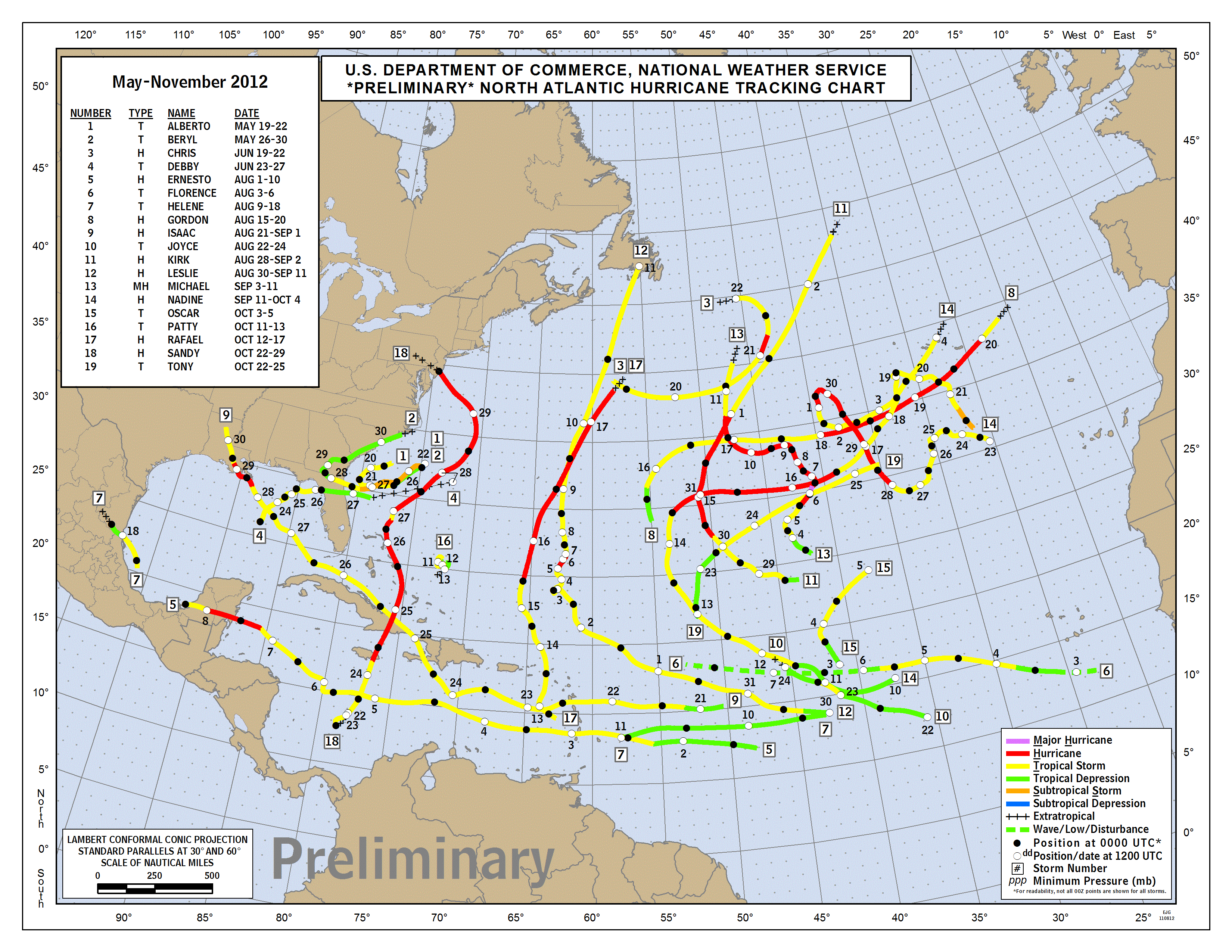
Based on the combined number, intensity, and duration of all tropical storms and hurricanes (ACE) the season was above-average, but the limited major Hurricane activity helped keep ACE down to 30% above average.
Since 1995 the US has on average been hit by 4 storms per year, with 1.5 of these being hurricanes and 0.6 being major hurricanes. This year, Beryl, Debby and Isaac hit the US. No major hurricanes hit resulting in 2012 being the 7th consecutive year with a major hurricane strike, the longest since 1861-1868 (see here).
Back in June I wrote a blog on the hurricane seasonal forecast that the Met Office issued, as well as the forecast from other centres. The Met Office was at the low end of the seasonal forecasts going for 10 tropical storms (7-13 most likely). Colorado State University were at the high end only predicting 13 tropical storms. So why did all of the seasonal forecasts significantly under predicted tropical storm activity?
Atmospheric-Oceanic conditions
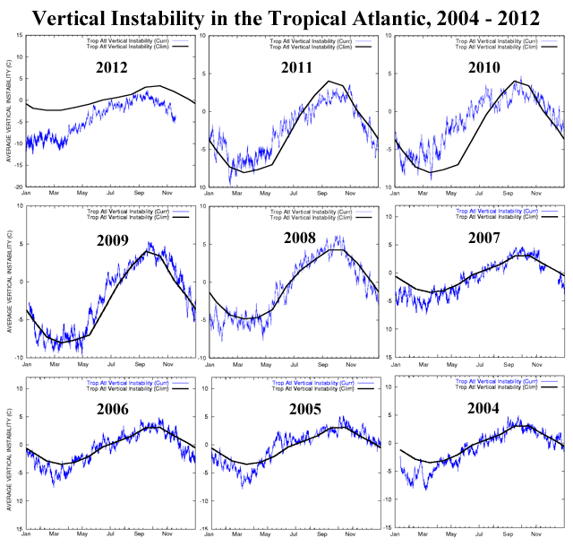
Phil Klotzbach from Colorado State University has great documentation on the Atmospheric-Oceanic conditions over the North Atlantic this season (hurricane.atmos.colostate.edu/Forecasts/2012/nov2012/nov2012.pdf). One reason was than the predicted El Niño did not develop, which usually calms tropical storm activity in the North Atlantic. A heavy influx of dry Saharan air over the tropical North Atlantic is also likely to have damped the intensity of storms forming in the tropics (see here). The figure below shows how stable the air has been in the tropical North Atlantic this season compared to the past 8 years.
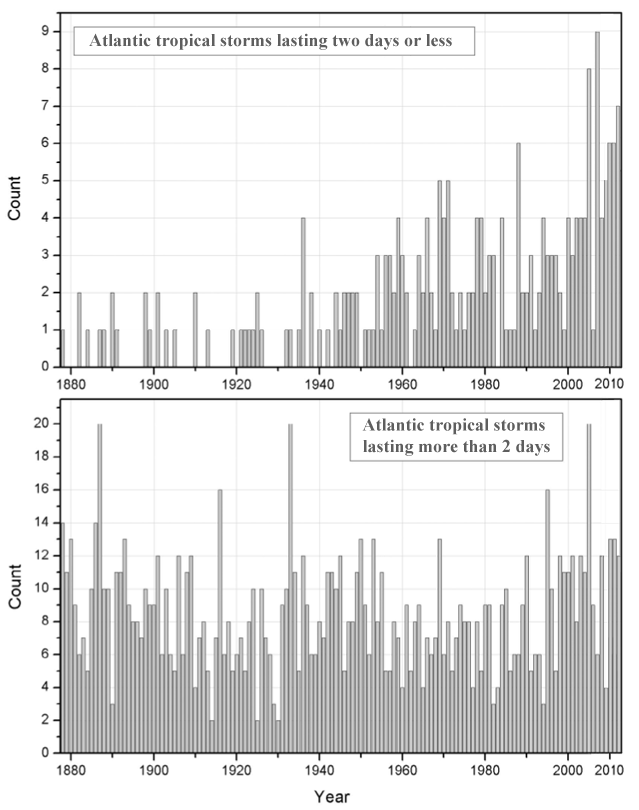
Dr. Landsea claims the tropical storm count this year is ‘slightly misleading’ due to satellites and an array of technological advances that allows systems to be identified that likely would have gone undetected decades ago (see here). 7 out of the 9 tropical storms this year reached tropical storms strength for only 2 days or less. The method in which the Met Office use currently excludes any systems with a duration of less than two days to prevent picking up transient disturbances and depressions. Planned increases to the horizontal resolution of the Met Office seasonal forecasting system in December 2012 may allow for a better distinction between weak tropical storms and tropical depressions (Jo Camp, Pers. Comm.).
Hurricane seasonal forecasts for 2013 will be released in May.
I would like to thank ex-Reading University student and colleague Joanne Camp for proof reading.
.