Green shoots from the grassroots at the 26th Conference of the Parties

By: Chris Merchant

On the opening two days of COP26, I was in Glasgow to raise awareness of the climate and environmental data freely available from satellite observations of Earth. While the news media focus on big political headlines from COP26, I was greatly impressed by many people I met who usually won’t make the “front page”.

I’m part of the National Centre for Earth Observation (NCEO) and lead a project within the European Space Agency’s climate programme. I took my place at a stand next to the Planetarium in the Glasgow Science Centre (GSC). The stand (figure 1) was created by Space for Climate which is a network of commercial, academic and public sector partners working together to maximise the use of Earth observations to benefit climate action.

Figure 1: The Space for Climate stand at COP26. Note the “heat map” from space over Glasgow and the model of the upcoming satellite mission BIOMASS.

One of the attractions was the touch sensitive globe where the curious could explore animations of climate data and case studies of their use. We were on hand to answer questions about what they could visualise (figure 2).

Figure 2: Discussing data animations on the touch-sensitive illuminated globe of the Earth

Many passers-by were interested to hear about Earth-from-space information and thought the data relevant to their interests. Meanwhile, I had a fascinating time discovering what their interests were. I learned a lot as they enthused about their actions related to climate change. Here are some of the stories I heard (anonymised) from some remarkable people.

An employee of a large food-packaging business explained the difficulty presented to an environmentally conscious business by complex supply chains. They want their paper and card to be sourced from sustainably managed timber. Their major customers in turn increasingly demand this. The necessary chain of information is not necessarily easy to prove, and we discussed space observations as a way of validating statements about where timber was harvested from.

The director of a planetarium (not the GSC’s) talked to me about getting up-to-date data and visualisations of the climate status of planet Earth to include in their programme, “Turning the telescopes to point downward” as he put it. Data from NCEO members can definitely help him with public communication on how the Earth is changing.

I had more than one conversation about pensions, to my surprise. And not from anyone trying to sell me one! Pension schemes are huge investors, and decarbonisation of society will be influenced by their investments. The parents of one impressive teenager related to me how their son ended up in a pension board meeting directly lobbying for a more climate-friendly investment strategy. Another delegate explained that “greening my pension” is an effective strategy for reducing my carbon footprint. And it could also be lucrative, since many sustainable investments have given better returns than general funds in recent years. (Disclaimer: this does not constitute financial advice.)

The south American lady who explained to me her business hugely reducing waste from women’s sanitary products was very impressive. She faces resistance to change, as seems to be a common experience of pioneers. But she palpably gained encouragement from meeting people at COP who appreciated her innovations to reduce everyday resource consumption.

I mention only in passing the economist helping businesses assess finance strategies in the light of climate change, the non-executive director of a start-up aiming to build “the best batteries in the world” in a carbon-neutral factory in England, and the aspiring restorer of Cumbrian peatlands (which can draw down and store carbon dioxide from the air).

I hope that gives some idea of how varied and inspiring the delegates I met were, actively working at the grassroots of climate action. The political outcomes of COP26 may hasten or hinder their progress, but it is these delegates whom I met, and countless others like them, who will drive the practical transition to the low-carbon future we need.

Posted in Climate, Climate change, earth observation, net zero carbon, Remote sensing | Leave a comment

Advance Of The Indian Monsoon Onset

By: Arathy Menon

The Indian monsoon provides water for agriculture, industry and the basic water needs of more than a billion people. The monsoon onset usually takes place in south India during the beginning of June and the monsoon rains then advances in a north-westward direction, over a period of six weeks, covering the entire country by around mid-July. It is interesting to note that the monsoon rains progress in a direction perpendicular to the direction of the mean winds which are southwesterly during the monsoon season from June to September.

Figure 1: An animation showing the progression of the monsoon onset isochrones (Courtesy: India Meteorological Department).  

Based on an observational dataset, Parker et al., (2016) showed that during the beginning of the monsoon season, northwesterlies prevail in the mid-troposphere, and they carry dry air from the Afghanistan region right across the Indian subcontinent as far as the southeast coast of India. During the pre-monsoon period, this layer of dry air in the mid-troposphere suppresses deep convection and rainfall. As the monsoon season begins, these northwesterlies are moistened by the moist monsoon winds which support the development of shallow cumulus and congestus clouds, slowly eroding the dry-air intrusion from the southeast. As the season develops, the northern limit of the onset progresses towards the northwest as the rate of moistening of the dry layer from southeast increases, relative to the horizontal advection of the dry air from the northwest. Volonté et al., (2020) elaborated on this finding by showing that the north-westward progression of the monsoon is a non-steady process modulated by the balance of the interaction between the moist monsoon air mass and the dry northwesterly air mass.

Figure 2: A schematic from Parker et al., (2016) showing the situation around the time of onset (around the 1st of June, top panel) along northwest-southeast India, when the dry layer is still quite deep in the southeast but has been sufficiently moistened to allow the onset of deep convection there. The bottom panel shows the situation around the 15th of July when the onset has advanced to the northwest and the dry layer extends only a few hundred kilometres into the subcontinent.

In one of our recent pieces of research, we used the Met Office Unified model at 4 km grid-spacing and found that the land-atmosphere interactions also play a major role in the advance of the monsoon by modifying the local onset. During the beginning of local onset over a region, onset or pre-monsoon showers lead to an increase in soil moisture heterogeneity. This introduces a gradient in sensible heat flux over that region. Increased gradients in sensible heat generate local mesoscale circulations which favour an earlier triggering of rains. However, as the onset advances and the soil becomes wetter, surface fluxes become less sensitive to soil moisture and then the mid-tropospheric moistening plays the major role in the further progression of the monsoon.

Figure 3: The time evolution of mean sensible heat flux (red lines) and spatial standard deviation in sensible heat flux (blue lines) at 6:30 UTC over a region in central India. Solid lines represent the values from a model simulation using CCI land ancillaries and dashed lines show values from a model simulation using IGBP land ancillaries. As the onset advances, in June and July, the mean sensible heat flux (H) falls due to the increase in soil moisture from the rains. During June, i.e., during the beginning of the onset, the spatial variability in H is at a maximum due to patchiness in rains and these gradients can result in local mesoscale circulations and rainfall during the beginning of the local onset.

A proper understanding of the basic physical mechanisms of the onset advance is a prerequisite for improving the biases in weather and climate models, eventually improving forecasts. An agrarian society like India, whose economy is mainly based on rain-fed agriculture depends a lot on accurate monsoon predictions.

References

Menon, A., A. G. Turner, A. Volonté, C. M. Taylor, S. Webster, and G. Martin, 2021: The role of mid‐tropospheric moistening and land surface wetting in the progression of the 2016 Indian monsoon. Quart. J. Roy. Meteor. Soc.https://doi.org/10.1002/qj.4183.

Parker, D. J., P. Willetts, C. Birch, A. G. Turner, J. H. Marsham, C. M. Taylor, S. Kolusu, and G. M. Martin, 2016: The interaction of moist convection and mid‐level dry air in the advance of the onset of the Indian monsoon. Quart. J. Roy. Meteor. Soc.142(699), 2256-2272. https://doi.org/10.1002/qj.2815

Volonté, A., A. G. Turner, and A. Menon, 2020: Airmass analysis of the processes driving the progression of the Indian summer monsoon. Quart. J. Roy. Meteor. Soc.146(731), 2949-2980. https://doi.org/10.1002/qj.3700.

Posted in Climate, Monsoons, Numerical modelling, Tropical convection | Tagged | Leave a comment

The Global Carbon Project’s TRENDY MIP, the 2018 European Drought MIP, the SDGVM Model, and me

By: Patrick C. McGuire

The annual TRENDY MIP was started in 2010 in order to compare different land models and their ability to model the sources and sinks of carbon in the land (i.e., to/from the soil and the vegetation from/to the atmosphere). TRENDY provides model-mean and model-spread estimates of the uptake of carbon by the land throughout the globe for the Global Carbon Project, resulting in an annual publication about the Global Carbon Budget. The Global Carbon Budget attempts to balance the carbon budget for the entire globe, including the anthropogenic carbon emissions (whether from burning fossil fuels or from changes in land use) and the changing carbon reservoirs in the ocean, atmosphere, and the land. As far as I know, TRENDY is not a typical acronym, where each letter corresponds to a word, but instead, it refers to ‘trends’ in the carbon stores and fluxes with time.

I arrived at the University of Reading from my former home in Berlin in July 2017 to work as a Land Surface Processes Computational Scientist here. My involvement in the Global Carbon Project’s TRENDY MIP can be traced back to January 2018 when Tristan Quaife (University of Reading) asked me to convert data for the CALIBRE agroforestry project. He wanted me to take the forcing/driving weather data from ISIMIP up to the year 2100, which was in NETCDF format, and convert it to an ASCII/text format used by the Sheffield Dynamic Global Vegetation Model (SDGVM; Woodward, Smith, and Emanuel, 1995; Woodward and Lomas, 2004; Walker et al., 2017). The idea was to then run SDGVM with this weather data and with a variety of agroforestry reforestation scenarios in the UK in order to see if there was an optimal agroforestry strategy. I was not involved in running the SDGVM model further for the CALIBRE agroforestry project, but my work on converting the driving weather data for SDGVM did catch the eyes of both Tristan and his colleague, Anthony Walker. Anthony has been a developer of SDGVM for a number of years, and he is based at Oak Ridge National Laboratory in Tennessee, in the USA.

Anthony and Tristan subsequently asked me in March 2019 if I could use SDGVM to participate in a MIP for comparing land models for the European Drought in 2018, which has been led by Ana Bastos. Ana was then at Ludwig Maximilians University in Munich, and she is now at the Max Planck Institute for Biogeochemistry in Jena, Germany. For this project on the 2018 European Drought, I was able, firstly, to adapt Anthony’s R scripts to convert the ERA5 driving data (from the NETCDF format to SDGVM text format) over the European region for 1979-2018 that Ana had provided; secondly, to run SDGVM with this converted data; and thirdly, to produce the daily and monthly NETCDF output files (converting from SDGVM text format to NETCDF format) for SDGVM. I then delivered those NETCDF output files from SDGVM to Ana, which she analyzed for the 2018 European Drought MIP. She has subsequently published three first-author journal papers, including myself as the unique SDGVM co-author, in Bastos et al. (2020a-b, 2021). One rule for the 2018 European Drought MIP was that only one member of each model’s team could be a co-author. This rule was passed down to the 2018 European Drought MIP from the TRENDY MIP’s set of rules. Otherwise, surely Anthony and Tristan would have been co-authors, as well.

From what I understand, some years earlier, Tristan had approached the TRENDY MIP organizers, suggesting that Anthony, as a SDGVM expert, could run SDGVM for the TRENDY MIP, and hence, SDGVM could further complement the other DGVMs that were already part of the TRENDY MIP. Anthony was able to get involved in the TRENDY MIP with SDGVM, and the first year that he was a co-author on the subsequent annual Global Carbon Budget paper was in 2016 (Le Quére et al. 2016). Anthony also ran SDGVM for the TRENDY MIPs, which were published in 2017, 2018, and 2020. Due to my work on the 2018 European Drought with SDGVM, Anthony and Tristan asked me to run SDGVM for the TRENDY MIP, which was published as part of the Global Carbon Budget in 2019 (Friedlingstein et al. 2019). This involved the conversion of CRU weather input data (Harris et al. 2014) from NETCDF format to SDGVM text format and the landcover data (Land-Use Harmonization based upon LUH2 v2h from 1700-1950, and based upon HYDE from 1951-2018) from NETCDF to the SDGVM text format; running the SDGVM under several different TRENDY experimental protocols; and converting the SDGVM text-formatted output files to NETCDF format. This sounds straightforward, but it also involves checking for mistakes and ensuring that the output data is reasonable and makes sense. Overall, this part of the process started for me in mid-July 2019, and I delivered the first SDGVM runs to the TRENDY team in mid-August 2019, and the publication of the GCB paper was in December 2019. The Global Carbon Budget paper in 2019 already has almost 800 citations! Anthony did the SDGVM runs for TRENDY in 2020, and I was asked to do the SDGVM runs for TRENDY this year (2021), wherein I made my first delivery this year in mid-September. The 2021 Global Carbon Budget publication (Friedlingstein et al. 2021) should be submitted in a week or so from the time of publication of this blog. So stay tuned!

References

Bastos, A., P. Ciais, P. Friedlingstein, S. Sitch, J. Pongratz, L. Fan, J.-P. Wigneron, U. Weber, M. Reichstein, Z. Fu, P. Anthoni, A. Arneth, V. Haverd, A.K. Jain, E. Joetzjer, J. Knauer, S. Lienert, T. Loughran, P.C. McGuire, H. Tian, N. Viovy, and S. Zaehle, “Direct and seasonal legacy effects of the 2018 heat wave and drought on European ecosystem productivity”Science Advances, 6, 24, EABA2724 (2020a).

Bastos, A., Z. Fu, P. Ciais, P. Friedlingstein, S. Sitch, J. Pongratz, U. Weber, M. Reichstein, P. Anthoni, A. Arneth, V. Haverd, A. Jain, E. Joetzjer, J. Knauer, S. Lienert, T. Loughran, P.C. McGuire, W. Obermeier, R.S. Padrón, H. Shi, H. Tian, N. Viovy, and S. Zaehle, “Impacts of extreme summers on European ecosystems: a comparative analysis of 2003, 2010 and 2018”Philosophical Transactions of the Royal Society B, 375, 20190507 (2020b).

Bastos, A., R. Orth, M. Reichstein, P. Ciais, N. Viovy, S. Zaehle, P. Anthoni, A. Arneth, P. Gentine, E. Joetzjer, S. Lienert, T. Loughran, P.C. McGuire, J. Pongratz, and S. Sitch, “Vulnerability of European ecosystems to two compound dry and hot summers in 2018 and 2019”Earth System Dynamics, 12, pp. 1015-1035 (2021).

Friedlingstein, P., M.W. Jones, M. O’Sullivan, R.M. Andrew, J. Hauck, G.P. Peters, W. Peters, J. Pongratz, S. Sitch, C. Le Quéré, D.C.E. Bakker, J.G. Canadell, P. Ciais, R. Jackson, P. Anthoni, L. Barbero, A. Bastos, V. Bastrikov, M. Becker, L. Bopp, E. Buitenhuis, N. Chandra, F. Chevallier, L.P. Chini, K.I. Currie, R.A. Feely, M. Gehlen, D. Gilfillan, T. Gkritzalis, D.S. Goll, N. Gruber, S. Gutekunst, I. Harris, V. Haverd, R.A. Houghton, G. Hurtt, T. Ilyina, A.K. Jain, E. Joetzjer, J.O. Kaplan, E. Kato, K. Klein Goldewijk, J.I. Korsbakken, P. Landschützer, S.K. Lauvset, N. Lefèvre, A. Lenton, S. Lienert, D. Lombardozzi, G. Marland, P.C. McGuire, J.R. Melton, N. Metzl, D.R. Munro, J.E.M.S. Nabel, S.-I. Nakaoka, C. Neill, A.M. Omar, T. Ono, A. Peregon, D. Pierrot, B. Poulter, G. Rehder, L. Resplandy, E. Robertson, C. Rödenbeck, R. Séférian, J. Schwinger, N. Smith, P.P. Tans, H. Tian, B. Tilbrook, F.N. Tubiello, G.R. van der Werf, A.J. Wiltshire, and S. Zaehle, “Global Carbon Budget 2019”Earth System Science Data, 11, pp. 1783-1838 (2019). 

Friedlingstein, P., M.W. Jones, M. O’Sullivan, R.M. Andrew, D.C.E. Bakker, J. Hauck, C. Le Quéré, G.P. Peters, W. Peters, J. Pongratz, S. Sitch, J.G. Canadell, P. Ciais, R.B. Jackson, P. Anthoni, N.R. Bates, M. Becker, L. Bopp, T.T.T. Chau, F. Chevallier, L.P. Chini, M. Cronin, K.I. Currie, L. Djeutchouang, X. Dou, W. Evans, R.A. Feely, L. Feng, T. Gasser, D. Gilfillan, T. Gkritzalis, G. Grassi, L. Gregor, N. Gruber, Ö. Gürses, I. Harris, R.A. Houghton, G.C. Hurtt, Y. Iida, T. Ilyina, I.T. Luijkx, A. Jain, S.D. Jones, E. Kato, D. Kennedy, K.K. Goldewijk, J. Knauer, J.I. Korsbakken, A. Körtzinger, P. Landschützer, S.K. Lauvset, N. Lefèvre, S. Lienert, J. Liu, G. Marland, P.C. McGuire, J.R. Melton, D.R. Munro, J.E.M.S. Nabel, S.-I. Nakaoka, Y. Niwa, T. Ono, D. Pierrot, B. Poulter, G. Rehder, L. Resplandy, E. Robertson, M. Rocher, C. Rödenbeck, J. Schwinger, C. Schwingshackl, R. Séférian, A.J. Sutton, T. Tanhua, P.P. Tans, H. Tian, B. Tilbrook, F. Tubiello, G. van der Werf, N. Vuichard, R. Wanninkhof, A.J. Watson, D. Willis, A.J. Wiltshire, W. Yuan, C. Yue, X. Yue, S. Zaehle, and J. Zeng, “ESSD Global Carbon Budget 2021”. Earth System Science Data Discussions (2021, in preparation).

Harris, I., P.D. Jones, T.J. Osborn, and D.H. Lister. “Updated high-resolution grids of monthly climatic observations – the CRU TS3.10 Dataset”Int. J. Climatol., 34, 623–642 (2014).

Le Quéré, C., R.M. Andrew, J.G. Canadell, S. Sitch, J.I. Korsbakken, G.P. Peters, A.C. Manning, T.A. Boden, P.P. Tans, R.A. Houghton, R.F. Keeling, S. Alin, O.D. Andrews, P. Anthoni, L. Barbero, L. Bopp, F. Chevallier, L.P. Chini, P. Ciais, K. Currie, C. Delire, S.C. Doney, P. Friedlingstein, T. Gkritzalis, I. Harris, J. Hauck, V. Haverd, M. Hoppema, K. Klein Goldewijk, A.K. Jain, E. Kato, A. Körtzinger, P. Landschützer, N. Lefèvre, A. Lenton, S. Lienert, D. Lombardozzi, J.R. Melton, N. Metzl, F. Millero, P.M.S. Monteiro, D.R. Munro, J.E.M.S. Nabel, S.-I. Nakaoka, K. O’Brien, A. Olsen, A.M. Omar, T. Ono, D. Pierrot, B. Poulter, C. Rödenbeck, J. Salisbury, U. Schuster, J. Schwinger, R. Séférian, I. Skjelvan, B.D. Stocker, A.J. Sutton, T. Takahashi, H. Tian, B. Tilbrook, I.T. van der Laan-Luijkx, G.R. van der Werf, N. Viovy, A.P. Walker, A.J. Wiltshire, and S. Zaehle. “Global Carbon Budget 2016”Earth System Science Data, 8 (2016).

Walker, A. P., T. Quaife, P.M. van Bodegom, M.G. De Kauwe, T.F. Keenan, J. Joiner, M.R. Lomas, N. MacBean, C.G. Xu, X.J. Yang, and F.I. Woodward. “The impact of alternative trait-scaling hypotheses for the maximum photosynthetic carboxylation rate (V-cmax) on global gross primary production”New Phytol., 215, 1370–1386 (2017).

Woodward, F.I., T.M. Smith, W.R. Emanuel.  “A global land primary productivity and phytogeography model”Global Biogeochemical Cycles, 9, 471– 490 (1995).  

Woodward, F.I., and M.R. Lomas.  “Vegetation dynamics – simulating responses to climatic change”Biological Review, 79, 643– 670 (2004).

Posted in Climate | Leave a comment

Regional vs Global Models From The Perspective of a Polar Climate Scientist

By: Charlotte Lang

There is a debate in the world of polar climate and ice sheet surface modelling about global (GCM) versus regional (RCM) models and each side is trying to convince the other that they do better: global modellers insist that regional models don’t add much to the topic while regional modellers try to convince them that their models can complement or even improve the outputs of global models.

Although originally I was a regional modeller as a user of MAR (Modèle Atmosphérique Régional, Fettweis et al., 2017) in Liège, Belgium, I have since joined the dark side as a global modeller in December 2020 when I started a postdoc at NCAS. 

Do these 2 types of models really have to be opposed? Can’t they be used in a complementary way?

Let’s review a few of the advantages of each of them.

Resolution: advantage RCMs

For a long time, the biggest advantage of regional climate models was their ability to run at a higher spatial resolution (~10 km) than highly time consuming GCMs (~100 km), allowing them to better represent smaller scale processes and to be calibrated for specific climates (Fig. 1). For Greenland for example, it means a better representation of the narrow ablation zone, the marginal area of the ice sheet where the amount of melt occurring at the surface in summer exceeds the mass gained in winter through snowfall. In Svalbard, it means a better representation of the hilly topography that gave its name to the main island Spitsbergen (“pointed mountains” in Dutch) and a better representation of orographic precipitation.

Figure 1: Representation of GCMs and RCMs. Source: Ambrizzi et al. (2018); Figure 1.

On the other hand, running on a limited area means RCMs have to be told what happens at their boundaries, which have to be “forced” at regular time intervals by the outputs of a global model. That is the biggest criticism one can have against RCMs: they can only be as good as the model used to force their boundaries. Feed them with a “good” GCM and they might even improve their results (and therefore a better representation of orographic precipitation); feed them with a biased GCM and their outputs will display larger biases as well.

Ice sheet surface processes: advantage RCM

When the progress in computing allowed GCMs to increase their spatial resolution, us polar climate and ice sheet surface modellers could still argue that we could better simulate the interactions between the climate and the ice sheets surface with RCMs. Indeed, some RCMs such as Liège’s MAR or IMAU’s RACMO (Noël et al., 2018) include snow modules allowing explicit simulation of the energy and mass transfer between the atmosphere and the surface of the ice sheets. Global models for their part didn’t include such complex models and users had to resort to forcing simpler and often empirical snow models with their climate, missing some of the feedback between the climate and the snow surface.

The rise of Earth System Models: advantage GCMs

More recently, regional climate models suffered a blow with the development of a new class of global models, Earth System Models (ESM). ESMs, like the British UKESM (Sellar et al., 2019), are complex models coupling many components of the Earth System: atmosphere, ocean, vegetation, biogeochemistry… UKESM also includes a complex model for the surface of ice sheets coupled to a thermo-mechanical ice sheet model (Smith et al., 2021) simulating the dynamics of the ice sheets, allowing it to take into account the effect of changing ice sheets on the climate and vice-versa. This feature is of particular interest in long term future projections (>2100) as the surface of the Greenland ice sheet is expected to lower as it melts, further increasing the near-surface temperature and therefore surface melt through the melt-elevation feedback that RCMs and their fixed geometry can’t represent (Fig. 2). A changing ice sheet geometry could also modify the atmospheric circulation on and around the ice sheet, including a weakening (resp. strengthening) of the katabatic winds, which could further enhance (resp. dampen) the positive feedback loop.

Figure 2: Melt-elevation feedback in a fixed vs dynamical ice sheet geometry.

Efforts have been made to couple RCMs to ice sheet models, like the PARAMOUR-EOS project (https://www.elic.ucl.ac.be/users/klein/PARAMOUR/index.html) aiming at coupling several RCMs to ice sheet and ocean models over the Greenland and Antarctic ice sheets but the use of coupled models is still quite marginal in polar climatology.

Furthermore, the system of elevation classes in UKESM allows it to downscale the climate and surface variables needed to force the ice sheet model from the lower resolution atmospheric grid onto a much higher resolution ice sheet grid. And here one of the last advantages of working with an RCM disappears.

Yet regional climate models are still useful in many aspects. Forced by reanalyses, they can rapidly produce high resolution simulations of regional weather events like the extreme melt of the surface of the Greenland Ice sheet in 2012 or the deadly floods that affected Belgium and Germany this summer. Forced by an ESM climate, they can rapidly run with a focus on specific surface ice sheet processes whose numerical representation need improving or are yet to be included in the models. RCMs are not dead (yet)!

References:

[1] Ambrizzi, T., M. Reboita, R. Rocha, and M. Llopart, 2018:  The state-of-the-art and fundamental aspects of regional climate modeling in South America. Annals of the New York Academy of Sciences, 1436, https://doi.org/10.1111/nyas.13932.

[2] Fettweis, X., and Coauthors, 2017: Reconstructions of the 1900–2015 Greenland ice sheet surface mass balance using the regional climate MAR model. The Cryosphere, 11, 1015–1033, https://doi.org/10.5194/tc-11-1015-2017.

[3] Noël, B., and Coauthors, 2018: Modelling the climate and surface mass balance of polar ice sheets using RACMO2 – Part 1: Greenland (1958 – 2016). The Cryosphere, 12, 811–831, https://doi.org/10.5194/tc-12-811-2018.

[4] Sellar, A. A., and Coauthors, 2018: UKESM1: Description and evaluation of the U.K. Earth System Model. Journal of Advances in Modeling Earth Systems, 11, 4513–4558, https://doi.org/10.1029/2019MS001739.

[5] Smith, R. S., and Coauthors, 2021: Coupling the U.K. Earth System Model to dynamic models of the Greenland and Antarctic ice sheets. Journal of Advances in Modeling Earth Systems, 13, e2021MS002520, https://doi.org/10.1029/2021MS002520.


Posted in Climate, Climate modelling, Cryosphere, Polar | Leave a comment

Modelling Dust Extremes Over East Asia

 By: Dhirendra Kumar

Mineral dust plays an important role in the earth system due to its interaction with climate, ecosystems, biogeochemical cycles, and human society in direct and indirect ways [1,2,3]. Their interactions with the weather and climate occur at multiple spatial and temporal scales. While dust aerosols affect the radiation budget by absorbing, reflecting, and scattering the incoming solar and outgoing terrestrial radiation, they can have many more indirect consequences in terms of modification of the cloud microphysical properties to changes in the hydrological cycles. These mineral dust aerosols mostly originate over the semi-arid to arid regions of the world such as Northern Africa, Arabian Peninsula, Southwest Asia, and northern Chinese region in the northern hemisphere [4]. In terms of the direct impacts of dust, it affects the visibility and air quality over downstream regions where dust is transported towards, thus affecting the well-being of the exposed population.

Figure 1: Atmospheric haze over Beijing during a recent massive dust storm on 15 Mar 2021.

The extreme episodes of dust over the East Asian region are very frequent and affect the major cities in China, Japan, South Korea, and far east regions. With the highest frequency during the spring season, the individual events may occur and persist for 2-3 days at least and have a wide range of impacts in the day-to-day life of large populations. A recent massive dust storm during March 2021 is a recent examples (Fig. 1) when compounded by the hot and dry conditions and heavy north-westerly winds, the Beijing skies experienced one of the worst air quality episodes in a decade [5].

Using a combination of the state-of-the-art CAMS (Copernicus Atmospheric Monitoring Service) reanalysis [6] which includes information on dust aerosols, as well as high-resolution climate model simulations, we are trying to understand the characteristics of these dust storms and their associated meteorological drivers. Based on case studies of extreme dust episodes, we try to understand the contrasting meteorological drivers for different cases having impacts over different regions. We find that extreme dust emission episodes originate over the Gobi and inner Mongolian deserts resulting in high dust aerosol load over the adjacent regions such as the Taklamakan desert, Gobi Desert, Beijing, and other far Eastern areas due to different transport conditions. An animation showing impacts in terms of high dust AOD (Aerosol Optical Depth) values over the larger East Asian region is shown in Fig. 2. The dust can also reach up to the southern parts of the Chinese territory and thus engulfs major cities including Beijing, Shanghai, and Nanjing.
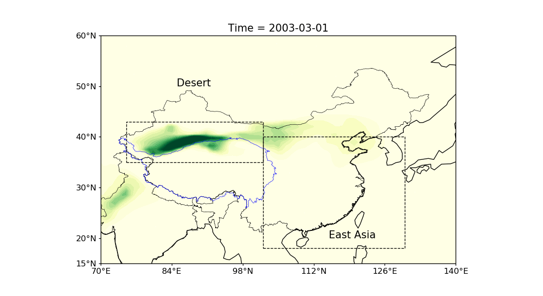
Figure 2: Daily variation of Dust Aerosol Optical Depth over the East Asia region during the spring from the CAMS dataset.

We also look at the large-scale meteorological conditions during these events using the reanalysis as well as the model simulations. We find that the high-resolution model can resolve the major characteristics of these dust storms and provide greater insights about the spatial structure of the dust emissions and associated impacts over the region. The models also accurately represent the large-scale meteorological drivers such as the surface and low-level circulations, and the synoptic conditions. Although the models can efficiently resolve the broad-scale features during extreme dust episodes, they have inherent systematic errors, as they overestimate the dust emission while underestimating the AOD values.

The experiences gained from such investigations provide further avenues for understanding the extreme dust cycle, its behaviour, and complex interactions within the climate system from the perspective of climate change. In addition, it also highlights the strengths and weaknesses of the model outlining the need for further improvements in the representation of processes related to mineral dust emission and transport.

References:

[1] Kaufman, Y., D. Tanré, and O. Boucher, 2002: A satellite view of aerosols in the climate system. Nature, 419, 215-223, doi:10.1038/nature01091.

[2] Li, Z., F. Niu, J. Fan, Y. Liu, D. Rosenfeld, and Y. Ding, 2011: Long-term impacts of aerosols on the vertical development of clouds and precipitation. Nature Geoscience, 4, 888-894, doi:10.1038/ngeo1313.

[3] Choobari, O., P. Zawar-Reza, and A. Sturman, 2014: The global distribution of mineral dust and its impacts on the climate system: A review. Atmospheric Research, 138, 152-165, doi:10.1016/j.atmosres.2013.11.007.

[4] Ginoux, P., J. Prospero, T. Gill, N. Hsu, and M. Zhao, 2012: Global-scale attribution of anthropogenic and natural dust sources and their emission rates based on MODIS Deep Blue aerosol products. Reviews of Geophysics, 50, doi:10.1029/2012rg000388.

[5] 2021: NPR Cookie Consent and Choices. Npr.org,. https://www.npr.org/2021/03/15/977397941/desert-dust-sweeps-into-beijing-causing-chinas-worst-sandstorm-in-10-years?t=1632084187221 (Accessed September 16, 2021).

[6] 2021: China sandstorms highlight threat of climate crisis. the Guardian,. https://www.theguardian.com/environment/2021/apr/03/china-sandstorms-highlight-threat-of-climate-crisis (Accessed September 16, 2021).

Posted in Aerosols, Air quality, China, Climate, Climate modelling | Tagged | Leave a comment

Using measurements of cloud ice to evaluate frozen particle scattering models

By: Karina McCusker

How do we measure cloud ice, and why do we need to?

Ice particles in clouds have complex geometries, making them more difficult to understand than droplets. As a result, ice clouds are a source of uncertainty in weather and climate simulations. To improve this, high-quality global observations are required. Microwave remote sensing instruments, such as radars and radiometers, allow observations of cloud over large areas on a continuous basis. This data is useful for improving microphysical schemes and evaluating numerical weather prediction and climate models.

Measurements of atmospheric cloud ice may also be assimilated into forecasts. For many years a major limitation to forecasts was that only clear-sky radiances were assimilated into numerical weather prediction models, and cloudy cells were discarded. This means a great deal of useful information was lost, thus in recent years a lot of focus was put into enabling all-sky assimilation of satellite radiances. At the ECMWF, all-sky assimilation of microwave data has been shown to have the largest relative impact on the quality of the 24-hour operational weather forecasts of all observations. Currently microwave data is assimilated using a combination of clear-sky and all-sky techniques, but by October an exclusively all-sky assimilation framework will be used for microwave observations.

To address the above points it is necessary to understand the relationship between the size and shape of an ice particle and its microwave scattering properties. To obtain information on particle properties, such as size, shape, and mass, direct measurements are also required. Thus, a novel dataset has been obtained as part of the PICASSO campaign, involving co-located in-situ aircraft observations with remote sensing measurements from ground-based radar. Unique tracking was used to ensure the same cloud was sampled by the aircraft instruments and the radars. Data from synchronized 3, 35, and 94 GHz radars was collected, allowing studies of how scattering by snowflakes changes with wavelength. Further details can be found in this blog post. Here we use the aircraft probes and multi-frequency radar information from the PICASSO dataset to begin to evaluate different ice particle shape models.

What are the benefits of using multiple radar frequencies?

Ice particles in clouds have a wide range of sizes, from frozen cloud droplets of about 10 μm to large aggregates of crystals that can reach 4-5 cm. At 3 GHz (i.e. 10 cm wavelength), the particle size is always less than the wavelength. This means the particles scatter in the Rayleigh regime. If we were to consider the case of homogeneous spheres in the Rayleigh regime, the amount of scattering would increase as the sixth power of particle size (D6). This is a bit more subtle for ice, where generally scattering is proportional to mass2. Either way, larger particles tend to scatter much more than smaller particles. For higher frequencies such as 94 GHz (shorter wavelengths), small particles scatter in the Rayleigh regime, but larger particles (which are comparable in size to the wavelength) will scatter in the Mie regime. This means that by using a combination of measurements at two different frequencies (i.e. the dual-frequency ratio; DFR), we can get a better indication of the size of the particles, consequently improving estimations of ice water content (IWC). Triple-frequency measurements have shown potential for providing information on particle shape/structure and density (e.g Kneifel et al. (2011; 2015)), along with potential to identify regions of aggregation, melting, and riming (Dias Neto et al., 2019). Stein et al. (2015) used triple-frequency observations to evaluate particle models, and we can perform similar experiments using the PICASSO dataset.

Why do we need to evaluate particle models?

RTTOV-SCATT is a fast multiple-scattering radiative transfer model designed to assimilate all-sky MW radiances in numerical weather prediction (Bauer et al., 2006; Saunders et al., 2020; Geer et al., 2021). Assimilation of observations requires accurate hydrometeor scattering models, and optimisation of particle representation is necessary in order to extend all-sky capabilities to include higher frequencies and observations from new sensors, e.g. the Ice Cloud Imager. The default in version 13 of RTTOV-SCATT is to use a range of realistic, non-spherical particles to represent frozen hydrometeors (i.e. snow, graupel, and cloud ice). These are obtained from the ARTS scattering database (Eriksson et al., 2018), as outlined in table 1 of Geer et al. (2021). Here we examine 4 particle mixtures from the ARTS scattering database – plates, columns, block columns, and ICON snow.

Examples of experiments performed
Results of the simulated IWC and radar reflectivity (Z) are shown in Fig. 1 for one of the aircraft runs on 13th February 2018. The in-situ measured particle-size distributions (PSDs) were used to perform the simulations. The red lines show the measurements obtained from the Nevzorov probe and the CAMRa 3 GHz radar, respectively. We find that none of the 4 particle mixtures simultaneously provide a good fit to IWC and Z. However, the block mixture tends to overestimate measurements of both quantities, and the column mixture underestimates measurements.

Figure 1: – (a) Simulated and measured IWC. The IWC measured using the Nevzorov probe is shown in red, with the IWC simulated using the in-situ measured PSDs and the 4 particle mixtures shown by the other colours, as outlined in the figure legend. (b) Same as panel (a) but for the 3 GHz radar reflectivity.

We also looked at the dual-frequency ratio, and found that columns predict a larger value of DFR(3,35) than the other mixtures (Fig. 2a), while ICON snow predicts a lower value of DFR(35,94) than the other shapes (Fig. 2b). Fig. 2c shows the DFRs calculated for all the runs during this case study, plotted in triple-frequency space with DFR(35,94) on the x-axis and DFR(3,35) on the y-axis. The dots are the values simulated using the in-situ measured PSDs, and the lines are simulated using exponential PSDs. The large variation of the dots from the lines shows that even if the chosen shape model is realistic, commonly-used parameterisations of the PSD (such as assumptions of exponential and gamma distributions) may still introduce a large error to the calculations.

We are currently in the process of comparing the DFR simulations to measurements in order to evaluate the particle models and determine whether any of them are realistic. This work will be useful to guide microphysical schemes and assumptions that are used in weather and climate models, and in data assimilation.

Figure 2:  (a) Simulated DFR calculated at 3 and 35 GHz for one of the aircraft runs. (b) Same as panel (a) but for 35 and 94 GHz. (c) The two DFRs calculated for all the runs during this case study, plotted in triple-frequency space with DFR(35,94) on the x-axis and DFR(3,35) on the y-axis. The dots are the values simulated using the in-situ measured PSDs, and the lines show the results calculated using exponential PSDs.

References:
Kneifel, S., M. S. Kulie, and R. Bennartz, 2011: A triple‐frequency approach to retrieve microphysical snowfall parameters, J. Geophys. Res., 116, D11203, https://doi.org/10.1029/2010JD015430.

Kneifel, S., A. von Lerber, J. Tiira, D. Moisseev, P. Kollias, and J. Leinonen, 2015: Observed relations between snowfall microphysics and triple-frequency radar measurements. J. Geophys. Res. Atmos., 120, 6034– 6055, https://doi.org/10.1002/2015JD023156.

Dias Neto, J., and Coauthors, 2019: The TRIple-frequency and Polarimetric radar Experiment for improving process observations of winter precipitation, Earth Syst. Sci. Data, 11, 845–863, https://doi.org/10.5194/essd-11-845-2019.

Stein, T. H. M., C. D. Westbrook, and J. C. Nicol, 2015: Fractal geometry of aggregate snowflakes revealed by triple-wavelength radar measurements, Geophys. Res. Lett., 42, 176–183, https://doi.org/10.1002/2014GL062170.

Bauer, P., E. Moreau, F. Chevallier, and U. O’Keeffe, 2006: Multiple-scattering microwave radiative transfer for data assimilation applications, Quarterly Journal of the Royal Meteorological Society, Wiley, 132 (617), pp.1259-1281, https://doi.org/10.1256/QJ.05.153.

Saunders, R., J., and Coauthors, 2020: RTTOV-13 science and validation report, EUMETSAT NWP-SAF.

Geer, A. J., and Coauthors, 2021: Bulk hydrometeor optical properties for microwave and sub-mm radiative transfer in RTTOV-SCATT v13.0, Geosci. Model Dev. Discuss. [preprint], https://doi.org/10.5194/gmd-2021-73, in review.

Eriksson, P., R. Ekelund, J. Mendrok, M. Brath, O. Lemke, and S. A. Buehler, 2018: A general database of hydrometeor single scattering properties at microwave and sub-millimetre wavelengths, Earth Sys. Sci. Data, 10, 1301–1326, https://doi.org/10.5194/essd-10-1301-2018.


Posted in Climate | Leave a comment

Projected longer dry spells under climate change occur during dry seasons not wet seasons

By Caroline Wainwright 

The latest Intergovernmental Panel on Climate Change (IPCC) report states that the global water cycle will intensify with continued global warming. This means fewer rainy days, but with more intense rain over many land regions, and more variability generally1 . More dry days and longer dry spells have the potential to lead to negative impacts on crop yields and food security, as reductions in water availability limit crop growth. The impacts on crops also depend on the timing of these longer dry spells in the annual cycle and future delays in the wet season are also reported in the IPCC report and by my previous research.

Exploiting the latest state of the art computer simulations, we have examined changes in wet and dry spell characteristics under future climate change across the tropics, applying novel techniques to diagnose wet and dry season changes. The results of our new research are summarised in the schematic below.

We find the start of wet season is projected to be delayed by up to 2 weeks by the end of the 21st century across South America, southern Africa, West Africa, and the Sahel. This is important since it can affect the planting of crops.

We also find a reduction in dry season rainfall and an increase in dry spell length during the dry season across Central and South America, southern Africa, and Australia. Mean dry season dry spell lengths are projected to increase by 5–10 days over northeast South America and southwest Africa. This may make the dry seasons more intense, negatively impacting perennial crops, such as cocoa, and crops grown during the dry season.

However, changes in dry spell length during the wet season are much smaller across the tropics. Therefore, agriculture grown solely during the wet season may be less affected by longer dry spells.

Temperature increases are projected to be larger in dry seasons than in wet seasons, with increases in dry season maximum temperatures found to be up to 3°C higher than the increases in wet season maximum temperatures over South America, southern Africa, and parts of Asia. In these regions, mean maximum temperatures greater than 35oC become more expansive with warming.

Overall, while we find that changes in dry spell length during the wet season are generally small, longer dry spells, fewer wet days, and higher temperatures during the dry season may lead to increasing dry season aridity and have detrimental consequences for perennial crops. As the latest IPCC report states, limiting human-induced global warming and associated changes in the water cycle requires rapid and sustained cuts in CO2, such that emissions are balanced by additional uptake by the land and ocean, along with strong reductions in other greenhouse gas emissions.Figure 1: Schematic summarizing the changes in wet/dry season rainfall and wet/dry spell lengths in wet/dry seasons found here; the top panel is for dry seasons and the bottom row is for wet seasons (including regions that are wet year-round). (top) Longer dry spells and lower rainfall during the dry season are found over Central and South America and southern Africa. Shorter dry spells and more rainfall during the dry season are found over East Africa and parts of Asia and the Sahel. (bottom) More rainfall in the wet season is found over East Africa and Asia. Less rainfall in the wet season is found over northern South America. Reductions in the length of wet spells in the wet season are found over South America and West and Central Africa.

References

Douville, H. et al. (2021) Water Cycle Changes. In: Climate Change 2021: The Physical Science Basis. Contribution of Working Group I to the Sixth Assessment Report of the Intergovernmental Panel on Climate Change, In press [Masson-Delmotte, V., et al.] www.ipcc.ch/report/ar6/wg1/downloads/report/IPCC_AR6_WGI_Chapter_08.pdf

Dunning C.M., Black, E. and Allan, R.P. (2018), Later wet seasons with more intense rainfall over Africa under future climate change, J. Climate, 31, 9719-9738, doi: 10.1175/JCLI-D-18-0102.1.

IPCC, 2021: Summary for Policymakers. In: Climate Change 2021: The Physical Science Basis. Contribution of Working Group I to the Sixth Assessment Report of the Intergovernmental Panel on Climate Change [Masson-Delmotte, V., P. Zhai, A. Pirani, S. L. Connors, C. Péan, S. Berger, N. Caud, Y. Chen, L. Goldfarb, M. I. Gomis, M. Huang, K.
Leitzell, E. Lonnoy, J.B.R. Matthews, T. K. Maycock, T. Waterfield, Yelekçi, R. Yu and B. Zhou (eds.)]. Cambridge University Press. In Press. https://www.ipcc.ch/report/ar6/wg1 

Wainwright, C. M., Black, E., and Allan, R. P. (2021). Future Changes in Wet and Dry Season Characteristics in CMIP5 and CMIP6 Simulations. Journal of Hydrometeorology 22, 9, 2339-2357, doi: 10.1175/JHM-D-21-0017.1


Posted in Climate, Climate change, Monsoons, Water cycle | Tagged | Leave a comment

From Falling Paper Strips, Tossed Coins To Settling Snowflakes

By Majid Hassan Khan

Did you notice money raining down in part three of the Spanish TV series “Money Heist” (Spanish: La casa de Papel, “The House of Paper”) on Netflix? A blimp flew over Madrid and showered money. These falling paper bills fluttered, tumbled and followed random trajectories while descending to the streets. The behaviour has a similarity with the falling of leaves from a tree, descent of snowflakes and path of tossed coins in fountains and wishing wells.

It is a wonder why Newton never addressed the behaviour of falling leaves from the apple tree in his garden at Woolsthorpe Manor. He did perform experiments by dropping glass spheres and inflated hog bladders from a cathedral in London. A look at the influence of air around falling leaves or freely falling paper strips or the behaviour of water around a flipped coin in a pool was to come later. It took another two hundred years before a 22-year-old James Clerk Maxwell paid heed to the physics around falling paper slips. He observed the flutter and explained the changes in pressure distribution around the strip and even referred to the resistance offered to the paper by the air around it. Similar is the nature of fall when coins are tossed in fountains, pools and rivers. Falling coins rotate, flutter, tumble and descend on different trajectories.

A common term used to emphasize the similarity in physics between air and water is ‘fluid’. The story of fluid dynamics can be woven using ‘inertia’ and ‘friction’ of the flowing medium as the central characters. The idea of friction in fluids was proposed by many scientists who contributed to the evolution of the physics of fluids. Newton being the first, followed by Poiseuille and Hagen. Later Stokes further emphasised the notion of friction in fluids. The physics of fluids was evolving, and newer ideas were included to aid a better understanding. When Reynolds demonstrated the onset of turbulence in flow and Prandtl explained the effect of viscosity close to the surfaces of an object immersed in the flow, newer insights in the understanding of external flows started taking shape. Now it is widely known that the storyline is influenced by the geometry of the object around which the flow happens. Inertia and viscosity swap the roles of being the main protagonist based on the size and shape of the object around which the flow is observed.

With recent advances in fluid dynamics, we can explain that the flow physics of a freely falling paper strip is influenced by its initial state, the size and symmetry of the falling paper strip, the density difference of falling paper and air, and the viscosity of the fluid. The flows separating at the edges of the strip roll in vortices leaving an unsteady trail behind the falling paper. This unsteadiness causes an imbalance in the forces acting on the paper strip. The extent of the force imbalance on the paper strip due to the flowing fluid around it causes it to fall steadily, flutter, rotate, tumble, drift, oscillate or stably fall. All these fall behaviours are direct outcomes of the interaction of the air and the paper strip. Similar interactions happen when a coin is tossed in a wishing well or a pool of water. Flow separates at the edge of the coin, vortices are formed and shed in the wake. The coin falls steadily, flutters, rotates or shows chaotic behaviour. The physics of these simple freely falling objects when extended to ice particles and snowflakes helps understand the fall behaviour of snowflakes and the nature of flow around them which aids in explaining their growth rates.

To appreciate the fall behaviour of a freely falling paper Maxwell used a paper strip with sides two inches long and one inch wide. You can try dropping paper strips of varied sizes and observing their fall. I suggest you cut a paper strip 1 cm wide and about 5 to 10 cm long and drop it from a height with the larger side slightly tilted away from the horizontal (and the flat face of the strip looking at you). You will be amazed by the fall behaviour. After the initial settling the paper will orient itself in one direction of fall and will start spinning around an axis parallel to the longest side (an example of autorotation).  If you get the feel of the fall, you can use different shapes and enjoy the diverse fall behaviour of simple, harmless paper pieces and marvel at the complexity of the fluid dynamics of freely falling paper strip.

The understanding of fluid object interaction is of immense use in environmental science, atmospheric physics, insect flights and industrial needs. In meteorology, clarity about the fluid dynamics of falling objects helps establish the fate of ice particles and snowflakes in the atmosphere and in clouds.

Posted in Climate, Fluid-dynamics | Leave a comment

Data assimilation under dramatic growth of observational data and rapid advances in computer performance

By: Guannan Hu

The importance of data assimilation

Data assimilation (DA) is a technique used to produce initial conditions for numerical weather prediction (NWP). In NWP, computer models describing the evolution of the atmosphere are used to predict future weather based on current or previous weather conditions. These models are usually very sensitive to initial conditions, meaning that slight changes in the initial conditions can lead to completely different weather forecasts. The Data Assimilation for the Resilient City (DARE) project is investigating the use of novel observations such as temperature data from vehicles, smartphone data, river camera images, etc. for weather and flooding forecasting. Accurate forecasting of hazardous weather events can help us prepare in advance to protect lives and property and reduce economic losses.

DA is also used to create climate reanalyses, which are gridded datasets providing long-term historical estimates of climate variables covering the globe or a region. These datasets are used to monitor climate change.

The basic idea of data assimilation

Data assimilation blends observations with model forecasts to produce the best estimates of atmospheric and climate variables. For example, the air temperature on campus can be measured by a thermometer or predicted from past temperatures (and other relevant variables such as humidity and wind) using a computer model. Then we obtain the estimates for air temperature from two sources. We assume that the true temperature is somewhere in between. It can therefore be given by a weighted average of the two estimates, where the one with the smaller error has the greater weight as it is considered more reliable. This is a very simple example; the real data assimilation applications are much more complex and involve a huge amount of data.

The assimilation of novel observations

As computers become more powerful and the volume of observational data increases rapidly, data assimilation becomes increasingly important in improving the skills of weather forecasting. The assimilation of novel observations (e.g., geostationary satellite, radar data) has led to great improvement in forecast skill. Unlike thermometers and other conventional instruments, the weather satellite and Doppler radar measure the atmospheric variables indirectly. These observations need to be transformed for use in data assimilation procedures. This will cause so-called representation errors in addition to measurement errors. The observation error (includes representation and measurement errors) been found to be spatially correlated for some observation types, such as geostationary satellite data and Doppler radar radial wind. In practical applications, these error correlations are usually taken into account indirectly in data assimilation systems or removed by thinning the observations. These approaches might be suboptimal as they prevent us from making full use of the observations. Accurately estimating observation error correlations for satellite and radar data can be very challenging. Satellite observations can have a mixture of inter-channel and spatial error correlations. Doppler radar radial wind has the error correlation lengthscales that may not be isotropic; they vary with the height of the observations and the distance of the observations to the radar. In addition, explicitly including correlated observation error statistics may largely increase the computational cost of DA. The increase is mainly caused by the inversion of dense matrices and the parallel communication costs in the computation of matrix-vector products. Another issue with including correlated error statistics is that it may change the convergence behaviour of the minimization procedure in variational data assimilation, which solves a least-square problem.

The more and more wide application of data assimilation

Starting with its use in the NWP, DA is now attracting more and more interest from the wider scientific community. People with different backgrounds and from different research institutes, universities, and weather services around the world are not only committed to developing new methods but are also keen to apply this technique to new areas. For instance, DA can be combined with machine learning. DA can be applied to space weather forecasting and even used to monitor and predict a pandemic!


Posted in Climate | Tagged | Leave a comment

How do we actually run very high resolution climate simulations?

By: Annette Osprey

High resolution modelling

Running very detailed and fine scale (“high resolution”) simulations of the Earth’s atmosphere is vital for understanding changes to the Earth’s climate, particularly extreme events and high-impact weather [1]. However, each simulation is 1) time-consuming to set up – scientists spend a lot of time designing the experiments and perfecting the underlying science, and 2) expensive to run – it may take many months to complete a multi-decade simulation on thousands of CPUs. But the data from each simulation may be used many times for many different purposes.

Under the hood

There is a lot of technical work that is done “under the hood” to make sure the simulations run as seamlessly and efficiently as possible and the results safely moved to a data archive where they can be made available to others. This is the work that we do in NCAS-CMS (the National Centre for Atmospheric Science’s Computational Modelling Services group), alongside our colleagues at CEDA (the Centre for Environmental Data Analysis) and the UK Met Office. My role is to work with the HRCM (High Resolution Climate Modelling) team, helping scientists to set up and manage these very large-scale simulations.

CMS is responsible for making sure the simulation code, the Met Office Unified Model (UM), runs on the national supercomputer, Archer2, for academic researchers around the UK. As well as building, testing and debugging different versions of the code, we need to install the supporting software that is required to actually run the UM (we call this the “software infrastructure”). This includes code libraries, experiment and workflow management tools [2], and software for processing input and output data. This is all specialist code that we need to configure for our particular systems and the needs of our users, and sometimes we need to supplement this with our own code.

Robust workflows

We call the end-to-end process of running a simulation the “workflow”. This involves 1) setting up the experiment (selecting the code version, scientific settings, and input data), 2) running the simulation on the supercomputer, 3) processing the output data, 4) then archiving the data to the national data centre Jasmin, where we can look at the results and share with other scientists. When running very high resolution and/or long-running simulations we need this process to be as seamless as possible. We don’t want to have to keep manually restarting the experiment or troubleshooting technical issues.

Furthermore, the volume of data that is generated from these high resolution simulations is incredibly large. It is too large to store all the data on the supercomputer, and it can sometimes take as long as the simulation to move the data to the archive. The solution therefore, is to process and archive the data as the simulation is running. We build this into the workflow so that it can be done automatically, and we have as many of the tasks running at the same time as possible (this is known as “concurrency”).

The HRCM workflow


Figure 1: An example workflow for a UM simulation with data archiving to Jasmin, showing several tasks running concurrently.

The image shows the workflow we have set up for our latest high resolution simulations. We split the simulation into chunks, running 1 month at a time. Once one month has completed, we set the next month running and begin processing the data we just produced. The workflow design means that the processing can be done at the same time as the next simulation month is running. First we perform any transformations on the data, then we begin copying it to Jasmin. We generate unique hashes (checksums) that we use to verify the data copy is identical to the original, so that we can safely delete it, clearing space for forthcoming data. Then we upload the data to the Jasmin long term tape archive, and we may put some files in a workspace where scientists can review the progress of the simulation.

Helping climate scientists get on with science

The advances that we make for the high resolution simulations are made available to our other users, whatever the size of the run. Ideally the workflow design means that the only user involvement is to start the run going. In reality, of course, sometimes the machine goes down, connections are lost, the model crashes, (or the experiment wasn’t set up correctly!) Thus, we have built a level of resilience into our workflow that means that we can deal with failures effectively. So, scientists can focus on setting up the experiment and analysing the results, without worrying too much about how the simulation runs.

References

[1] Roberts, M. J., et al. (2018). “The Benefits of Global High Resolution for Climate Simulation: Process Understanding and the Enabling of Stakeholder Decisions at the Regional Scale” in Bulletin of the American Meteorological Society, 99(11), 2341-2359, doi: https://doi.org/10.1175/BAMS-D-15-00320.1

[2] H. Oliver et al. (2019). “Workflow Automation for Cycling Systems,” in Computing in Science & Engineering, 21(4), 7-21, doi: https://doi.org/10.1109/MCSE.2019.2906593.

Posted in Climate | Leave a comment